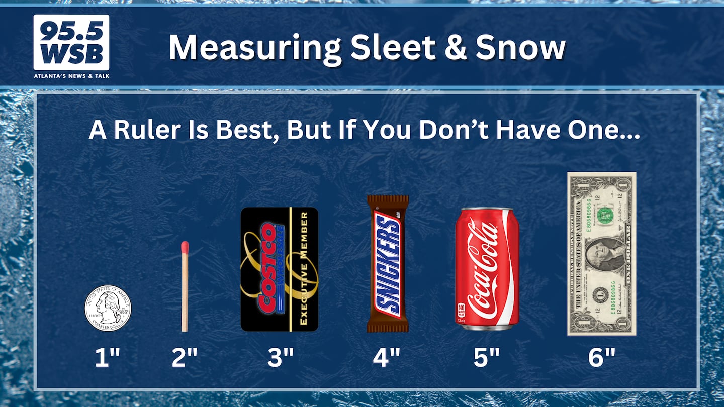
The National Weather Service in Peachtree City issued a Winter Storm Warning for Metro Atlanta, which is now in effect for Metro Atlanta.
Sleet and snow showers moved into Metro Atlanta on Friday morning accumulating over an inch of snow in some areas.
12:08PM:
A wintry mix will return after 1pm and continue through the evening.
Expect sleet and freezing rain accumulation as high as 0.10” to 0.35” through this evening.
12PM:
Officials urge citizens across the metro and North Georgia to stay off the roads as many are retreated due to icy conditions.
The police department and other county partners have responded to numerous road issues and vehicle accidents. The police department is encouraging everyone to stay off the roadways unless absolutely necessary. The following list of major road issues have been reported (Last… pic.twitter.com/nGog5xChX3
— Gwinnett County Police (@GwinnettPd) January 10, 2025
BLOCKED again as it's being treated. Folks stuck for hours I-75/sb down from Mt Paran. #ATLtraffic https://t.co/9DyVyDXTiA
— Triple Team Traffic (@WSBTraffic) January 10, 2025
11:30AM:
There is currently a break in the wintery precipitation in the south metro area. More is expected into the afternoon.
Expect ice accumulations.
11:05 AM:
The ramp from I-285 east bound to I-85 north bound has been blocked for hours.
RED ALERT Spaghetti Junction: Ramp from I-285/eb to I-85/nb has been blocked for hours. Here are trucks stuck. #ATLtraffic pic.twitter.com/kEUBqfyjvK
— Triple Team Traffic (@WSBTraffic) January 10, 2025
10:54AM:
There is a ground stop at Hartsfield-Jackson Airport due to the ongoing severe weather and an incident that occurred at 9:10AM when an aircraft aborted takeoff, deplaning passengers via emergency slides .
— Atlanta Airport (@ATLairport) January 10, 2025
10:30AM:
Gov. Brian Kemp says state officials are thankful they were prepared based on the forecasts for Georgia.
“I want to thank the media and our citizens for listening to the advice in last 24-48 hours about being prepared and winter ready,” Kemp said. “It is better to be overprepared than not in these situations. We’ve learned a lot of lessons over the years.”
10:10AM:
NWS Peachtree City says they are starting to see ice accumulations on the top of pines in Peachtree City.
10:00AM:
Snow continues to transition into freezing rain and sleet. This wintry mix will continue into the evening.
Crews are continuing to work to clear roadways. Natalie Dale at the Georgia Department of Transportation urges everyone to stay off the roads unless it is an emergency.
RED ALERT Downtown: Stalled truck blocks all lanes of I-75/85/sb at University Ave (exit 244), please avoid the Connector. #ATLtraffic pic.twitter.com/df8gNXdjGZ
— Triple Team Traffic (@WSBTraffic) January 10, 2025
MARTA has suspended both bus and street car service. Rail service continues.
9:30AM:
Snow showers transitioning to rain showers throughout Metro Atlanta, expect a wintry mix throughout the afternoon and evening.
At 9:30 AM EST, 1 N Roswell [Fulton Co, GA] Public reports Snow of 2.00 Inch. Snow. #gawx https://t.co/BDEPSBk0g8 pic.twitter.com/9XNC1Gi7kq
— Christina Edwards (@ChristinaWSBwx) January 10, 2025
The City of Atlanta is urging everyone to stay off the roads during this weather event as road conditions continue to deteriorate.
The City of Atlanta is urging everyone to stay off the roads during this severe weather event. Your safety is our top priority—please avoid driving and stay indoors unless absolutely necessary.
— Atlanta Police Department (@Atlanta_Police) January 10, 2025
Stay tuned to official updates and check in on neighbors who might need assistance. pic.twitter.com/qdg18NH5ZN
Cobb Co.: Crash and ice shuts down the I-75/sb ramp to I-285 (exit 259), please get OFF the roads as soon as possible!! #ATLtraffic pic.twitter.com/aHYjh6Ap8R
— Triple Team Traffic (@WSBTraffic) January 10, 2025
8:48AM:
Seeing snow? Send us your photos and videos using the WSB Radio app! Please include your city/county. If you can, place a ruler or object in the snow to give us an idea of the accumulation.
8:30AM:
Sleet showers arrived shortly before 5am, and the snow showers arrived around 6am. Heavy snow showers continue to fall this morning before the transition to a wintry mix later this afternoon.
Track the snow and wintry mix with our interactive radar below:


