Severe thunderstorms impacted the South this past weekend, bringing tornadoes to Mississippi, Alabama and west Georgia.
The weather is starting to calm down in North #Georgia, but take a look at the sheer volume of Severe Thunderstorm Warnings (yellow) and Tornado Warnings (red) issued throughout the Southeast from Friday PM through this AM! #ATLwx #GAwx #ATL #Atlanta pic.twitter.com/5mOYcXeBl9
— Christina Edwards (@ChristinaWSBwx) March 27, 2023
In Metro Atlanta, flooding rains and large hail impacted the region late Sunday night into early Monday morning.
At 10:09 PM EDT, 2 S Norcross [Gwinnett Co, GA] PUBLIC reports HAIL of ping pong ball size (E1.50 INCH). PING PONG BALL SIZE HAIL NEAR THE INTERSECTION OF I-85 AND JIMMY CARTER BLVD JUST OF NORCROSS. https://t.co/9PeDJSsuu4
— Christina Edwards (@ChristinaWSBwx) March 27, 2023
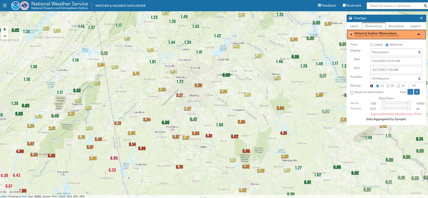
A band of heavy rain developed over the southern half of Metro Atlanta and continued to push through central Georgia. While the Atlanta airport received 2.37 inches of rainfall Saturday morning through Monday morning, the LaGrange area received nearly 6 inches of rainfall!
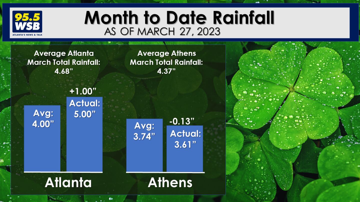
Month to Date rainfall in Atlanta and Athens are running close to average.
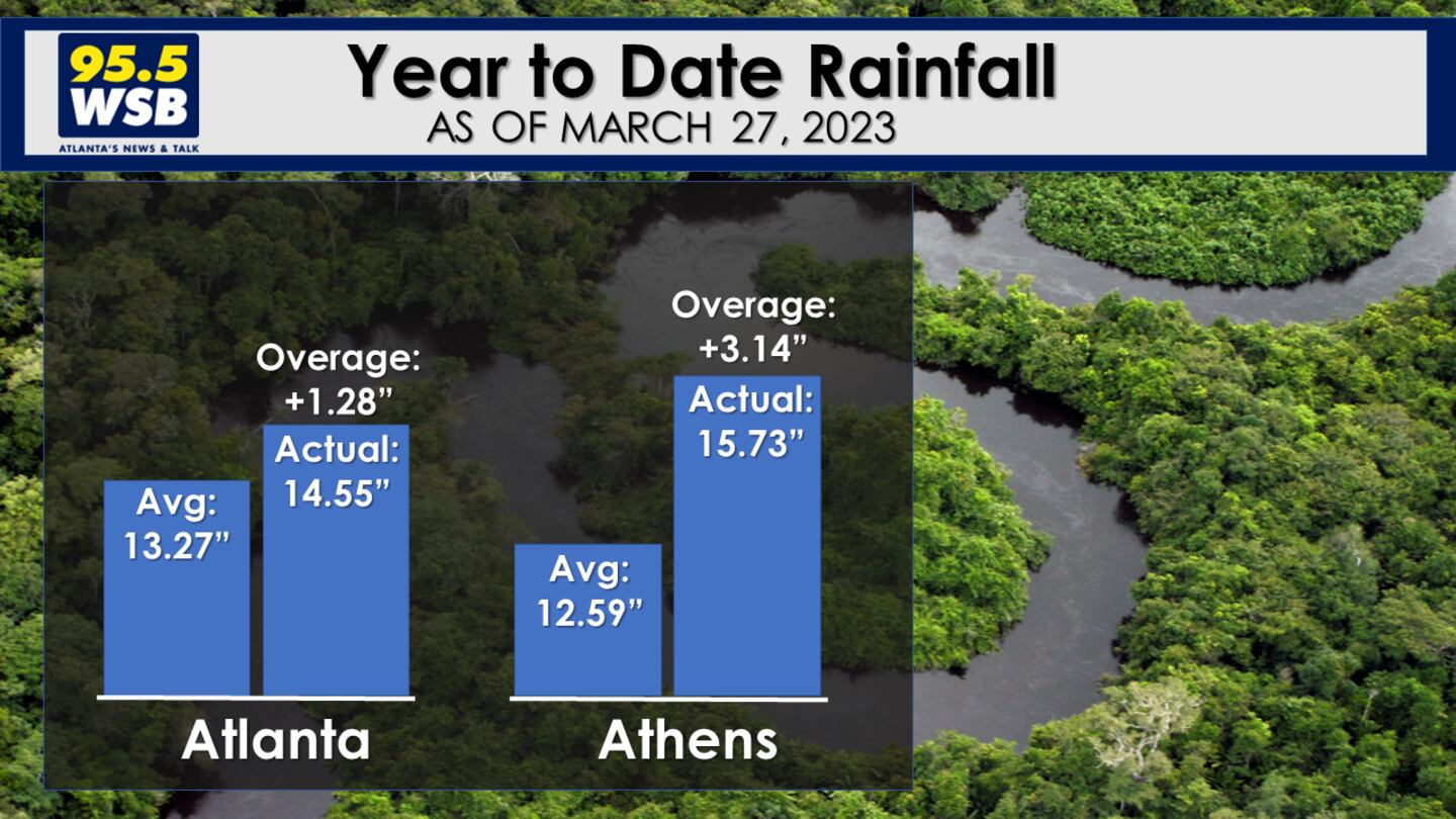
Year to Date rainfall in both Atlanta and Athens are running well above average.
The good news: Dry air will continue to move into North Georgia. The animation below illustrates the dew point -- the lower the number, the drier the air. The dew points will dip into the 30s through the middle of this week, signaling a dry spell that will last into the weekend!
Connect with Me!
Facebook: Christina Edwards WSB
Twitter: @ChristinaWSBwx
©2022 Cox Media Group


