We have a long way to go before the leaf color change, but “the wedge” Sunday and Monday gave us an autumn “tease” with unseasonably cool weather breaking the heat wave which included 29 strait days with lows above 70 and 20 consecutive 90+ days.
But heat will build back later this week, it is after all still August.
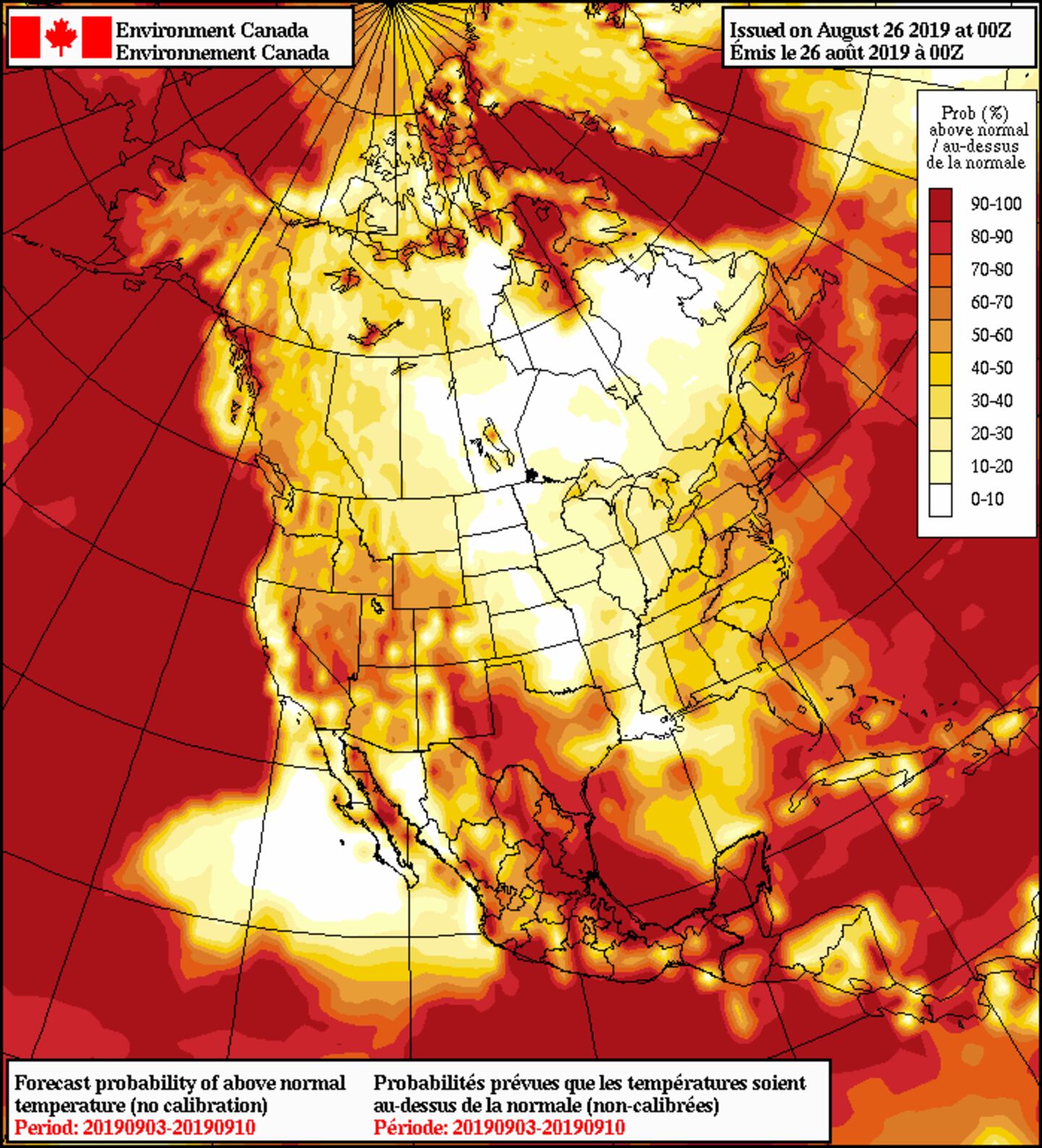
NAEFS TEMPS SEPT 3-10TH:
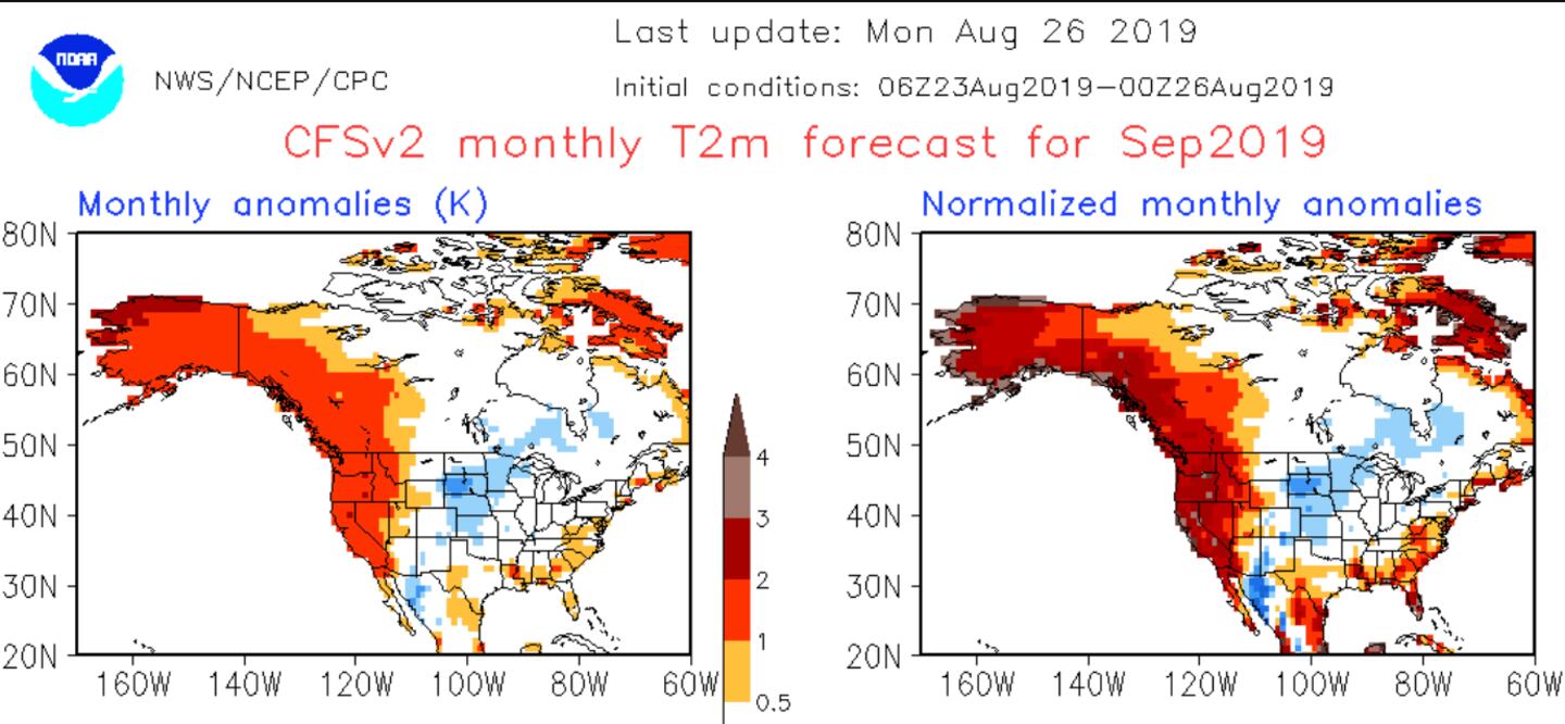
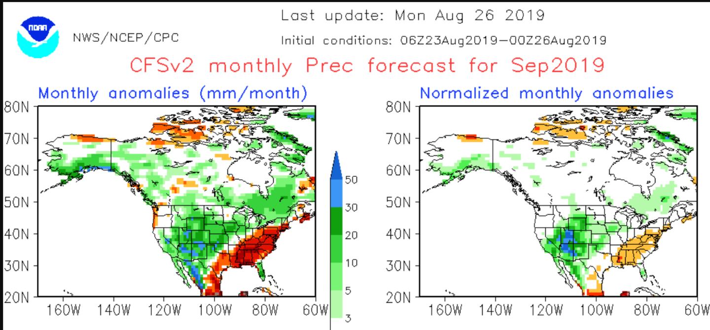
SEPTEMBER CFSv2 TEMP AND PRECIP:
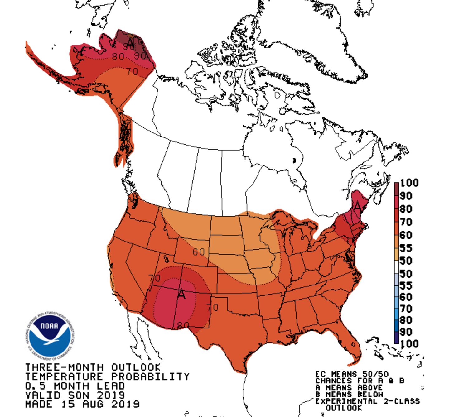
NOAA 90-DAY TEMP/PRECIP OUTLOOK:
The trend for September and for the Fall period September through November is for temperatures to average near-normal to a little above-normal and for rainfall to average near-normal to a little below-normal.
Keep in mind this is the average for the 30 and 90-day periods NOT for every day or every week.
The most “above-average” period is expected for September into the first half of October, while there looks to be a trend toward cooler than normal by November as a flat ridge over the Southern third of the nation gets replaced by a jet stream trough over the Eastern third of the U.S. in October or November.
NOTE: the outlook can not and does not explicitly include tropical storm or hurricane influences which are random.
For more follow me on Twitter @MellishMeterWSB.


