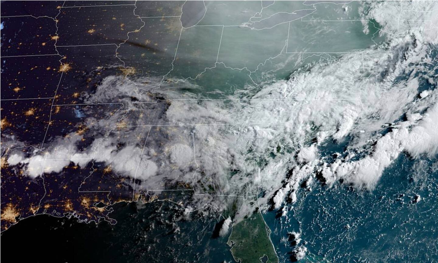
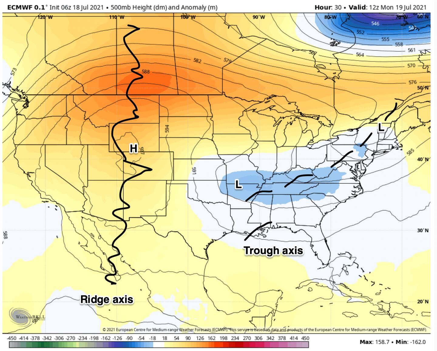
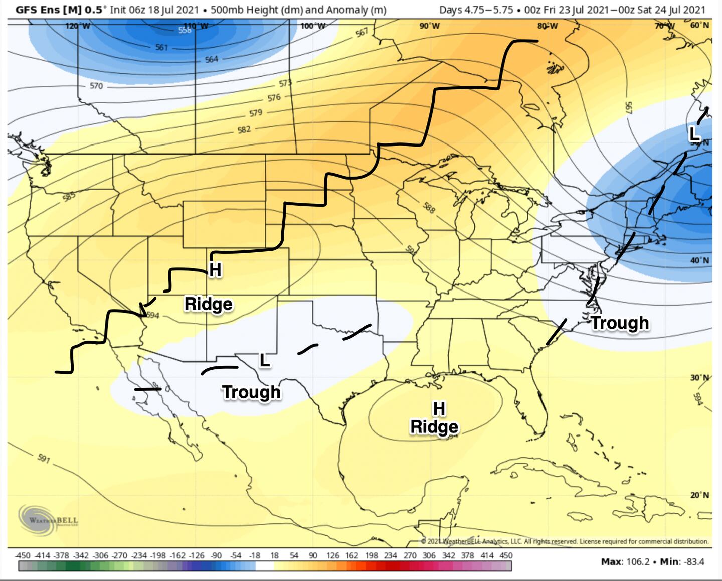
The jet stream pattern has been stuck in a rut for a long while with an upper level hot dry high pressure ridge out West/NW and a cooler wetter upper level trough over the East/SE U.S. We start the new work week the same:
You just can’t get sunny days and lots of heat with that kind of a jet stream configuration over the Southeastern states which allows for higher than normal moisture in the atmosphere leading to greater than normal cloud cover and greater than usual rain chances which in turn holds down temperatures below normal to near normal at best.
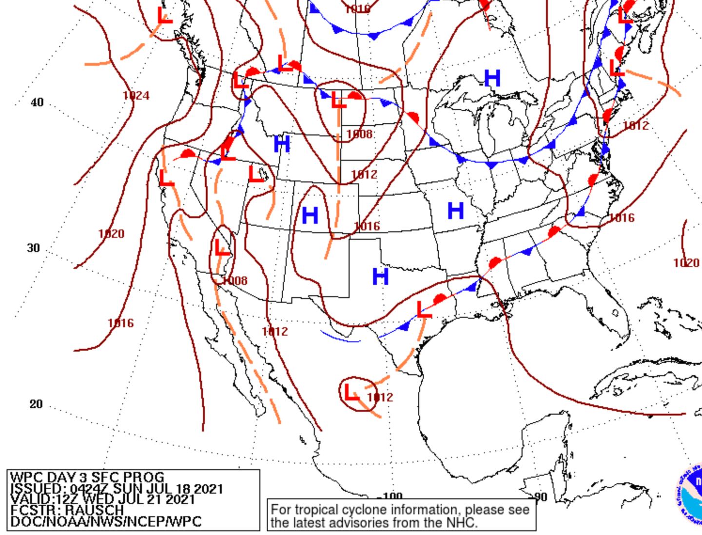
This week a diffuse surface thermal boundary will serve as the focus for unsettled weather with overnight or morning showers in a couple spots then increasing cumulonimbus formation in the afternoon or early evening hours the first half of the week.
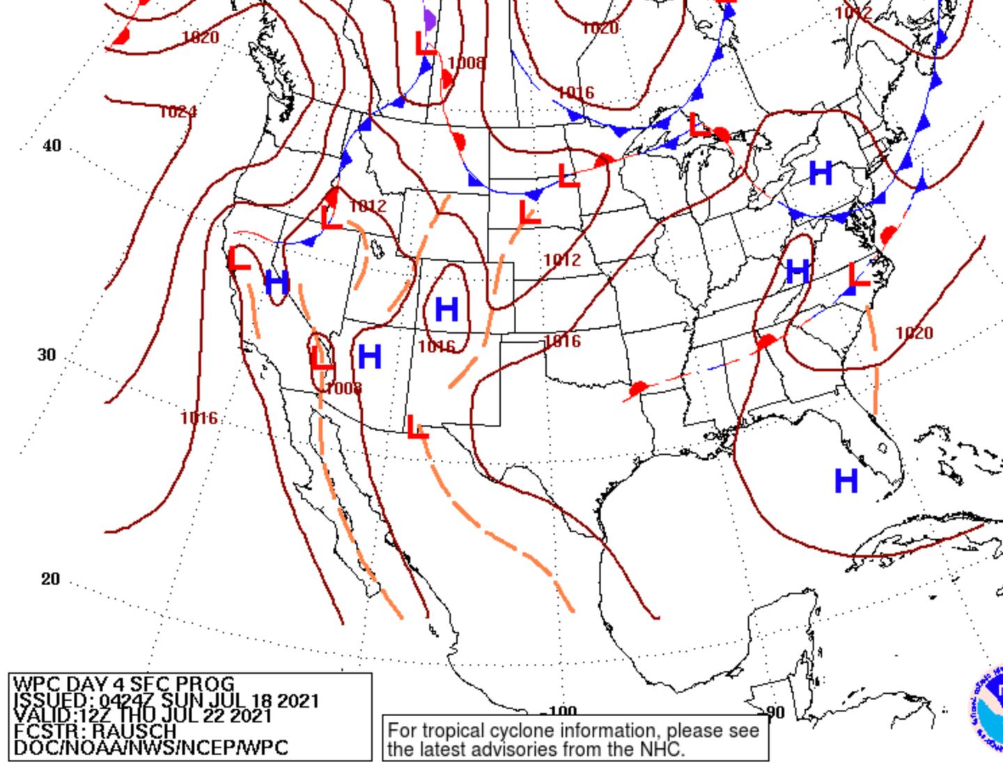
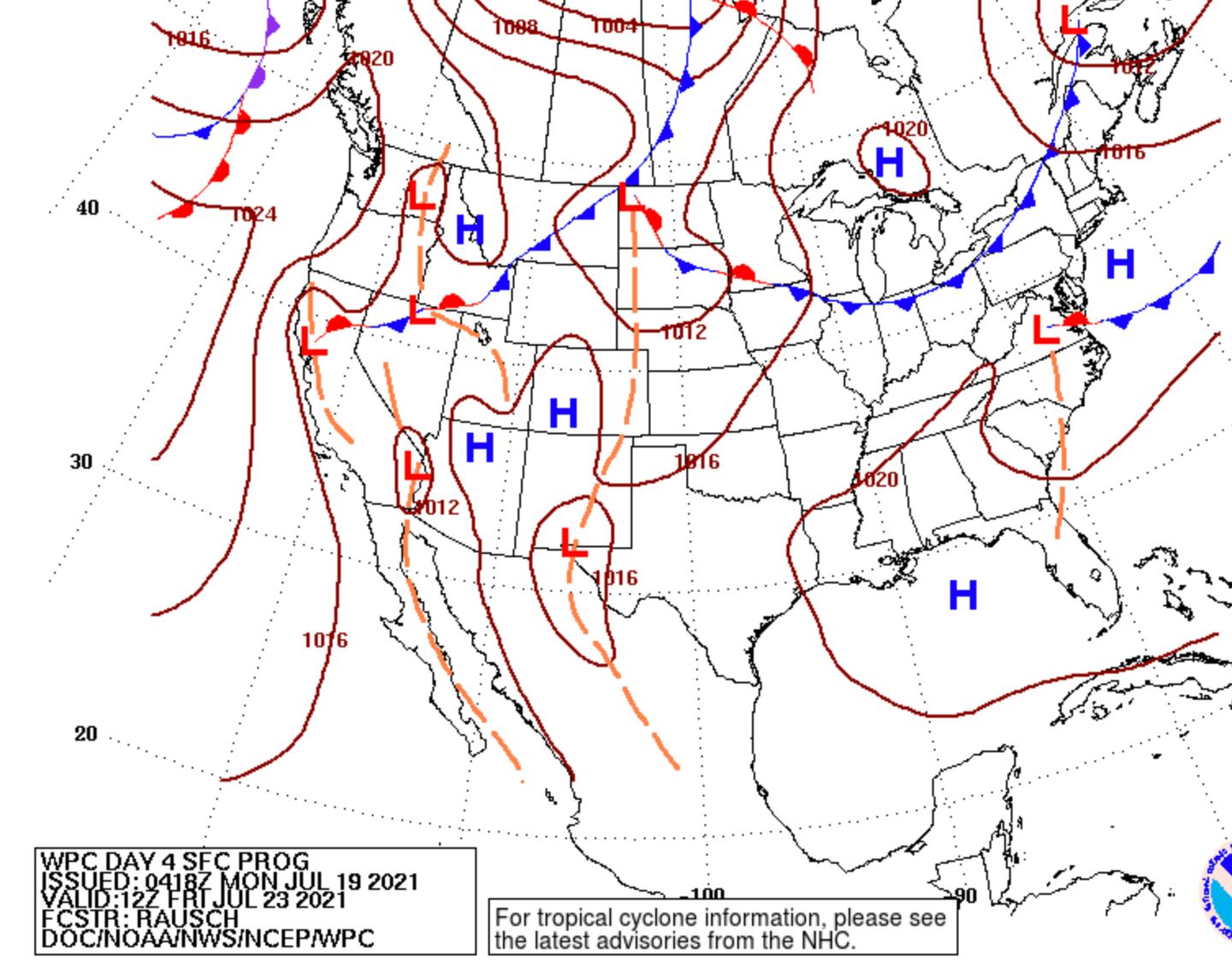
Then toward the end of the week and into the coming weekend the frontal thermal boundary sinks South or at least falls apart and dissipates as weak surface high pressure tries to take more control:
The surface charts above are the result of the changes in the jet stream configuration aloft as the trough splits with one over the NE and one over the Southern Plains and Northern Mexico with the big heat ridge from Canada into the Southwest U.S. Another high pressure ridge forms in the Gulf and pressure heights rise over the Southeast:
HOWEVER, notice there is still a gap or weakness in the jet stream configuration over Georgia and surrounding states. Thus I don’t think we can rid ourselves completely of the pattern of these many weeks, but rather tip toe closer to average for this time of year to get a little more sun, more heat, and a little less rain as we get into the weekend and the following week.
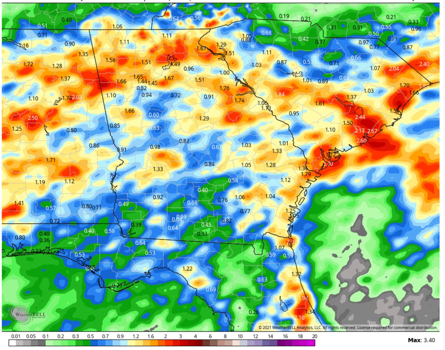
48-Hour estimated rainfall average:
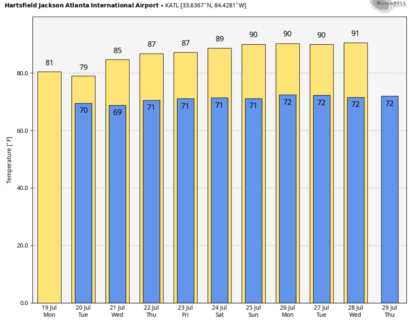
Beyond that, for late this month and August the models want more heat and dryness for the Southeastern states. But color me skeptical.
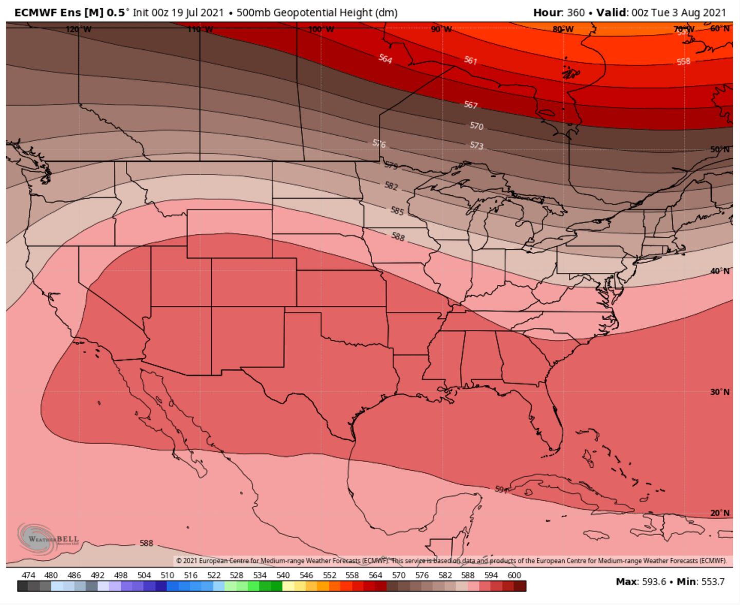
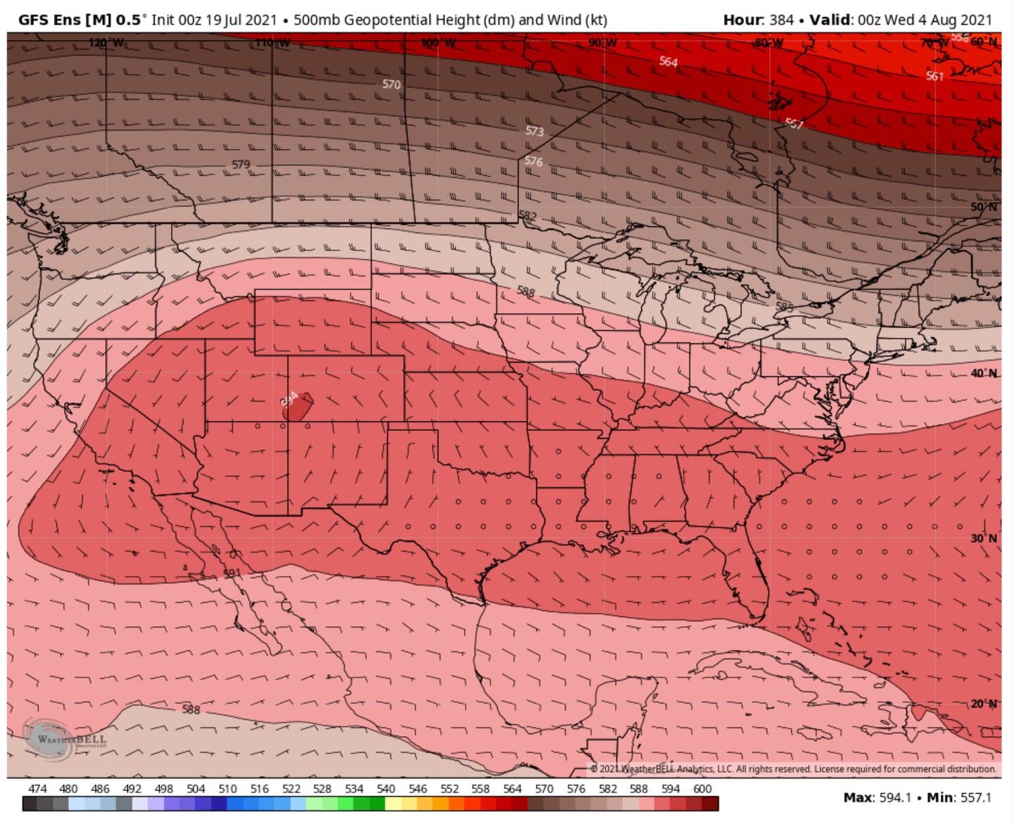
By late July and into August both global equations ECMWF/GFSV2 are showing a conjoined Sonoran-Bermuda mega ridge forming, that IF true, would spell big time heat for Georgia and adjacent states, well into the 90s if not higher:
We would expect that at some point before “Calendar Summer” ends we will have a bout of real heat or maybe it comes in the early Fall. But at least for now I think the odds favor the pattern repeating and any real heat being just the “come and go” variety before the pattern reverts and repeats back to what we’ve already experienced.
I’ll post if I see any convincing signs of big and lasting heat. For now when I see the models suggest that, I have to have my doubts any big-time heat will happen or if it does that it will not last long.
For updates follow me on Twitter @MellishMeterWSB.
©2021 Cox Media Group


