
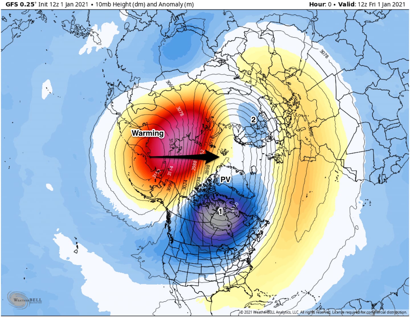
Since the opening days of December I’ve been talking about the La Nina and the penchant for it to provide occasional wild swings in the jet stream that can keep our weather active and changeable. Then for the past several weeks I’ve been telling you about the possibility of a Polar Vortex disruption thanks to a projected Sudden Stratospheric Warming (SSW) event. (68-85,000 feet high) near the bottom of “outer space”. Well the models were right and that SSW is taking place now above Asia/Siberia.
The SSW aids blocking of the jet stream at high latitudes. High pressure builds and cold dense air builds. Cold high pressure is dense and therefore heavy and it pushes the jet stream storm tracks farther South than normal (Suppression).
This opens the window of opportunity for winter precipitation in parts of the South and East states including Georgia in the medium and long-range. Keep in mind there is NOT any such system in sight as of this writing.
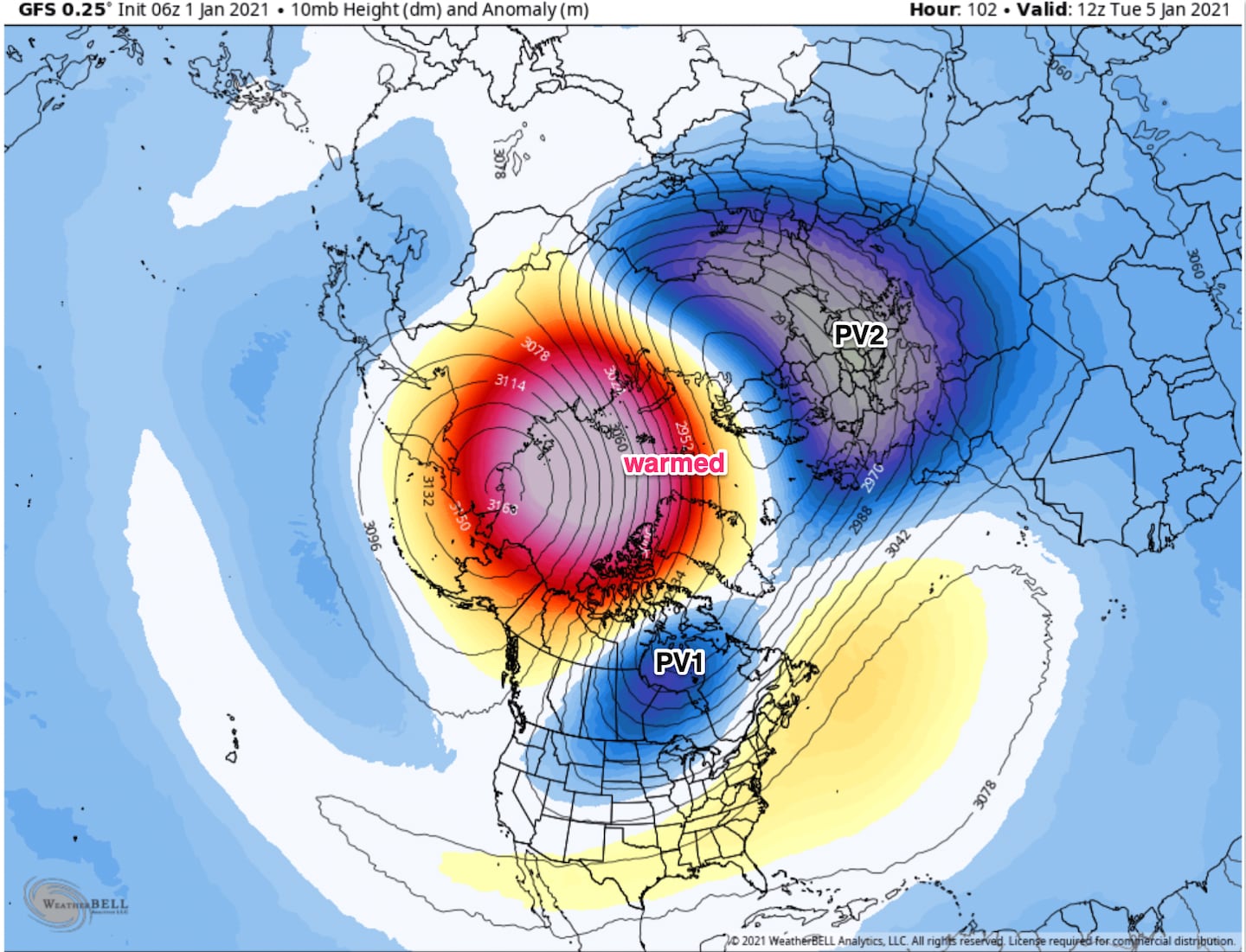
The SSW splits the Polar Vortex (in the Stratosphere) and this changes the jet stream circulation around the entire global Northern Hemisphere.
First we have to get the jet stream pattern favorable and that is increasingly expected to happen especially in the second half of January possibly into or returning in February. The impacts on the U.S. from a SSW can take from 2-5 weeks.
As I stated in the past no two are ever exactly alike so we just have to monitor how the cold and storm systems line up, will it be mostly Asia and Europe while the U.S. misses out? Sometimes that happens. Early indications are that all three regions will share in time.
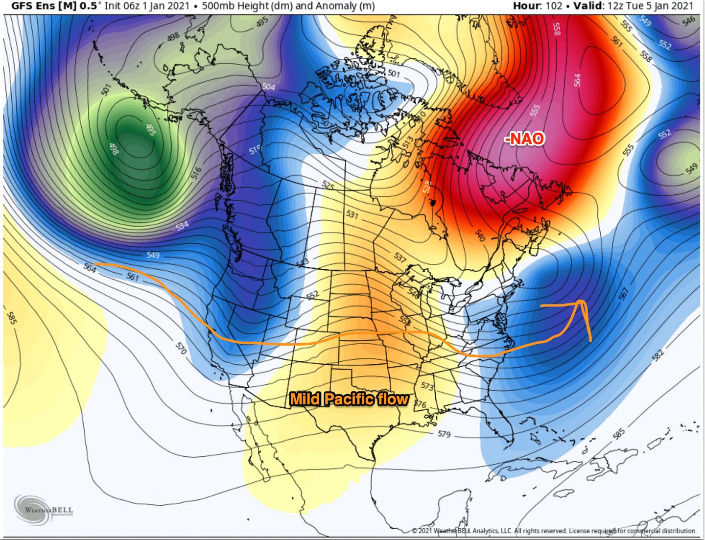
As discussed in prior blogs we have a favorable AO/NAO and they are projected to become more favorable in the weeks ahead as the SSW reinforces the persistent negative phase of the AO/NAO.
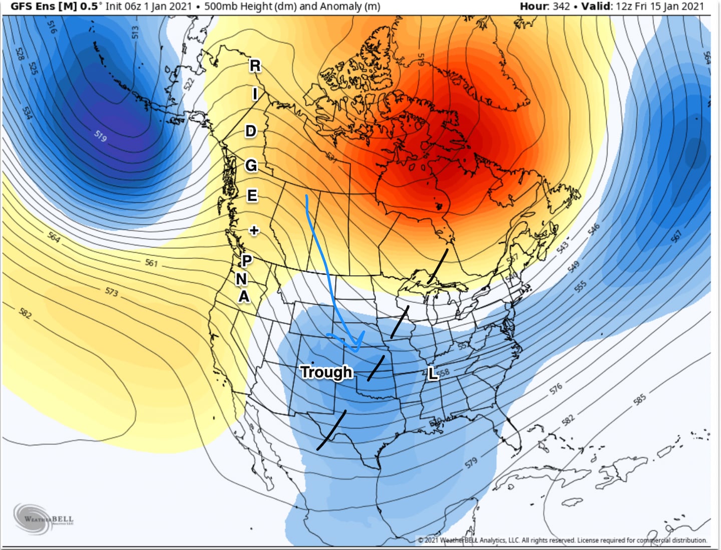
Other signals are consistent such as the Aleutian low pressure and Ural-Barents Sea high pressure blocking pattern and retrograding Scandinavian Ridge into Davis Strait. You see we look far away from Georgia for weather “yellow flags” that give us hints long before ANY point and click weather model shows anything here. These are called teleconnections in meteorology. They were used PRIOR to the advent of computer models.
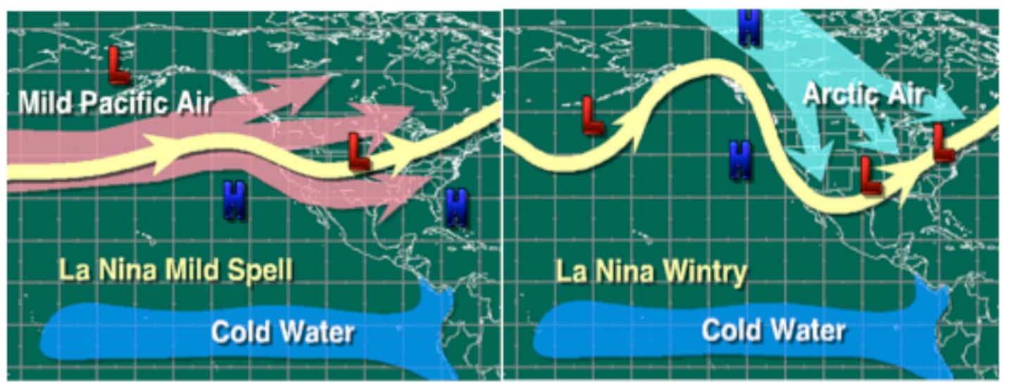
Some teleconnections however are still UNfavorable for winter precip and cold in the Southeast. These are the WPO/EPO and PNA. They represent in essence the Pacific Ocean influence on the jet stream storm track and the SOURCE REGION of air masses and movement of air those air masses across the lower 48. When unfavorable they indicate a pattern of a more North based storm track and/or warmer air from the Pacific.
If the WPO/EPO change to negative that would help the AO/NAO (which also connect to storm track and air masses) to bring more cold air from the North and if you have that AND add in a +PNA that would likely deliver the goods. But there have been times we got winter weather in the Southeast without the best phase of the Pacific WPO/EPO, because the -NAO and +PNA carry more weight.
So not all the puzzle places are in place yet, and of course it’s not guaranteed it will happen. But it starts with first steps and at least we have that:
So the long and short of it is that there are teleconnection signals, that at least in the past have led to significant snow and/or ice and cold in Dixie including Atlanta as that -NAO/Greenland (high latitude blocking) and the SSW -AO “suppress” the jet stream with time. However, the pattern change is a slow process.
There is a parade of low pressure storm systems lined up across the Pacific Ocean to Asia for weeks to come to provide maybe historic Greenland/-NAO blocking and interesting weather for much of the U.S. this month and maybe next. The devil will be in the detail as to where each goes, TBD.
But first we have to see if the models and teleconnection signals are correct about the blocking and jet stream suppression underneath the block. Otherwise this will go for naught.
Meanwhile our back and forth up and down temperature and precipitation pattern that we’ve been stuck in for many months will continue:
While nothing is shown right now for the foreseeable future, I think that block and SSW will have an impact and eventually the models will start to sniff it out and show one or more systems of potential winter interest in the South between now and Spring. A challenging pattern for models and meteorologists to be sure.
Timing is critical and maybe things don’t work out for cold and moisture to be here at the right time as is so often the case here, but given the big picture over the Northern Hemisphere I am cautiously optimistic for better than normal odds of winter impact weather in the Southeast the second half of this month into February. Remember this does not mean the whole period, every day or every week, it’s the overall window of opportunity worth watching.
It is what this type thing has brought in the past and not all that many years back for the last time for that matter.
But as the finance and investing industry always warns us: “Past performance does not guarantee future results”.
For daily weather info follow me on Twitter @MellishMeterWSB.
Cox Media Group


 Sign Up


