
Sorry for the long delay in new blogs. The radio station (corporate CMG) and my location had technical difficulties which were compounded by the recent global cloud issues.
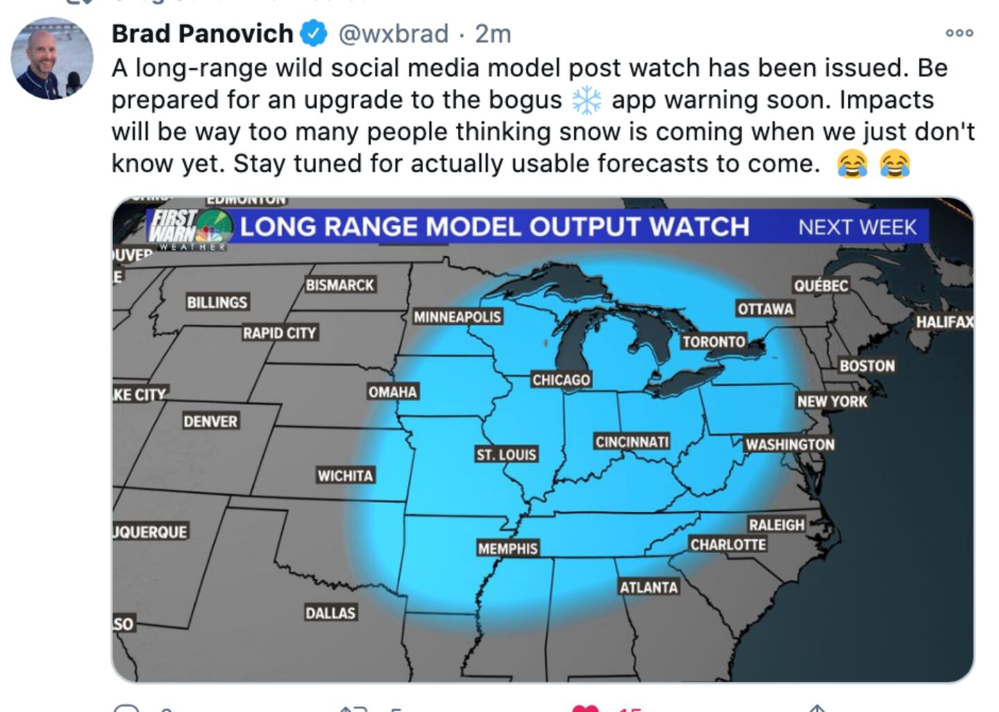
Brad a forecaster in North Carolina has it nailed in his cartoon maps about winter weather outlooks and winter weather reaction when it comes to people who live in the South, well actually everywhere.
Most people blindly instinctually reflexively share things they see on social media concerning the weather without having a clue as to the veracity of the maps, the credibility of the source, or even how to properly interpret a snow, ice, tornado, hurricane, flood, wind, temperature map.
Even if there IS a legitimate map (not photoshopped or faked in some way) showing model X says 28 inches of snow in Chicago, or 6 in Atlanta or 1 in Savannah it does NOT mean that degreed meteorologists look at it the way the untrained eye does!
The biggest misconception the general public has is that there is JUST ONE forecast delivered by different people or different sources. That’s like saying there is JUST ONE diagnosis in medicine and surgery, no second or third opinions.
Web sites and APPS use just A SINGLE model (not even the best one) and there is no human meteorologist involved in that automated stuff. Meteorologists don’t use a single model, we look at a dozen or as many as needed, AND weigh them based on training and experience. Forecasters, like doctors or engineers or building contractors etc. differ in their prognosis. Sometimes just a little, sometimes by a lot.
The way it goes during the winter for individual weather systems is there are lots of changes and usually more hype than hope and more fear than reality. This is why I try to avoid both in my forecasts on-air on the radio and in my blogs and on Twitter.
Pretty color moving pictures on TV and the web or an APP can make it look easy simple and straight forward, but forecasting is none of those things:
As you know we can sometimes get the forecast for today wrong, so why would any sane and normal person look at a forecast for 7, 10, 15, 30 days away and think a specific number is going to be correct at that distance in the future. As Spock would say, “Highly illogical, captain”.
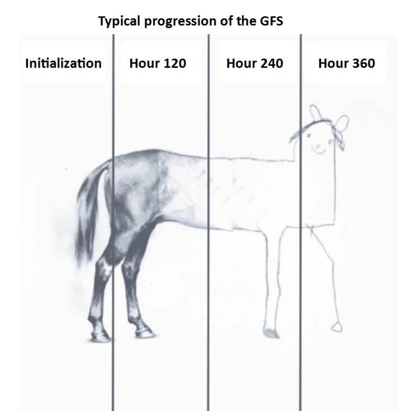
On top of that, when you see some BS snow maps beyond 3-5 days you’re probably seeing one posted by someone who has no idea what is “under the hood” in that model output, and you are not seeing 8 DOZEN other models that show something different or no precipitation or cold wave at all!
Also, the model map some clown posted may very well have changed 100% when it was run again mere hours later!
But nobody posts the updates and nobody posts maps that DO NOT show anything exciting even though those maps might out do the exciting one 100:1, so lets be smart.
Over the past two weeks some clowns have posted “snow maps” showing some significant accumulation in the Mountains and some even for Atlanta. Well, that VERY SAME MODEL, run TEN TIMES has shown completely different things each time it was run over just the past couple days. Ignore this garbage.
Forecasting is METEOROLOGY, NOT model-ology.
Stay calm and tarry on. Happy Thanksgiving and Merry Christmas.
For more follow me on Twitter @MellishMeterWSB.
Cox Media Group


 Sign Up


