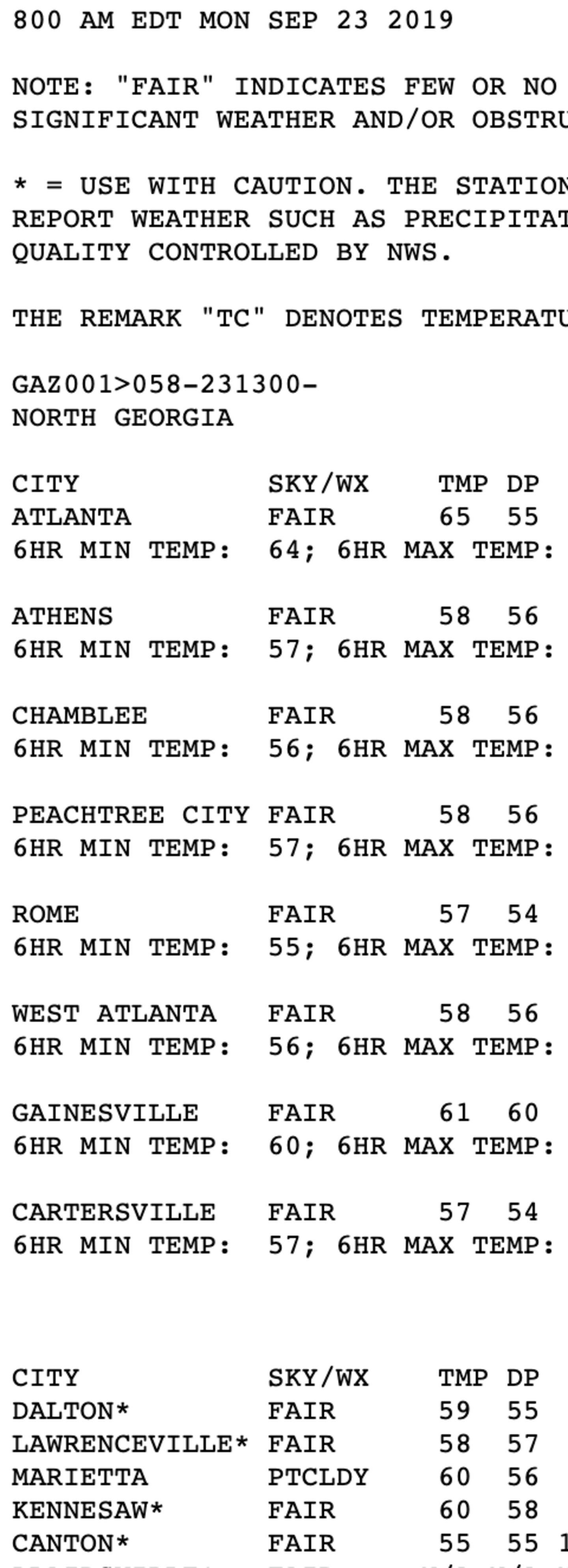
The first day of Autumn started with refreshing temperatures this morning thanks to dry air (dew points in the mid 50s) morning lows were mostly in the mid to upper-50s:
Dry air cools quickly after dark but warms quickly during the day. The dry ground also helps to heat the air because less of the sun’s energy has to go into evaporation. Therefore, the soil heats more rapidly when it’s dry, giving that heat to the air. This is called a “positive feedback loop” and is why heat and drought often re-enforce each other and go together.
Don’t bother with the equinox EGG STANDING thing, that is an old myth. Scientific tests have shown there is no better chance of standing an egg up on the equinox as any other random day of the year.
This was researched as far back as 1947 and as recently as the 1980s and found to be untrue, but the old wives tale refuses to die. I guess not enough Americans read.
So while it is the first day of Autumn mother nature is going in the other direction, something forecast since last week. Temperatures running 10 degrees or more above-average in the afternoons. But at least it is a DRY HEAT so we don’t have a heat index of 105 as would be the case in a July or August heat wave.
None-the-less we could tie or break RECORD HIGHS Thursday/Friday. The record Thursday is 90 set in 1911 and 1986. The record Friday is 93 set in 1954.
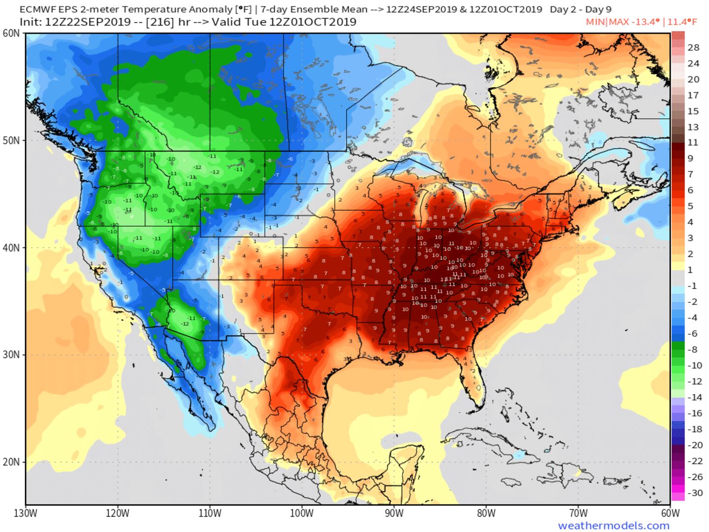
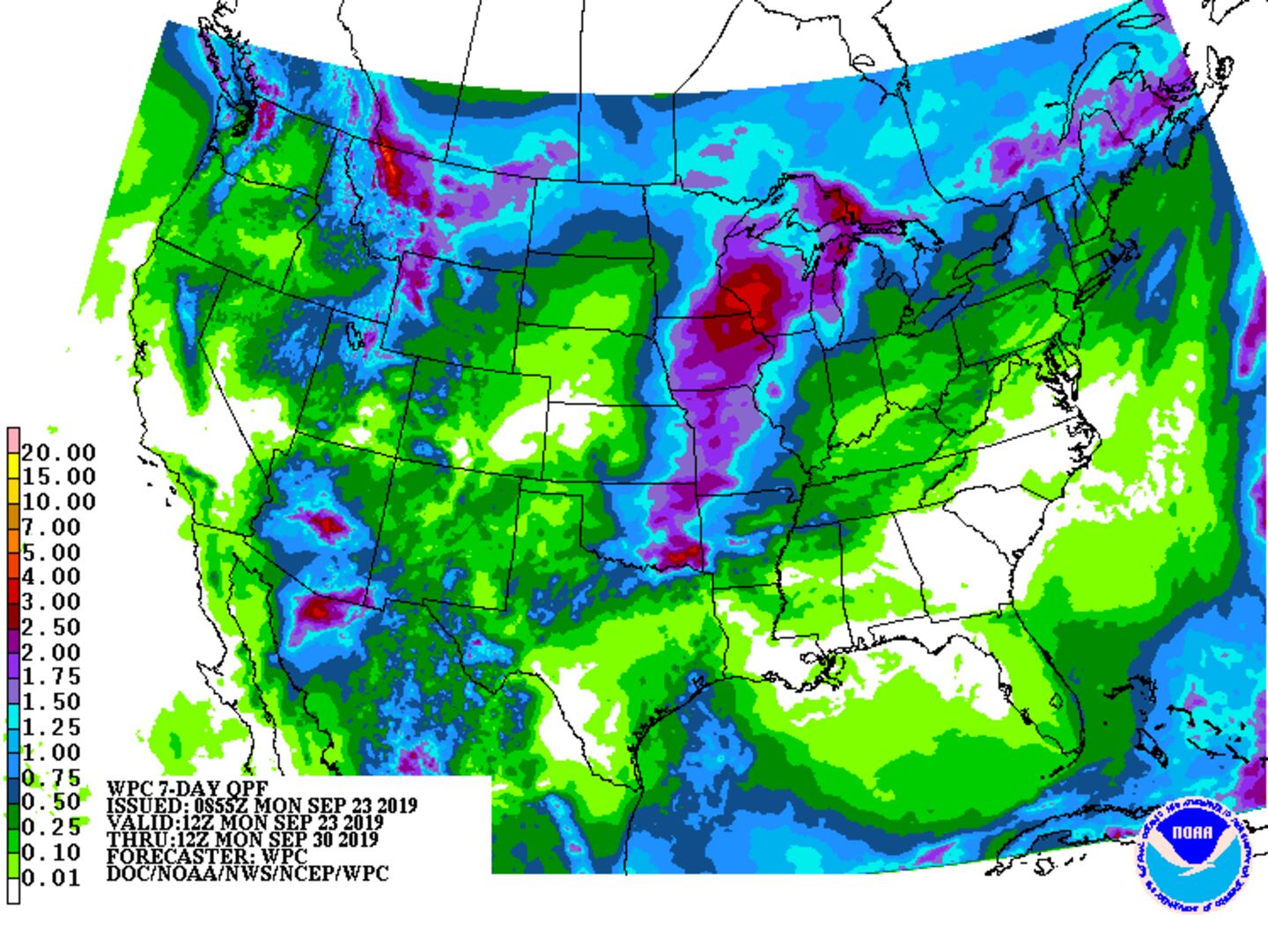
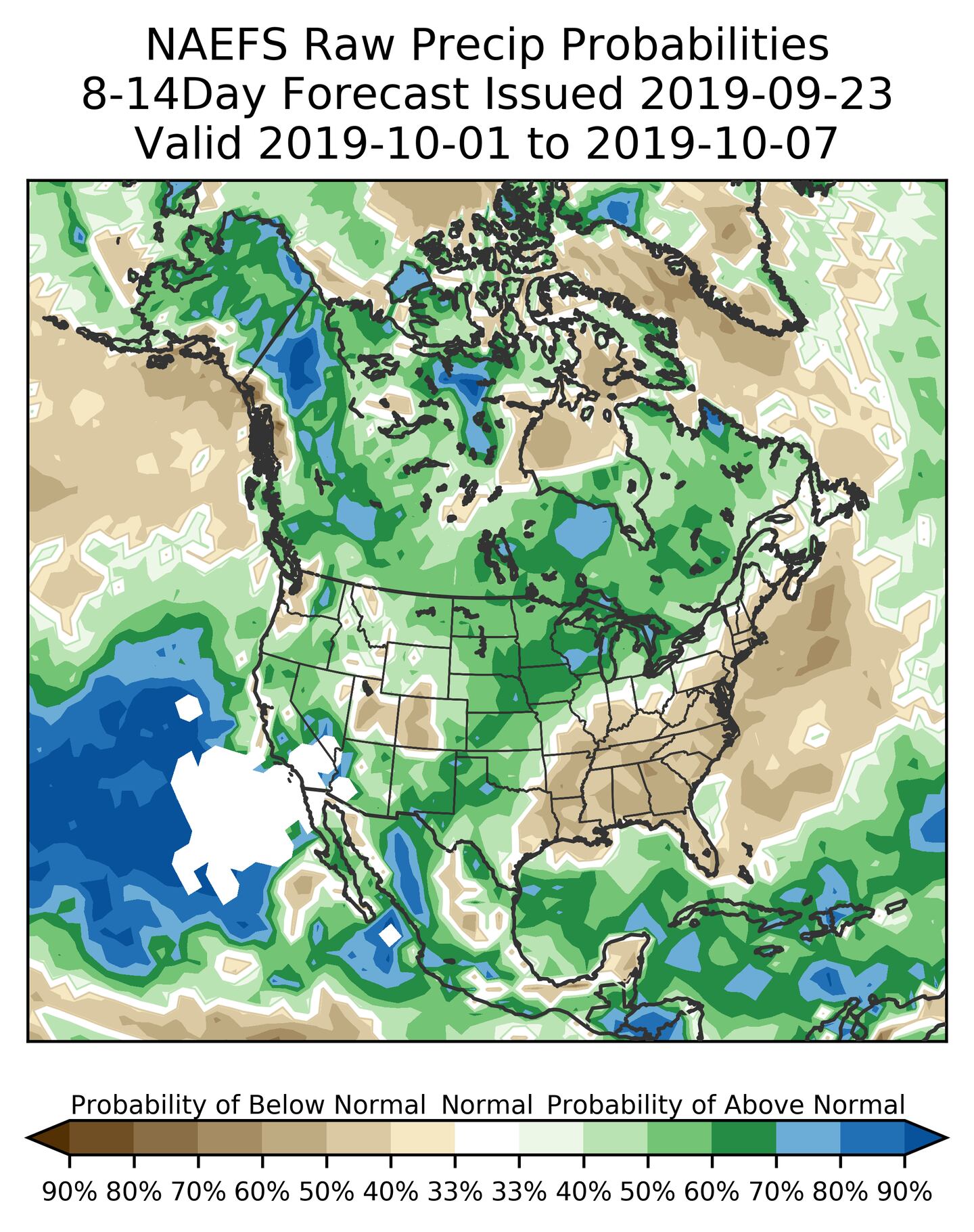
Little or no rain the next 7-12 days at least with above-normal high temperatures the whole time bringing us into October.
September is already in 2nd place for the hottest September on record behind only 1925! This year will probably end up in first place since records began in 1878.
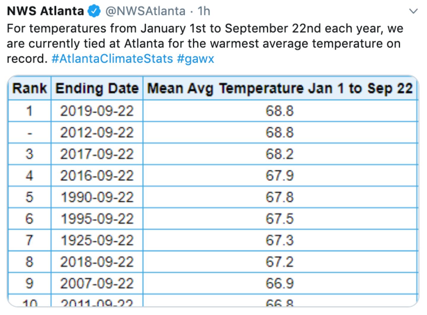
Since the start of the year we are tied for First Place with 2012:
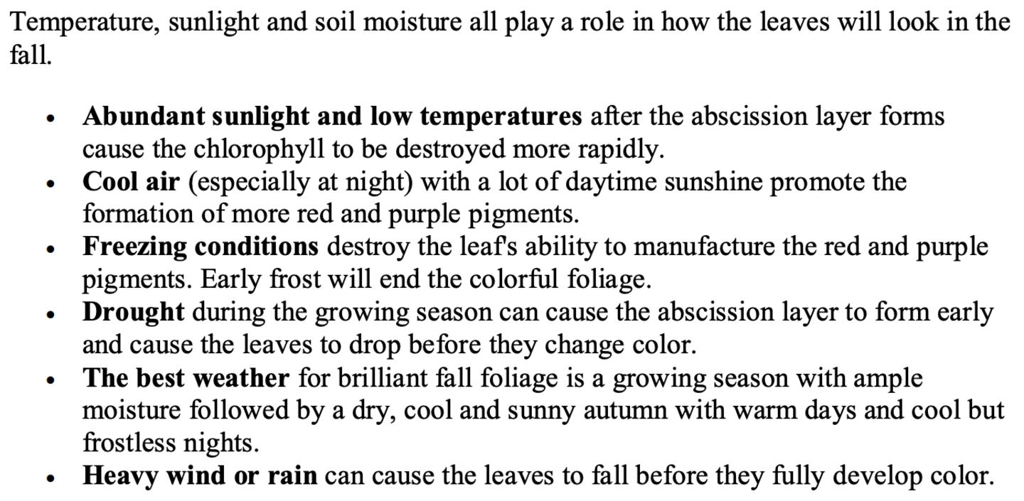
Some sources have predicted a delayed peak autumn leaf change due to warm overnight temperatures. But locally our lows at night have been bouncing around from above to normal or slightly below normal so it’s difficult to forecast max leaf color.
As tree expert Rex Bastian points out:
The dry weather and especially the daytime HEAT seems to be causing leafs on many trees this year to turn yellow or brown and fall off sooner than normal. The change seems to be starting 3-4 weeks earlier than normal.
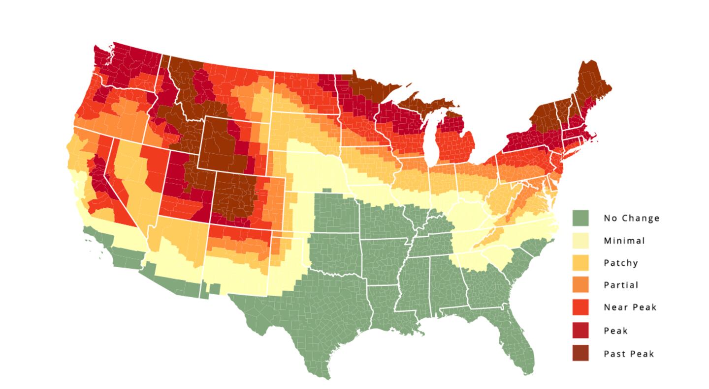
Below is a map of typical conditions on October 12th, it seems we’ve been here for at least a week now:
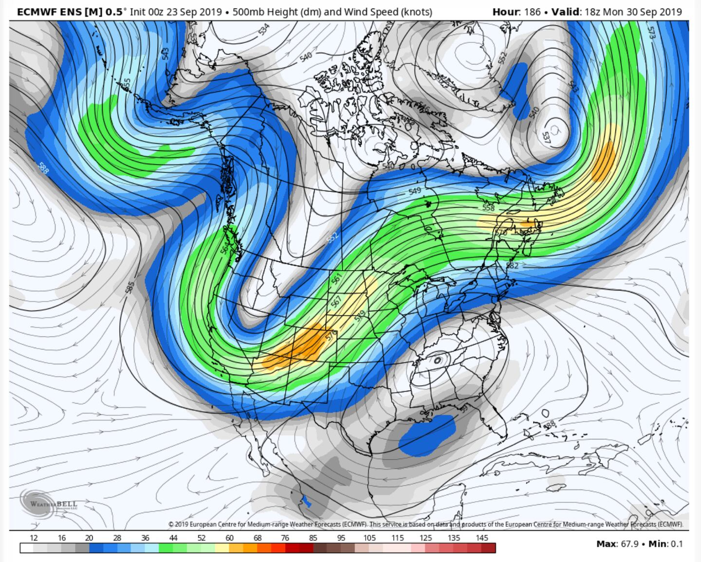
The cause of the drought and heat is a mega sized and mega strong upper-level high pressure ridge in the jet stream centered over the Southeastern U.S. and blocking the storm track well to our North and West:
7-DAY AVERAGE RAINFALL ESTIMATE:
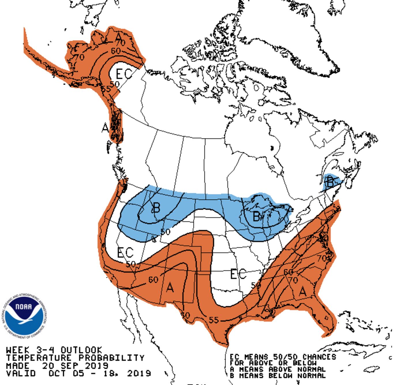
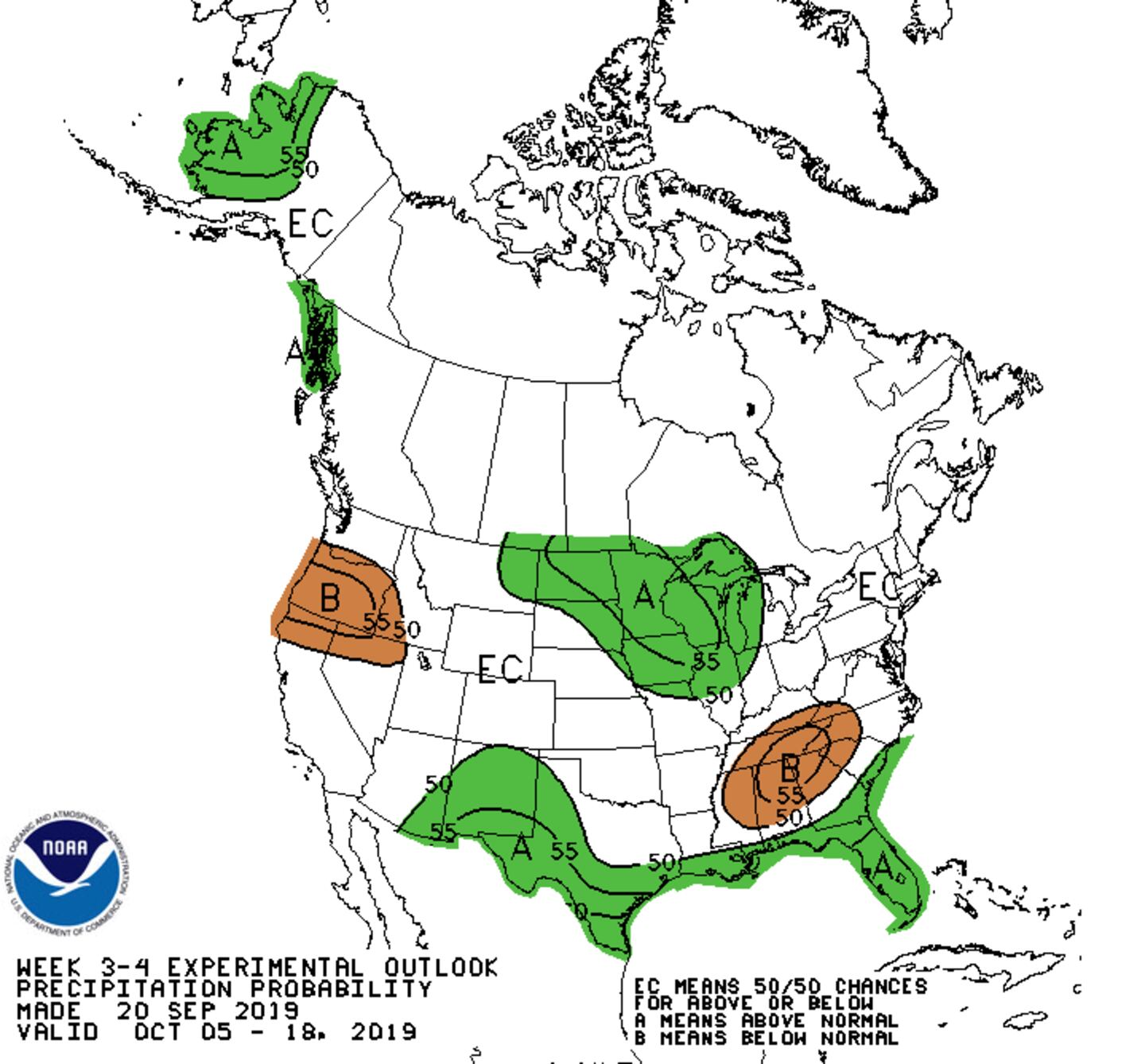
WEEK 3-4 OUTLOOK:
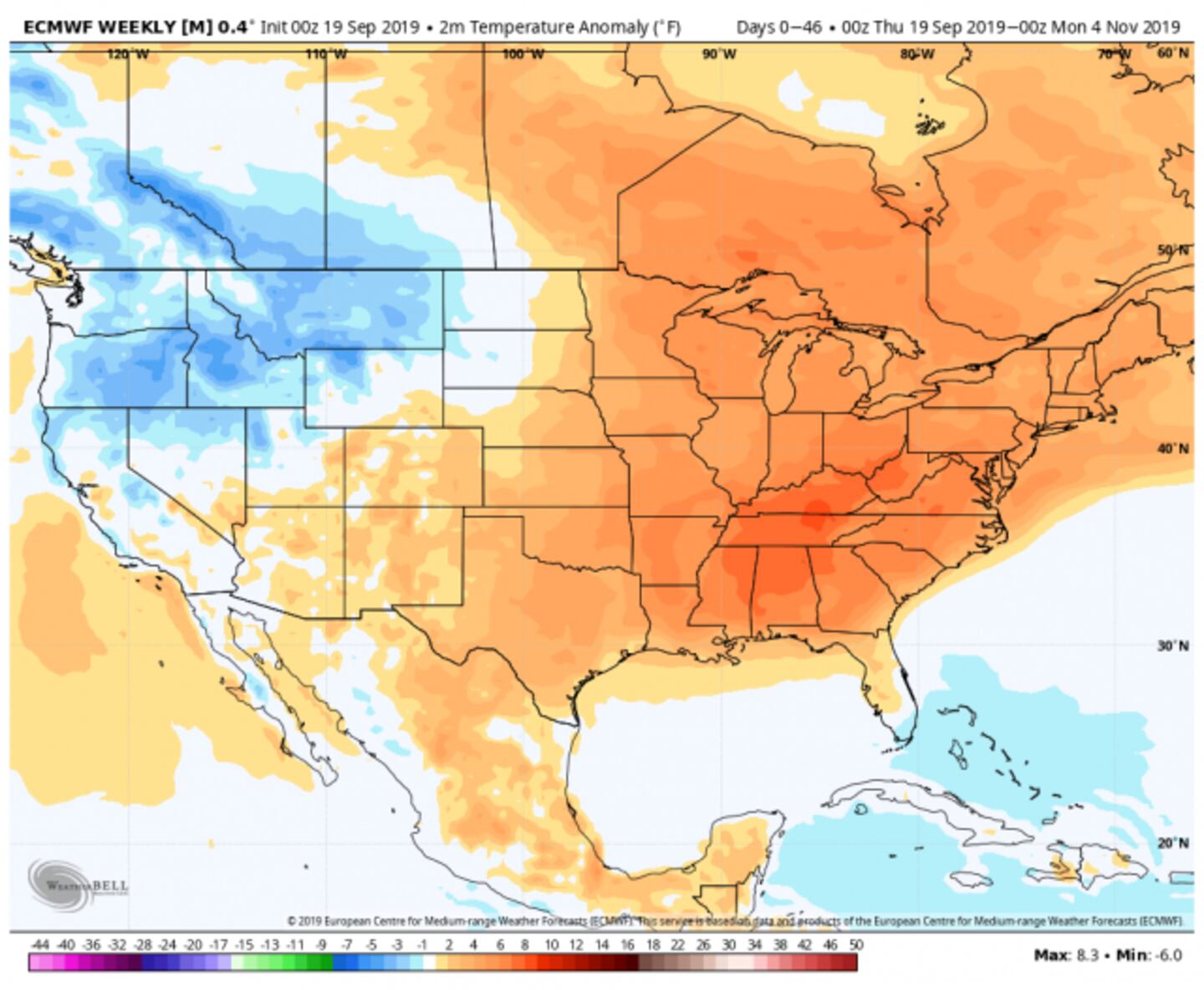
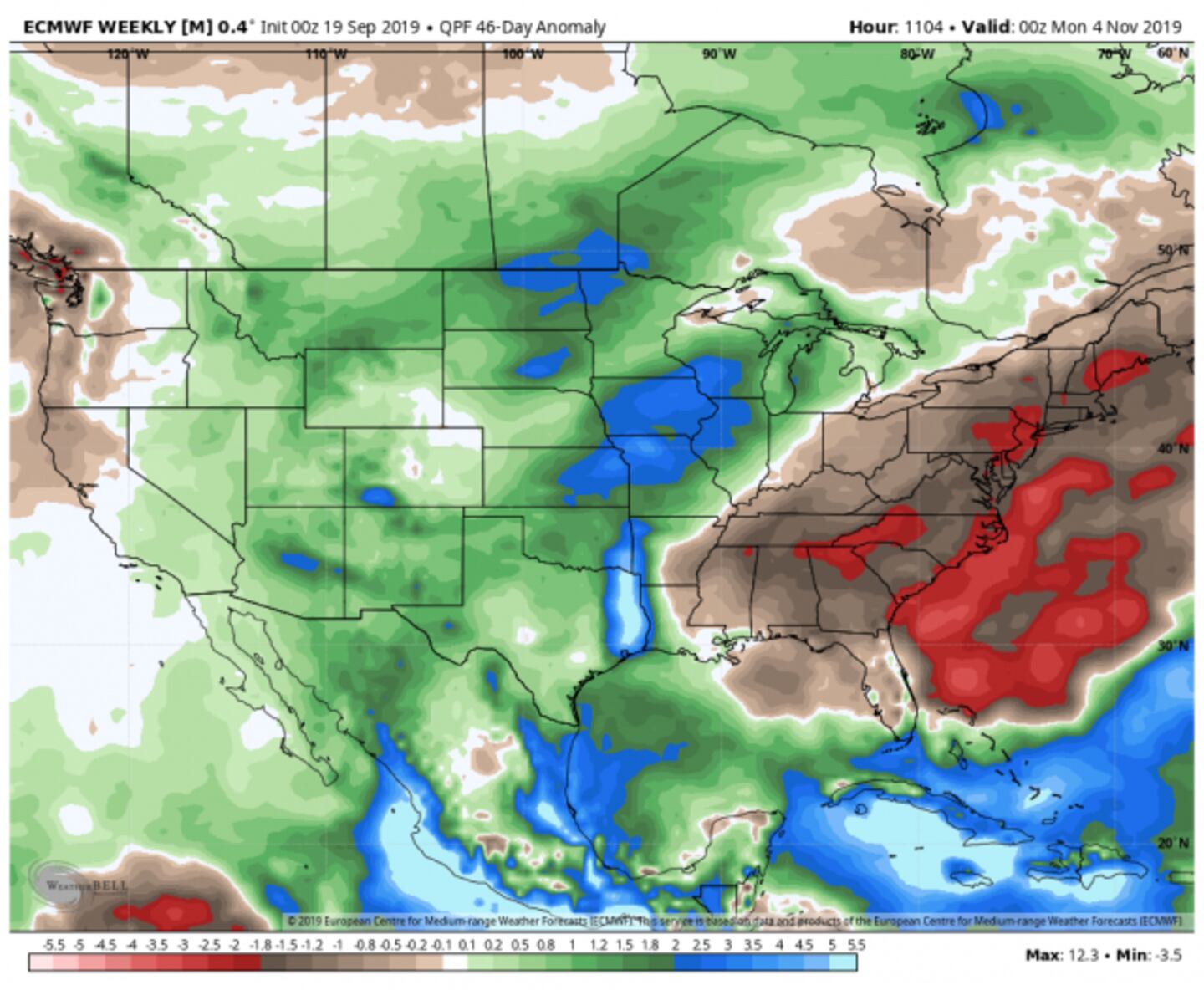
ECMWF MODEL ENSEMBLE 4-6 WEEK AVERAGE:
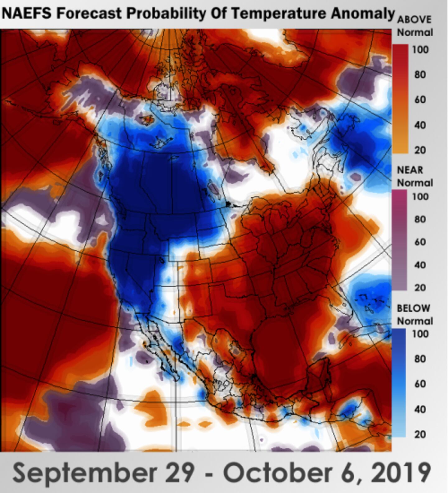
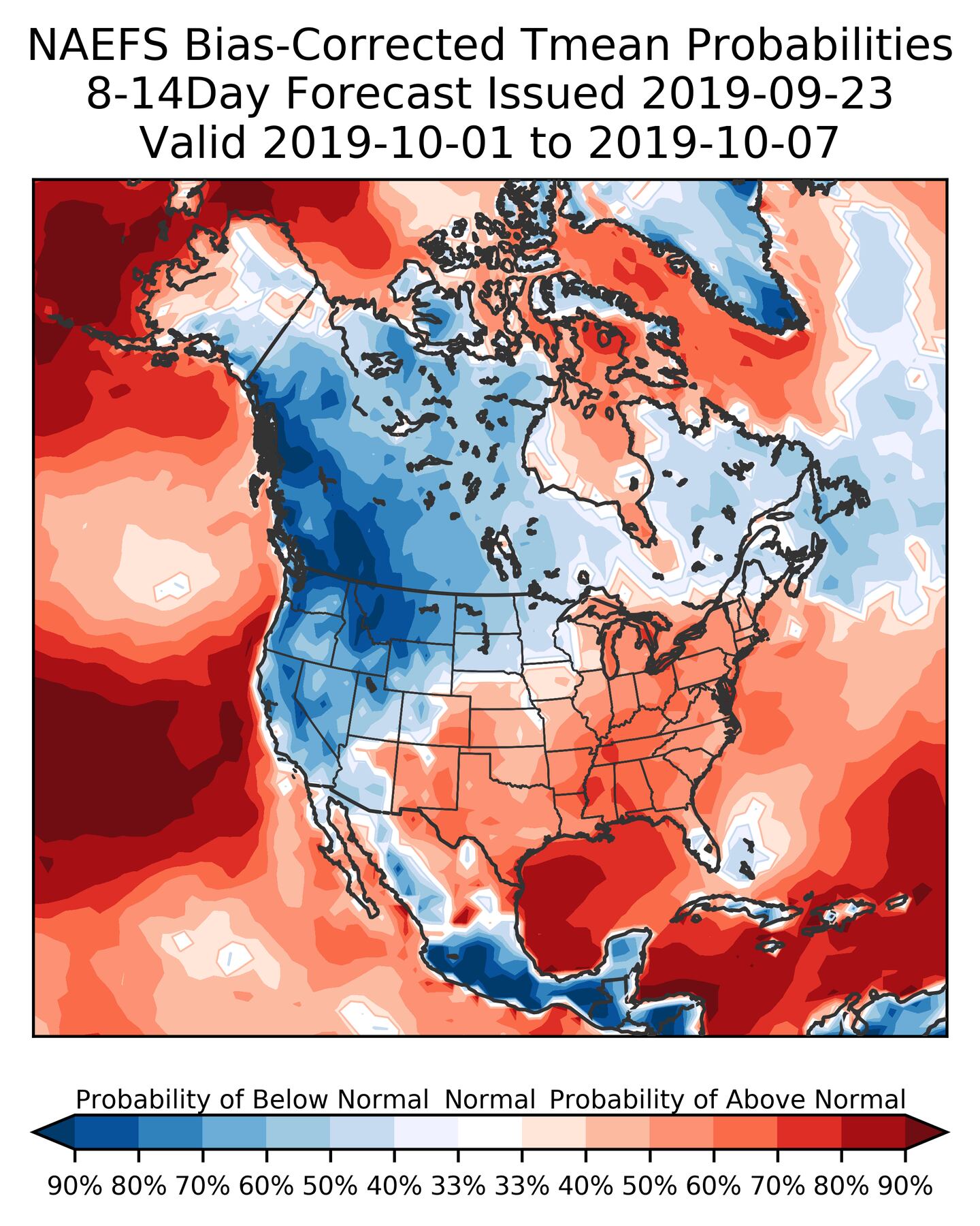
So October looks to average above-normal in temperatures and below-normal in rainfall for at least the first half, if not the whole month. It would probably take a tropical system of some kind to prevent that from happening.
One thing that is always in the back of my mind when we get extreme weather, the pendulum often swings so that many floods end in drought and many droughts often end in flood. It doesn’t HAVE to go that way and there’s no sign of it yet. But something to remember.
For more follow me on Twitter @MellishMeterWSB.


