
A large and dynamic storm system will move through the eastern United States today and tomorrow, bringing heavy rain and strong winds to the Southeast.
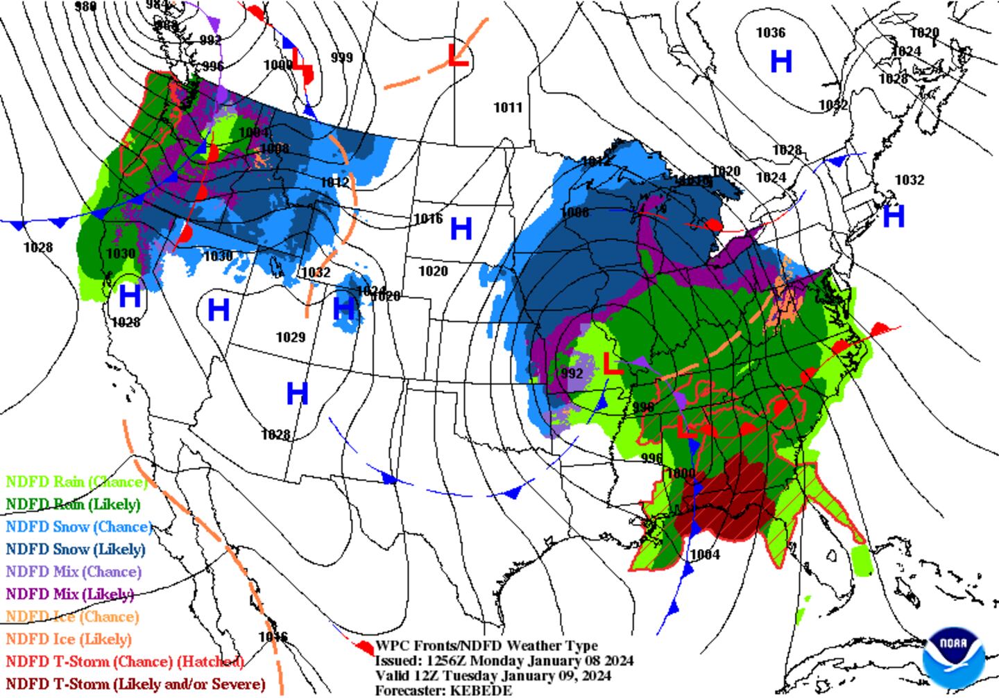
Georgia faces the potential for severe storms, including damaging winds and tornadoes.

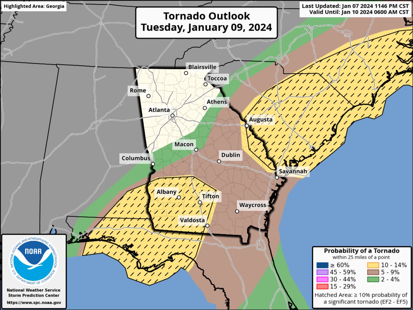
North Georgia -- including Metro Atlanta -- will stay just cool enough to mitigate the tornado threat, however heavy rain and gusty winds will still impact the area Tuesday morning.
Timing Out the Rain
Light rain showers will move into Metro Atlanta and North Georgia late tonight, becoming widespread after midnight into early Tuesday morning.
However, as the storm system continues to organize, a squall line will develop in Alabama and march east through North Georgia, just in time for the Tuesday morning commute.
The timeline for the arrival of this squall line is as follows:
- 3-5 AM: Bartow, Paulding, Carroll counties
- 5-7 AM: Pickens, Cobb, Douglas, South Fulton, Coweta, Fayette counties
- 7-9 AM: Forsyth, North Fulton, Clayton counties
- 8-10 AM: Hall, Gwinnett, Rockdale, Henry, Barrow, Walton, Newton counties
The animation below illustrates the Futurecast Radar Imagery early Tuesday morning through Tuesday afternoon.

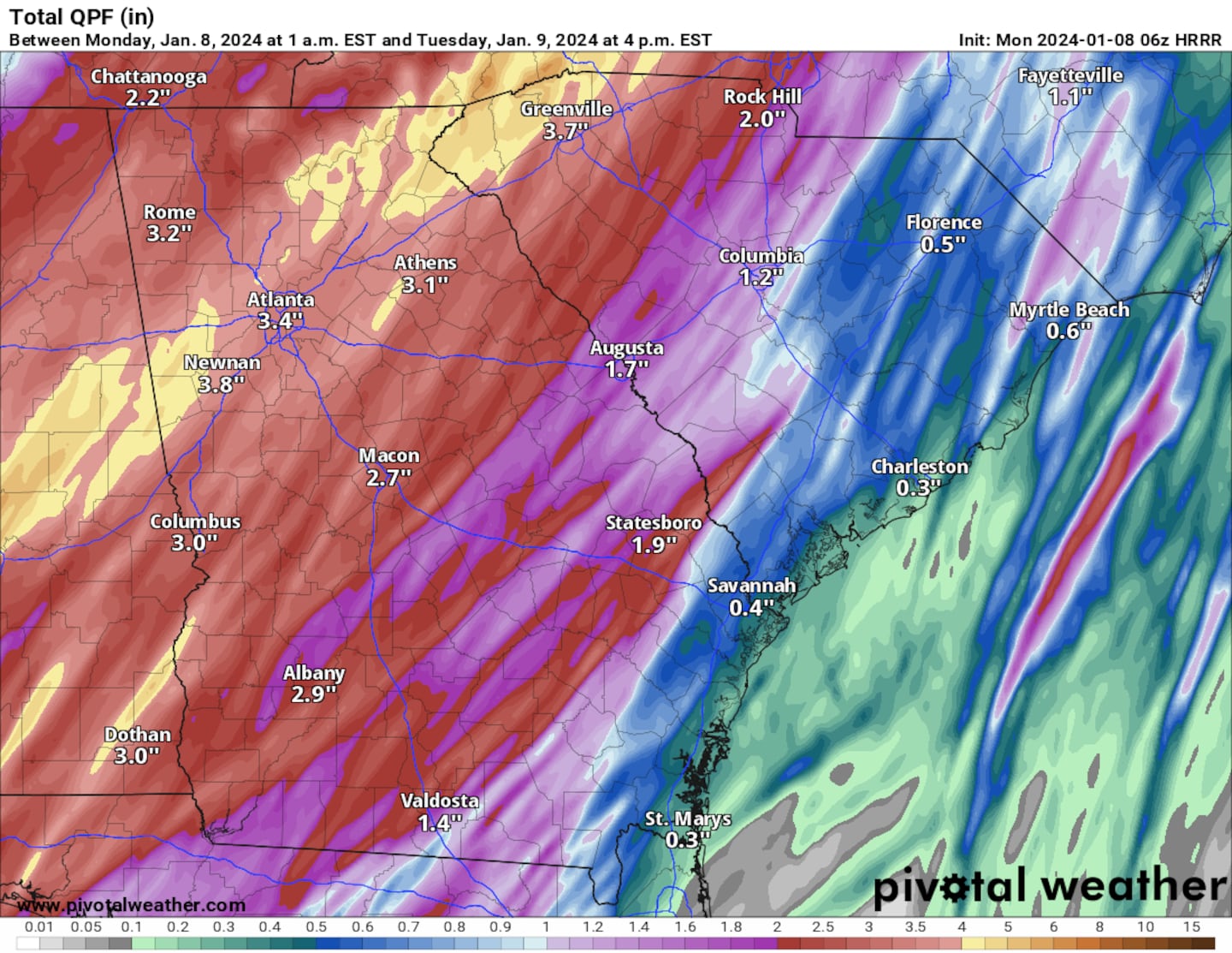
How Much Rain?
Light rain showers will arrive shortly before midnight, and they will continue before the squall line arrives.
The squall line will be a prolific rainmaker, dropping as much as an inch per hour as it moves through. Once it passes the Metro Atlanta area, stratiform steady rain showers will continue, tapering off in the afternoon.
As a result, as much as 1″ to 3″ of rainfall is highly likely across the Metro Atlanta area, with isolated areas receiving potentially 3″ to 4″ of rainfall, depending on storm motion and speed.
Below illustrates the potential total rainfall through Tuesday afternoon.
Windy Conditions
A strong pressure gradient will set up between the parent low moving through Missouri/Illinois and a high pressure system off the coast of New England.
As a result, strong non-thunderstorm winds will develop late Monday night and they will continue through early Tuesday morning.
Sustained winds of 20-25 mph are likely between 12 AM Tuesday through 12 PM Tuesday. In addition, wind gusts will peak as high as 45 mph in the Metro Atlanta area, and as high as 50 mph in the North Georgia mountains.
As a result, a Wind Advisory is in effect for much of the state of Georgia through 7pm Tuesday. A High Wind Warning is in effect for the North Georgia Mountains.
Wind gusts 40-50 mph are strong enough to knock down trees, branches, and potentially cause power outages.
The animation below illustrates the Futurecast wind gusts for Metro Atlanta and North Georgia between this evening and Tuesday evening.

Share Your Rainfall and Wind Reports With Me!
Facebook: Christina Edwards WSB
Instagram: ChristinaWSBwx
Twitter: @ChristinaWSBwx
TikTok: @ChristinaEdwards955WSB
©2023 Cox Media Group


 Sign Up

