An upper level longwave trough is digging through the Southeast today, producing torrential downpours this afternoon followed by a dramatic change in temperatures Wednesday morning!
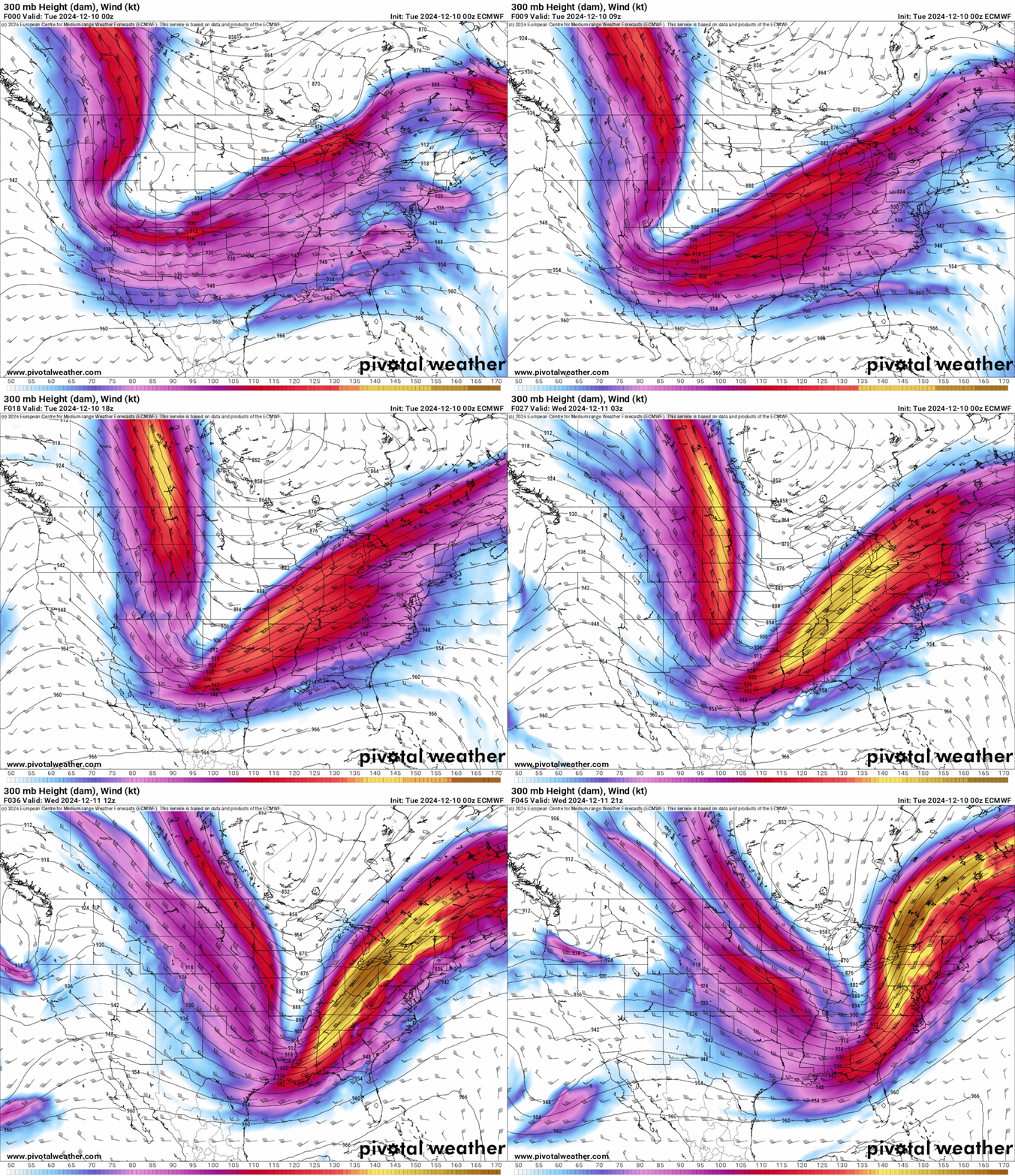
The animation below illustrates the upper level winds and a large dip in the jet stream as it moves into Metro Atlanta.
This upper level set up supports widespread heavy rainfall, and even a few thunderstorms across the Southeast.
Locally, heavy rain will return to Metro Atlanta today, potentially creating a traffic headache for the afternoon and evening commute.
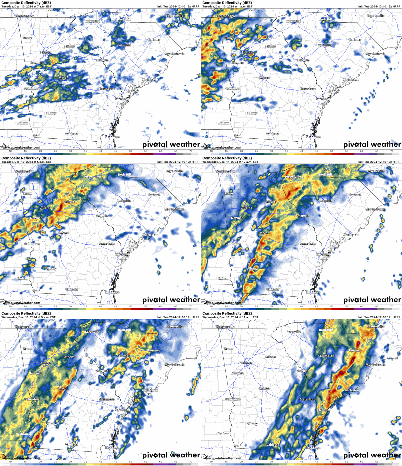
The animation below illustrates the Futurecast Radar Imagery for this afternoon and into this evening.
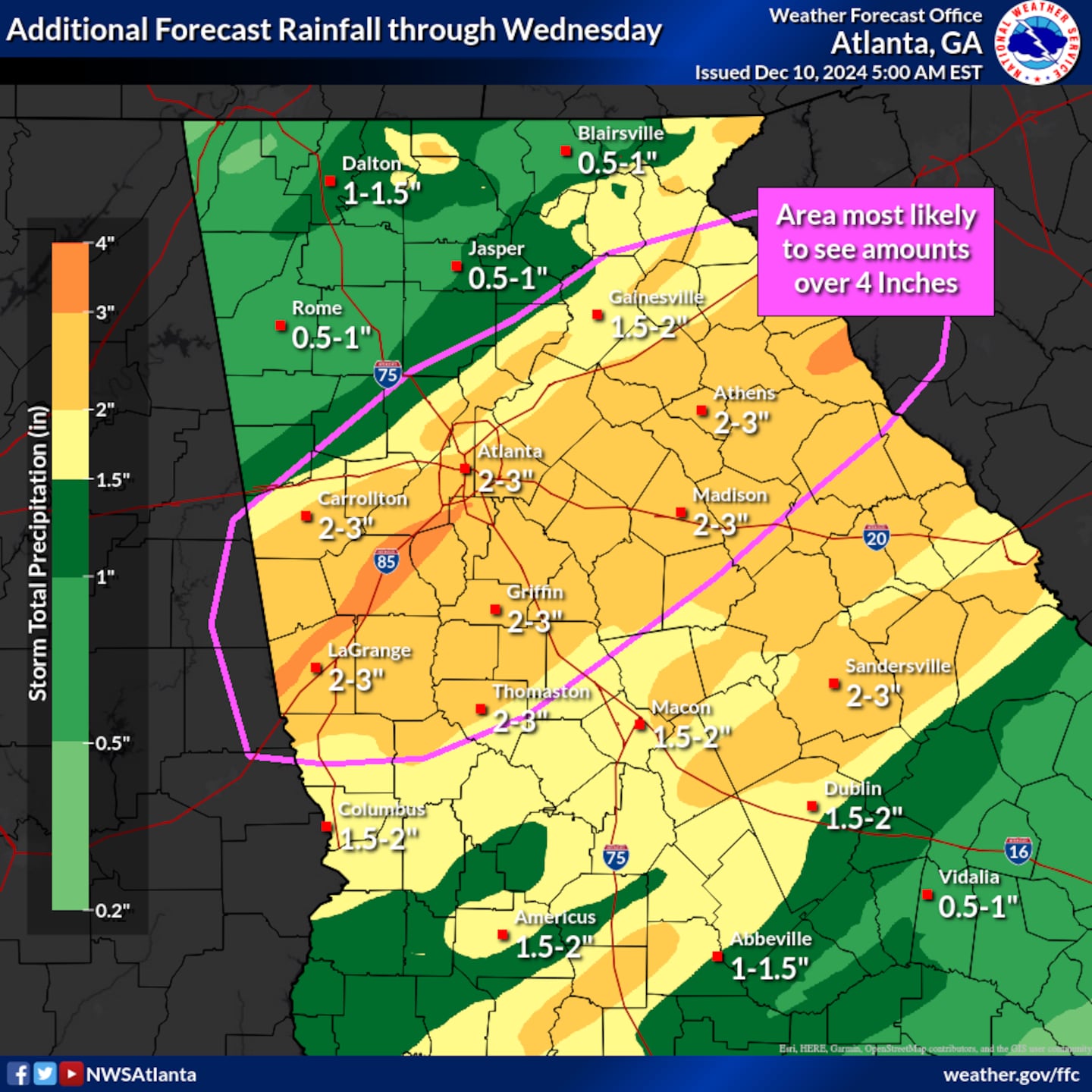
The majority of Metro Atlanta can expect 2 inches of rainfall through this evening, though locally higher amounts are possible where rain showers move over the same area over and over again -- a process known as “training” in meteorology.
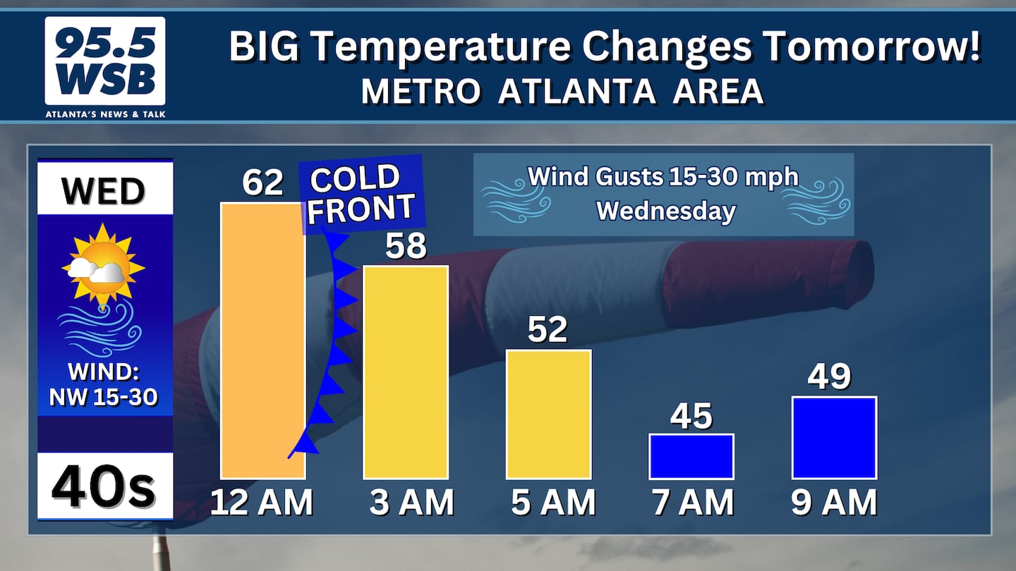
The rain will move out of Metro Atlanta by 7am Wednesday as a cold front sweeps through the region.
However, the cold front will bring a significant change to our temperatures! Instead of daytime highs in the mid 60s, expect afternoon highs in the 40s with wind gusts as high as 30 mph!
Temperatures will drop to the freezing mark (low 30s) by Thursday morning.
Share Your Rainfall Totals With Me!
Facebook: Christina Edwards WSB
Instagram: ChristinaWSBwx
Twitter: @ChristinaWSBwx
TikTok: @ChristinaEdwards955WSB
©2024 Cox Media Group


