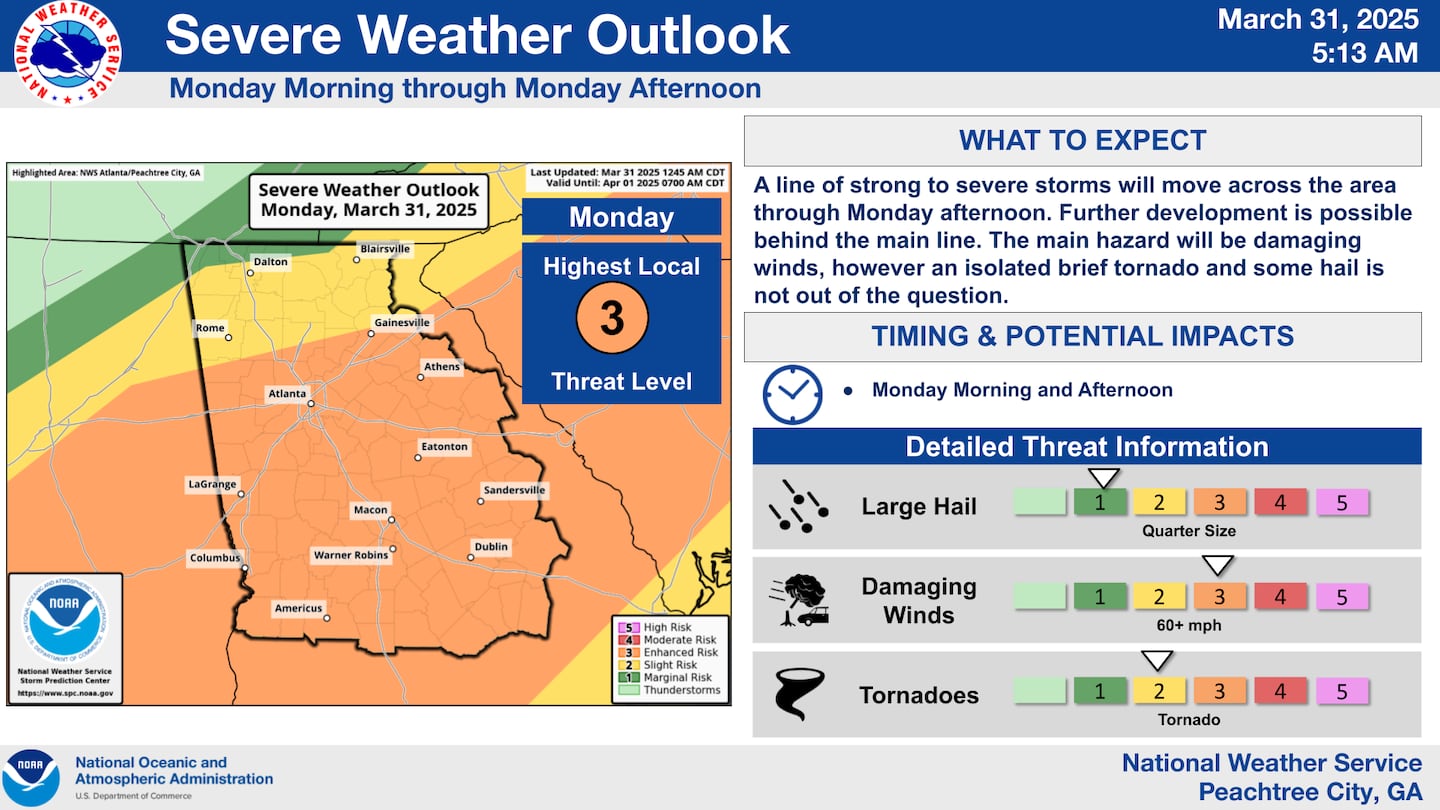
A cold front will push heavy rain and thunderstorms through North Georgia today, and some storms may be strong to severe with damaging winds possible for the Metro Atlanta area.
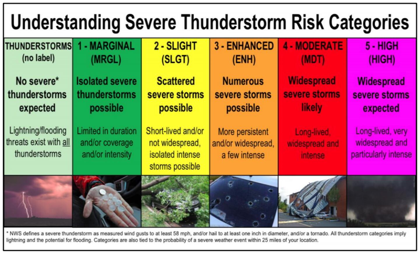
The Storm Prediction Center has outlined the majority of the state of Georgia in an *ENHANCED RISK* for severe storms, or Level 3 out of 5.
The storms are already moving through Mississippi and Alabama before arriving in Georgia later this morning and early afternoon.
Use the Interactive Radar below to track the storms.
Metro Atlanta Timeline
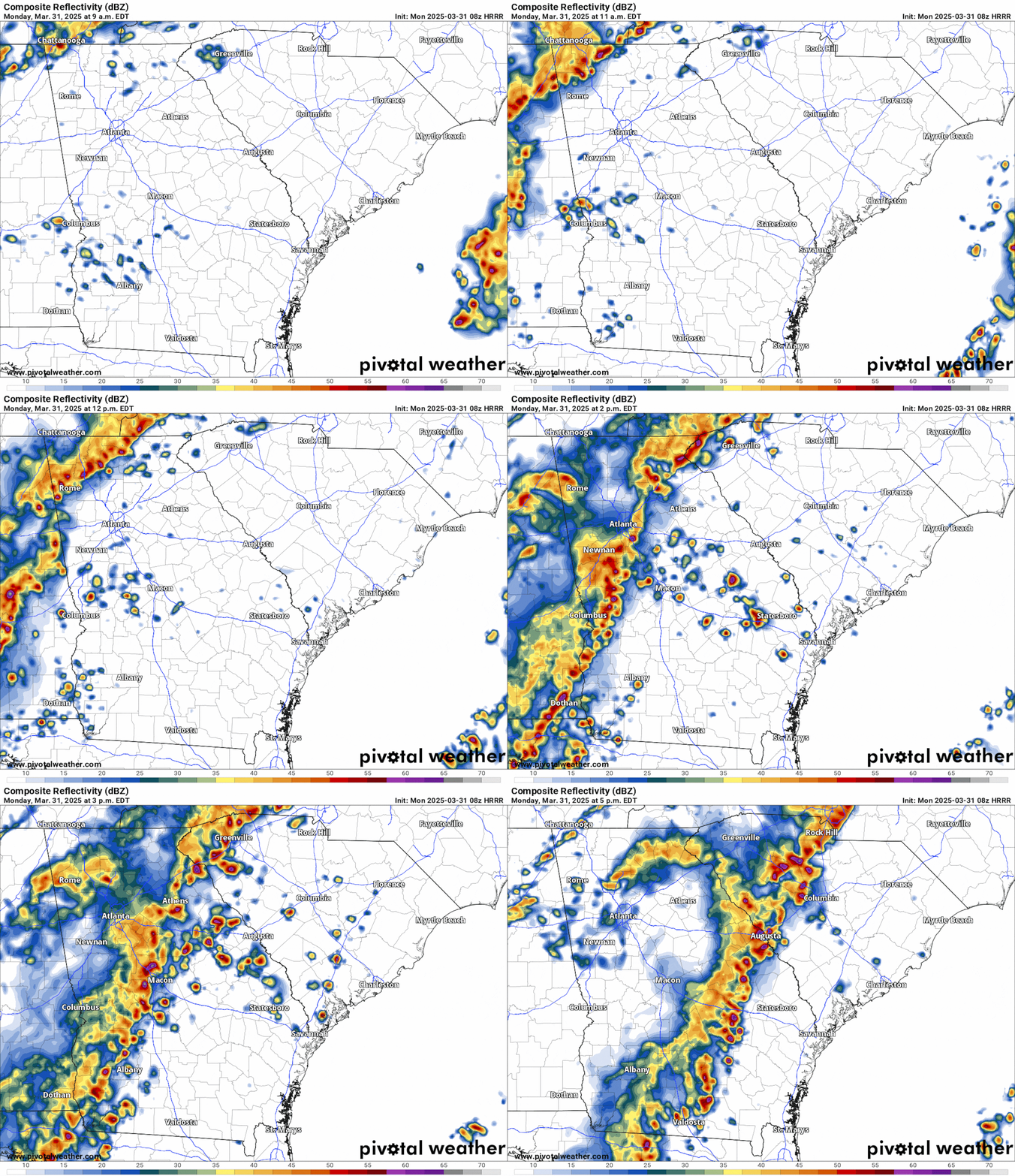
The storms will roll through the Metro area between 11am and 4pm. The animation below illustrates the Futurecast radar imagery for later this morning into this afternoon.
Potential Impacts
These severe storms will be capable of the following:
- Wind gusts 60+ mph (straight-line winds strong enough to knock down trees and powerlines)
- Large hail (diameter 1 inch or greater)
- Tornadoes are possible, though they will be brief and isolated
Continue to monitor the weather forecasts through this afternoon, and keep cellphones charged before the storms arrive. In the event of power outages, the cellphone can serve as a flashlight. In addition, stream the 95.5 WSB storm coverage with our 95.5 WSB News App.
Share Your Storm Reports With Me!
Facebook: Christina Edwards WSB
Instagram: ChristinaWSBwx
Twitter: @ChristinaWSBwx
TikTok: @ChristinaEdwards955WSB
©2025 Cox Media Group


