Warming events in the stratosphere above the North Pole often occur in winter but are not common in the Fall months. These events can release polar air in a Southward displacement as the jet stream is often distorted after the event peaks with a lag of a number of weeks. No two are ever alike and thus the degree and location of impact varies.
They do NOT HAVE TO have a major impact on the weather in the U.S. but they often do. A SSW is just one of many weather/climate drivers, one piece of the puzzle, there are no 1:1 relationships in the atmosphere.
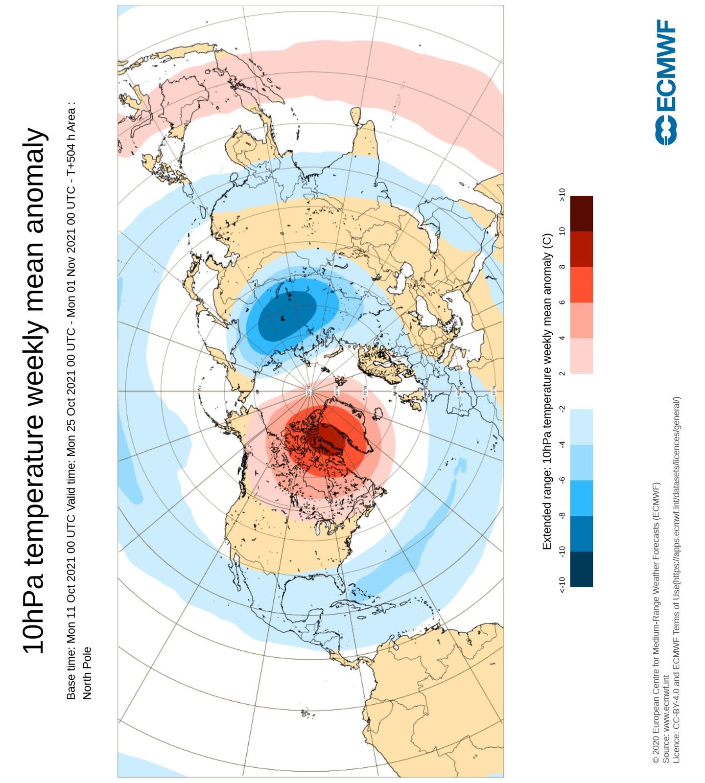
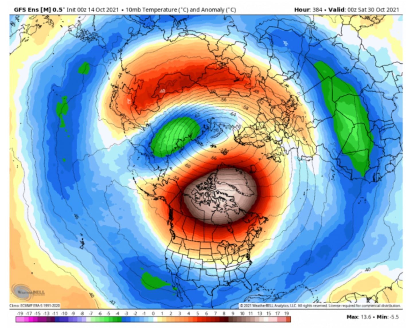
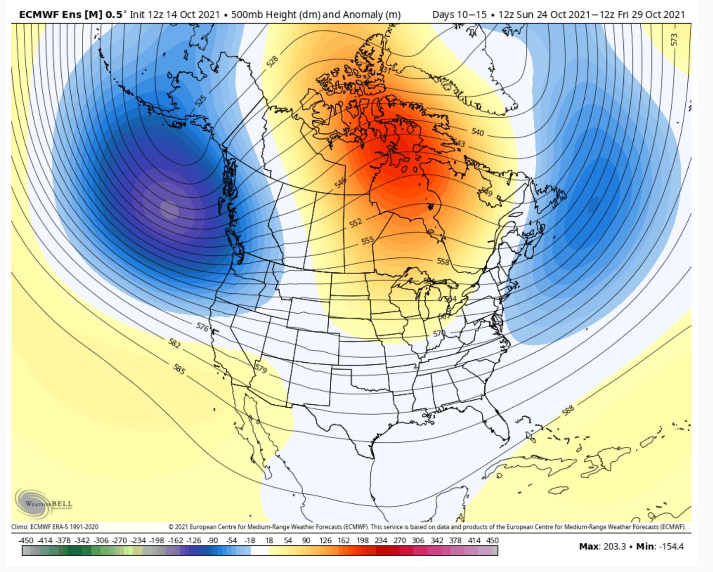
Both primary Global Prediction Models project a somewhat rare Sudden Stratospheric Warming Event (SSW) which weakens the polar vortex circulation with anomalies shown over Greenland/Canada late this month-early November:
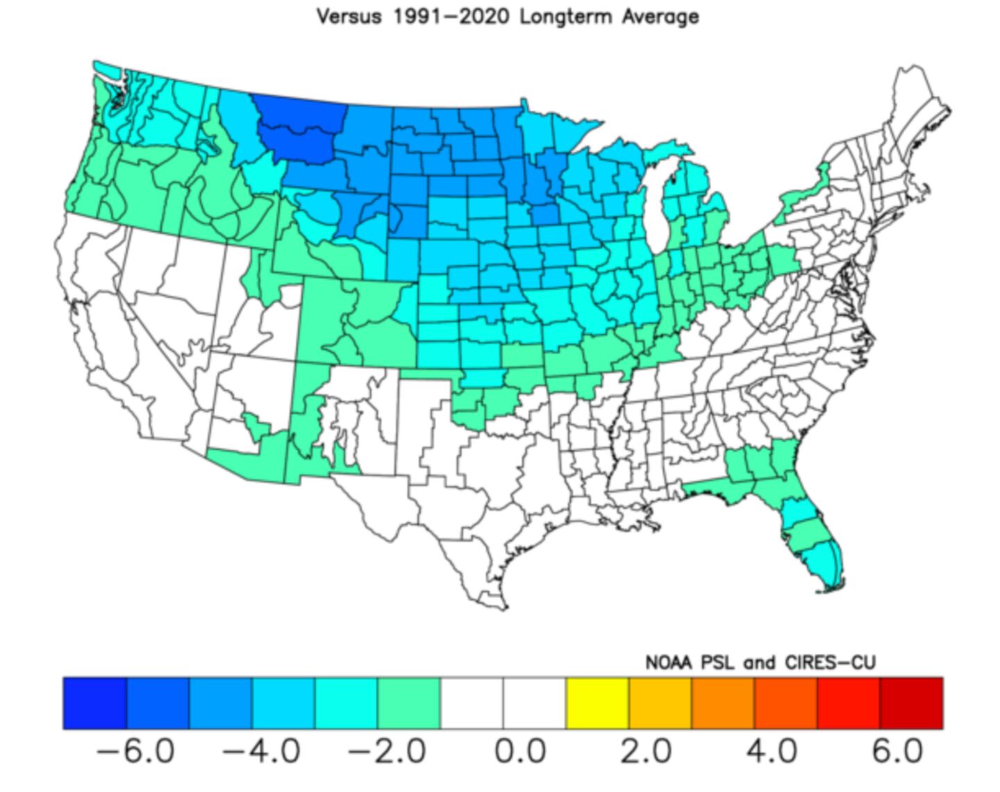
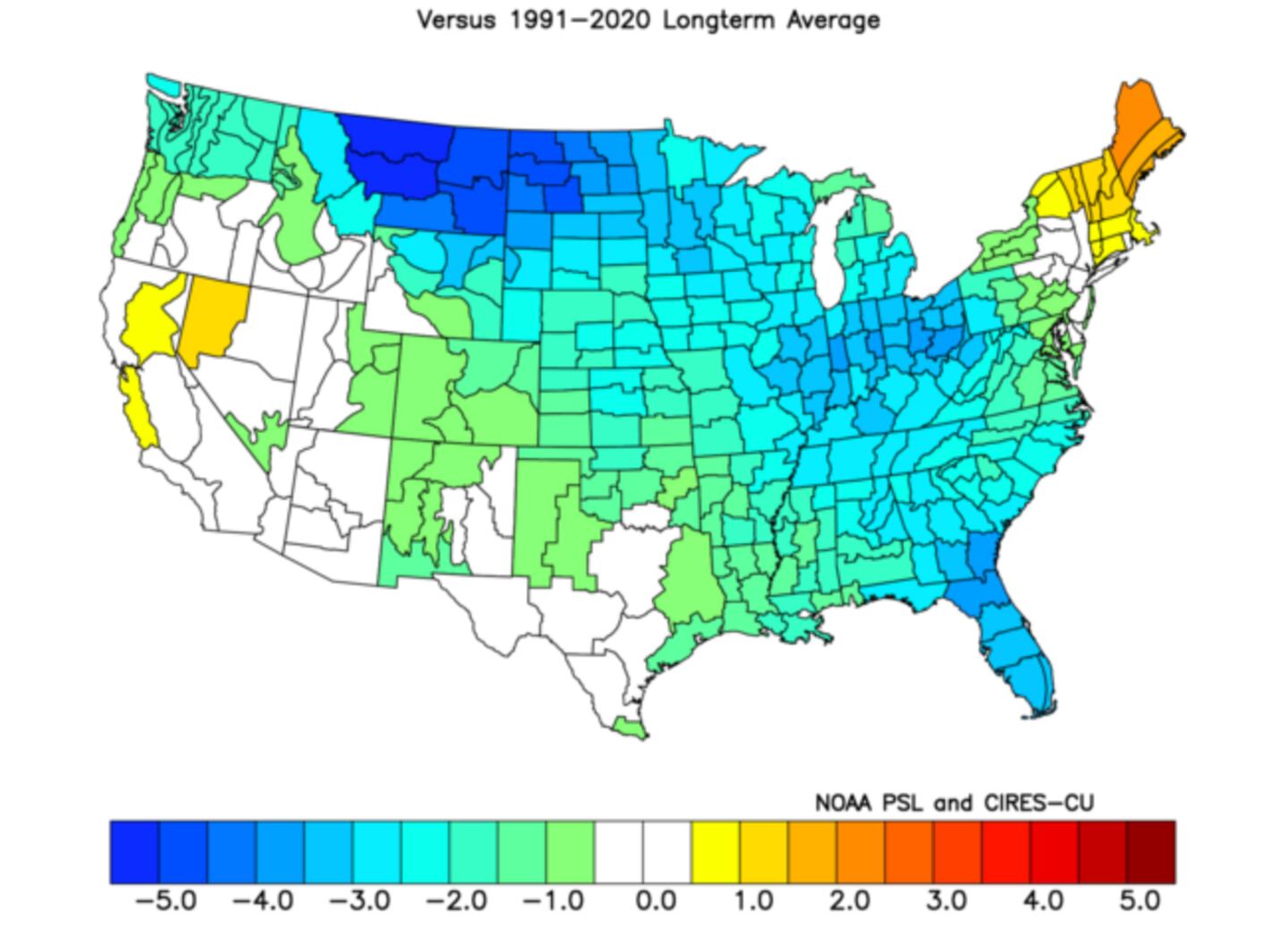
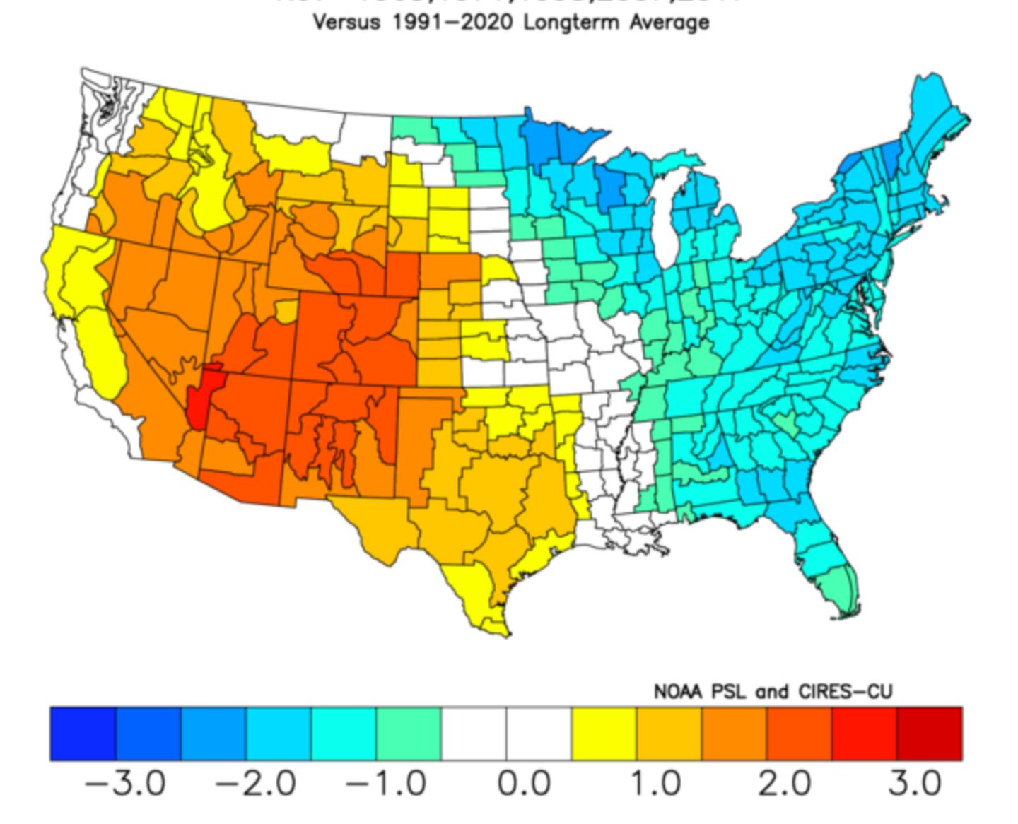
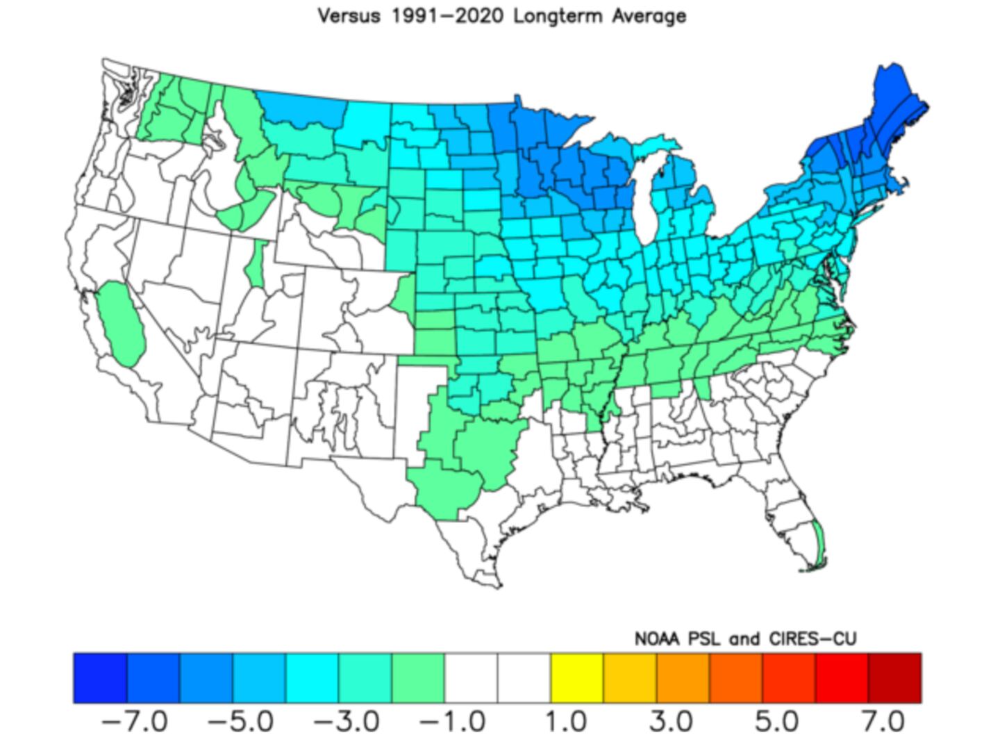
Below shows what happened to November temperatures with similar SSW from the past. The first map shows all close matches and the second map shows the closest historic analogs:
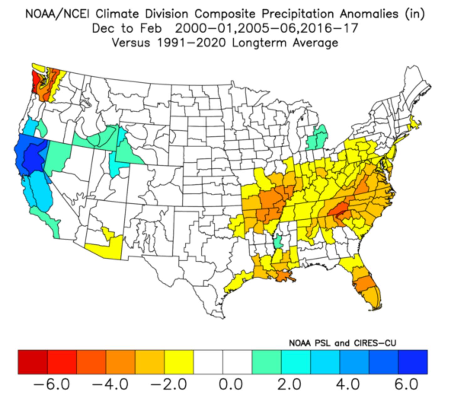
Precipitation from those past autumn SSW events was drier than normal in November on average in Georgia.
ECMWF ENSEMBLE 500MB JET STREAM PATTERN FORECAST LATE MONTH:
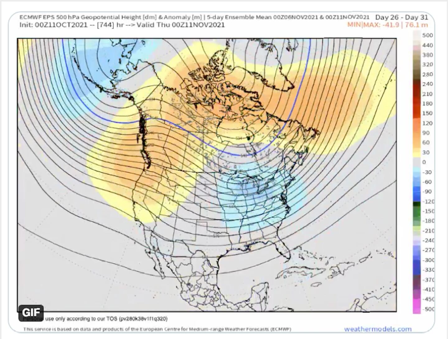
ECMWF MODEL ENSEMBLE JET STREAM PATTERN 5-DAY MEAN BY EARLY TO MID NOVEMBER:
This is NOT A FORECAST for November but is something to monitor going forward for signs of where the atmosphere will respond to the SSW IF the models are right about it occurring. REMEMBER THREE THINGS: 1) the stratosphere and the lower atmosphere do not always couple together in these events, 2) there is a many weeks lag between what happens with the vortex over the pole and what happens in the troposphere (where weather occurs), 3) the cold air displacement sometimes goes into Europe/Asia and not the U.S.
Previous expectations (prior blog posts you may have missed) have been for November temps to average near-normal in our area and that has not changed, yet.
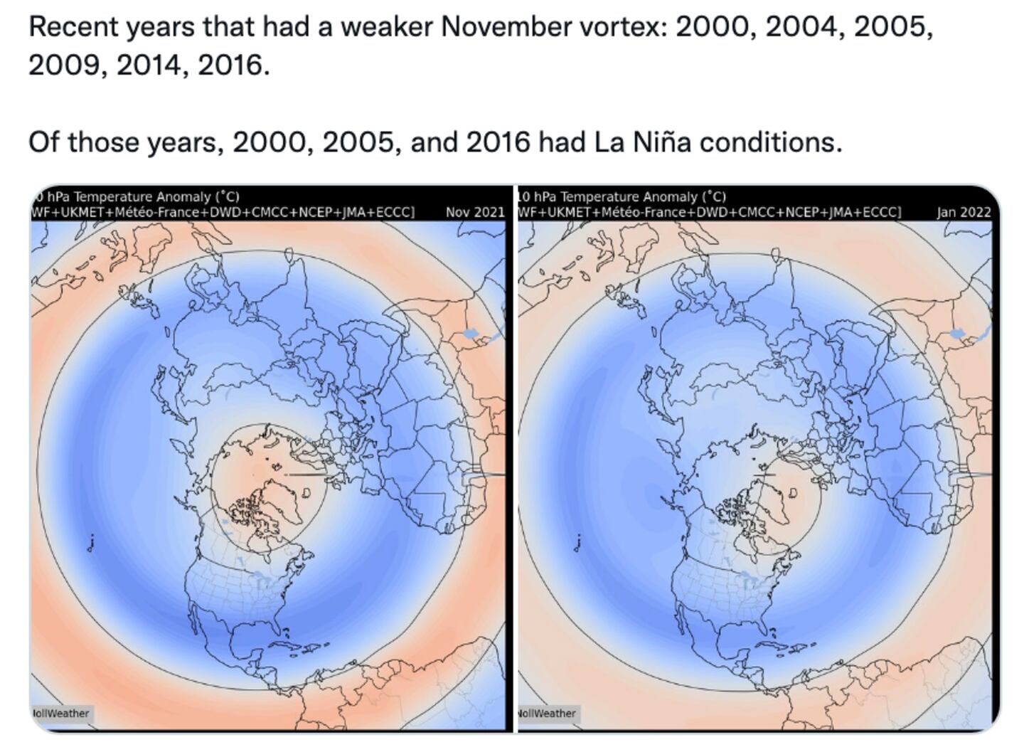
8 DIFFERENT MODELS FROM 6 DIFFERENT COUNTRIES FORECAST NOVEMBER AND JANUARY TO HAVE THE WEAKEST POLAR VORTEX WHICH “OPENS THE DOOR” TO JET STREAM POSSIBLY DISCHARGING POLAR AIR:
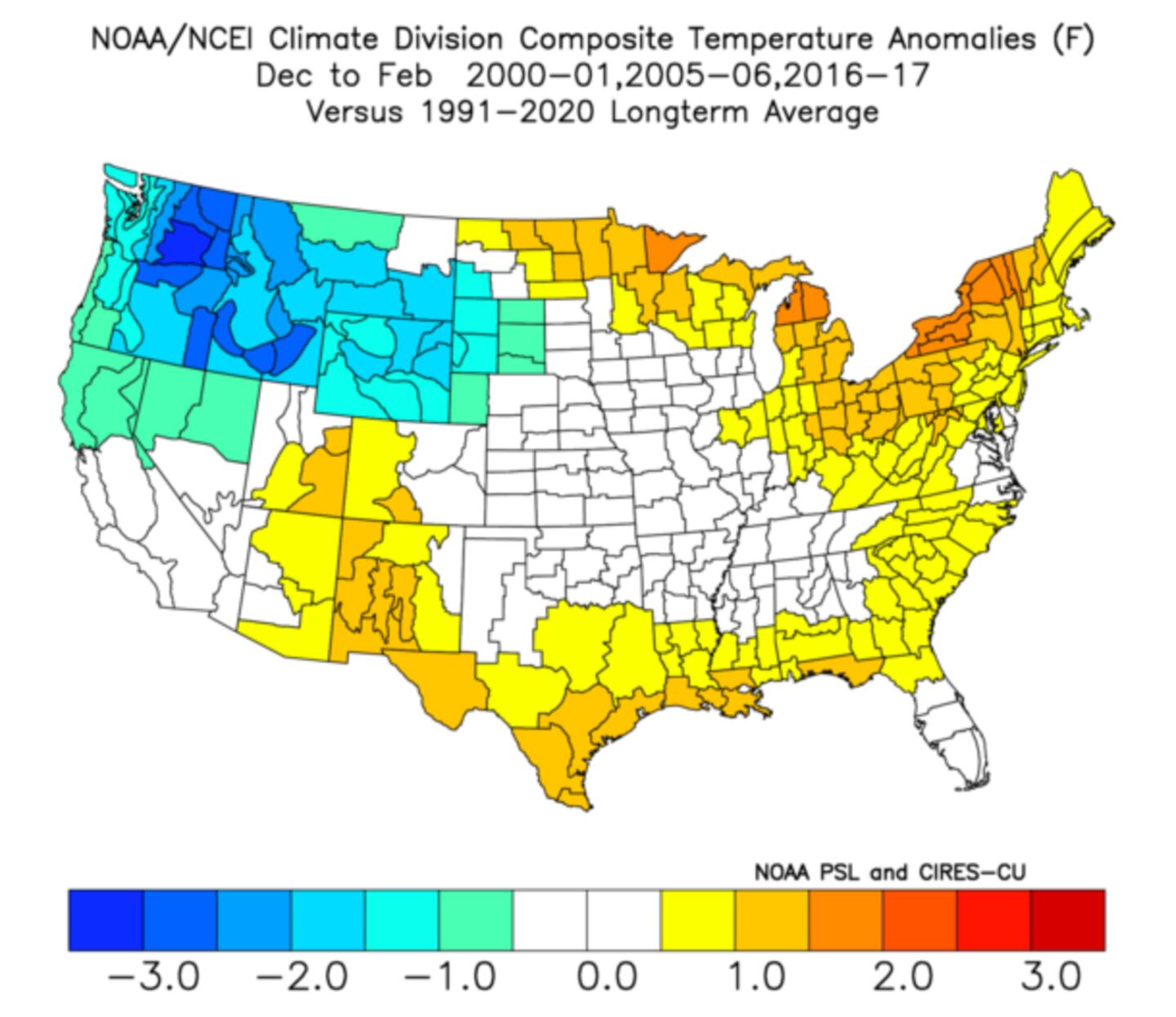
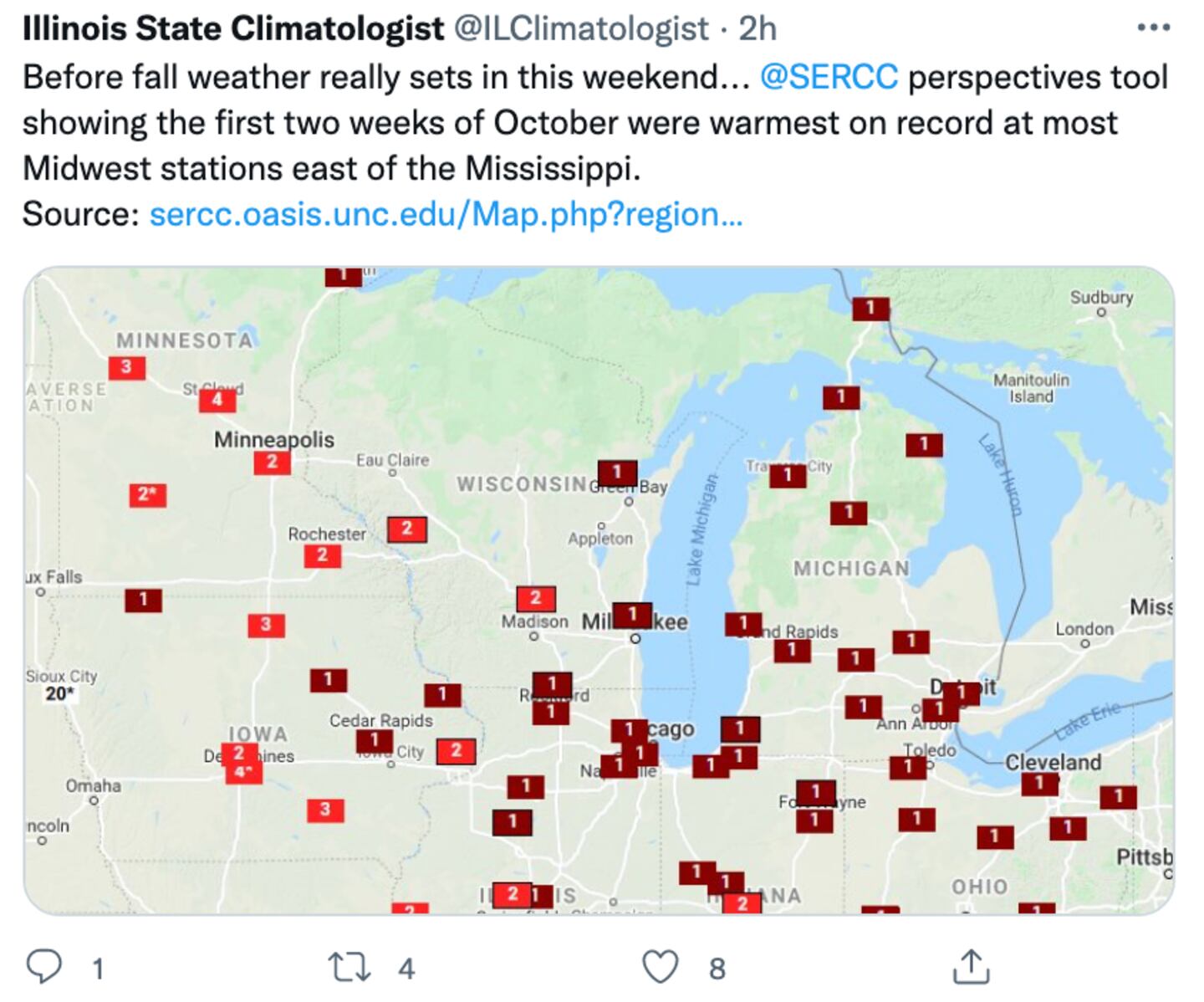
Meanwhile, the warmer than normal OCTOBER temperatures have been widespread so far, even in New England. Here is what past November and December temps have looked like on average following similar past Octobers:
However, since it is only mid-October, we don’t know yet if this October will end up as one of the handful of warmest Octobers. I have my doubts. At any rate, this is just research NOT A FORECAST.
My winter forecast will be released next month with an outlook for November late this month.
©2021 Cox Media Group


