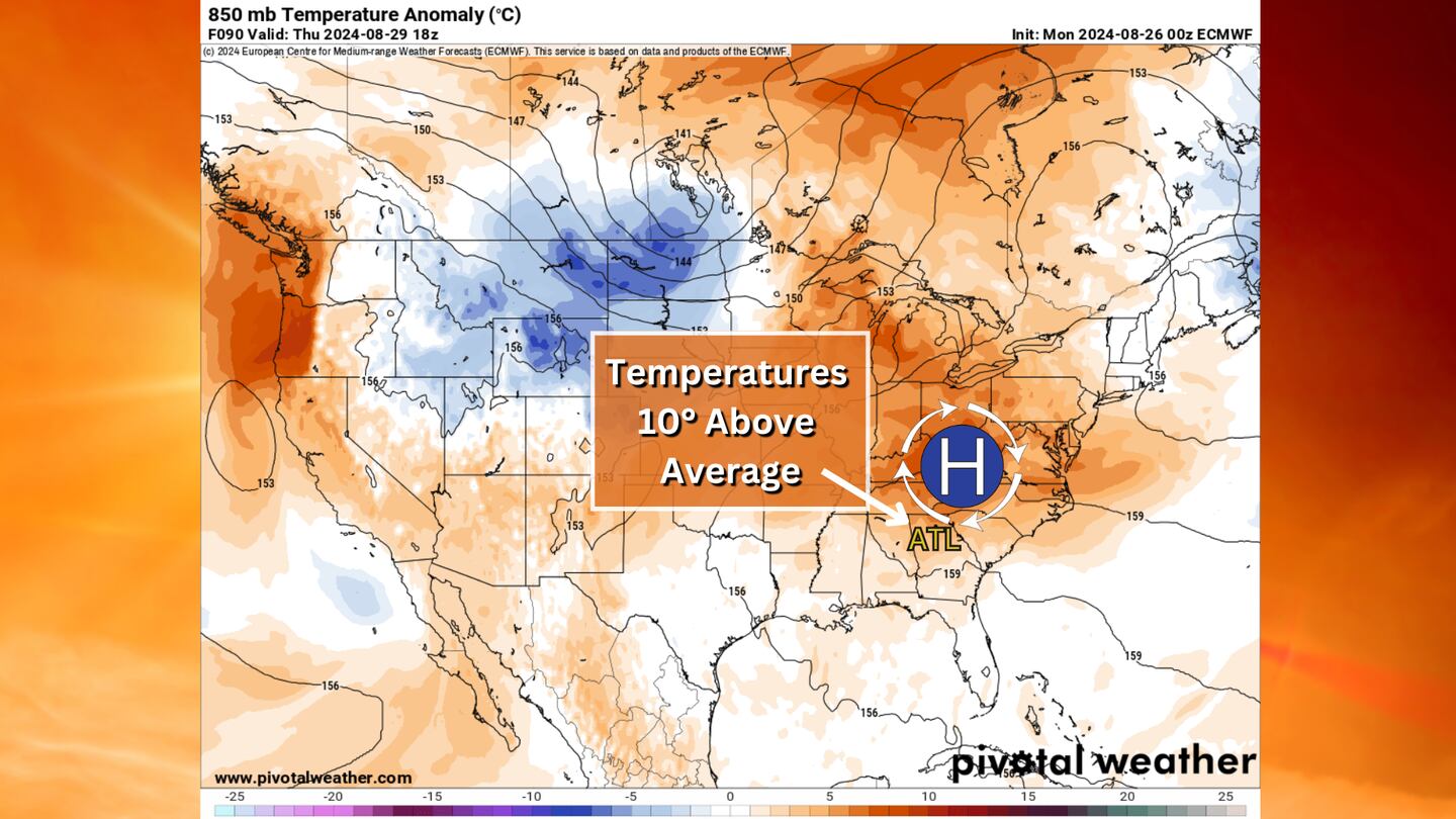
Over the weekend, high pressure settled over the Great Lakes, pushing cool and dry air south into Georgia.
However, that same high pressure system will move directly over Georgia, which allows humid air from the Atlantic Ocean to flow back into Metro Atlanta.
The high will also be responsible for climbing afternoon temperatures.
High pressure means sinking air, and sinking air compresses as it reaches the ground. That compression causes adiabatic heating, which means the temperature heats up naturally due to the sinking air.
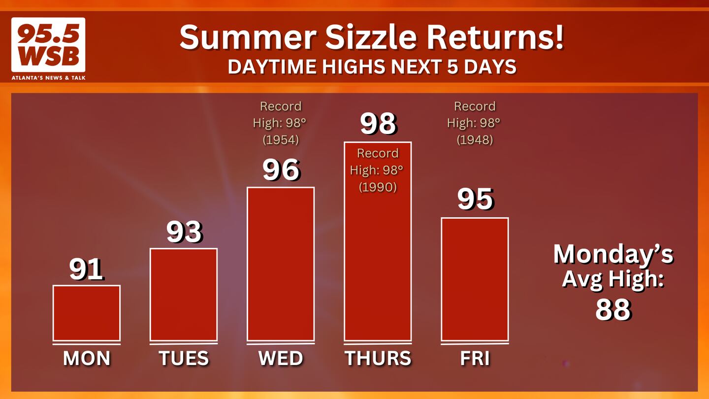
As a result, a heat wave will develop over Metro Atlanta as temperatures soar close to 100 degrees by Thursday, which is trending about 10-15 degrees above average.
Temperatures this week will be close to record-high territory! Below is the list of daily record highs for this week.
- Monday, August 26: 100° in 1943
- Tuesday, August 27: 100° in 1943
- Wednesday, August 28: 98° in 1954
- Thursday, August 29: 98° in 1990
- Friday, August 30: 98° in 1948
Share Your Temperature Reports With Me!
Facebook: Christina Edwards WSB
Instagram: ChristinaWSBwx
Twitter: @ChristinaWSBwx
TikTok: @ChristinaEdwards955WSB
©2024 Cox Media Group


