SUNDAY, JANUARY 5 MORNING THOUGHTS:
Let me preface this by saying, this is not a “milk, eggs, bread” drill.
BUT, I will be monitoring Friday and Saturday, Jan 10-11 very closely!
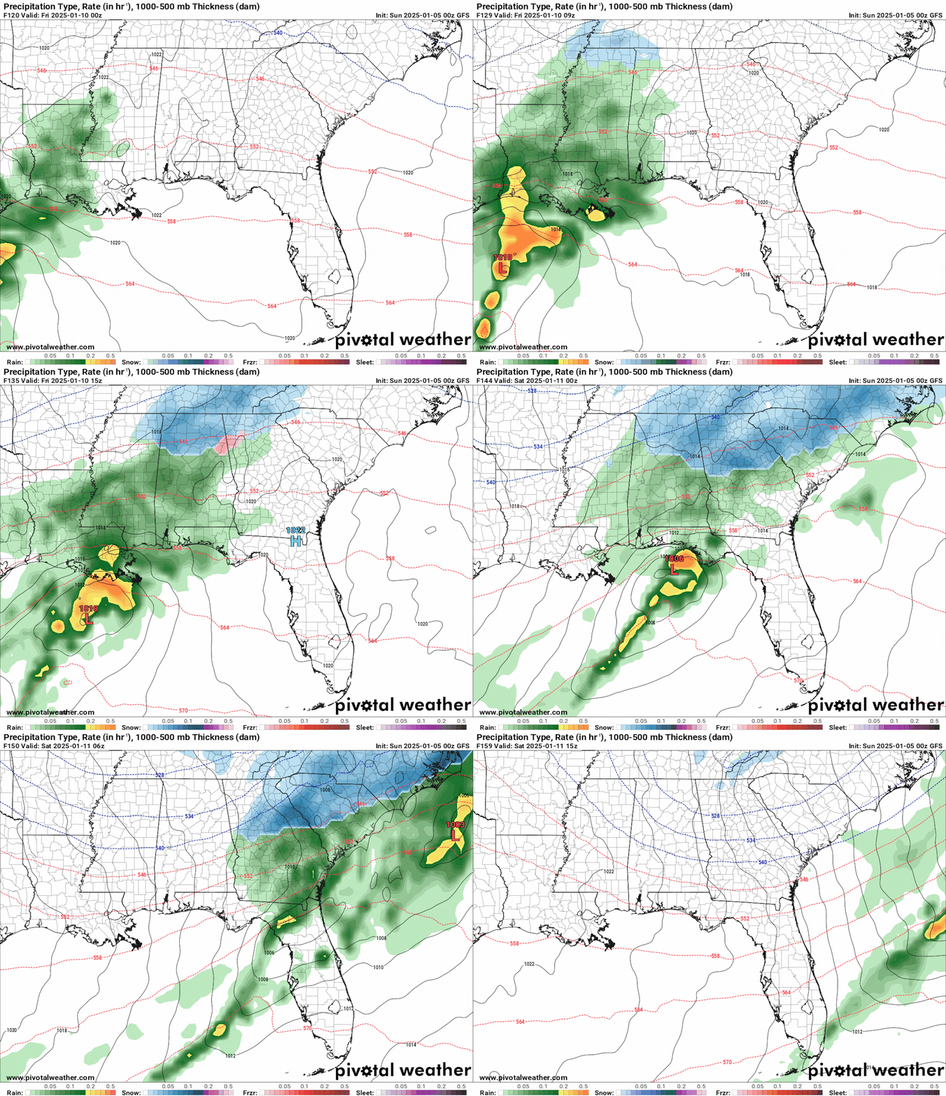
Over the past 48 hours -- last Friday-- I noticed that our long range models were honing in on a Southern Low set up on Friday and Saturday, January 10-11.
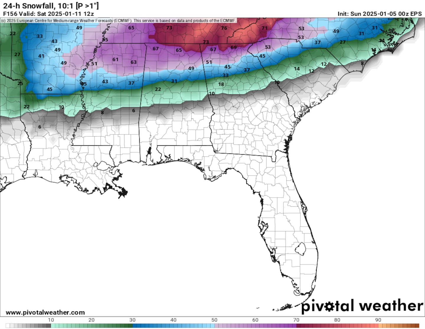
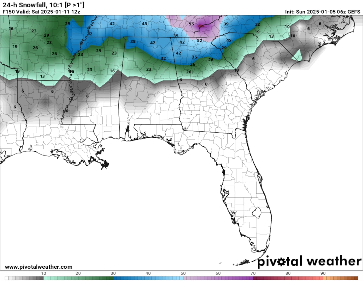
I’m noticing the two models are consist in run-to-run, as well as with each other. They’re both consistently showing some kind of wintry set up on Friday and Saturday...
Below is the ECMWF, or the “Euro Model”:
Below is the GFS, or the “American Model”:
HOLD YOUR HORSES!! WHAT KIND OF WINTRY PRECIP??!!
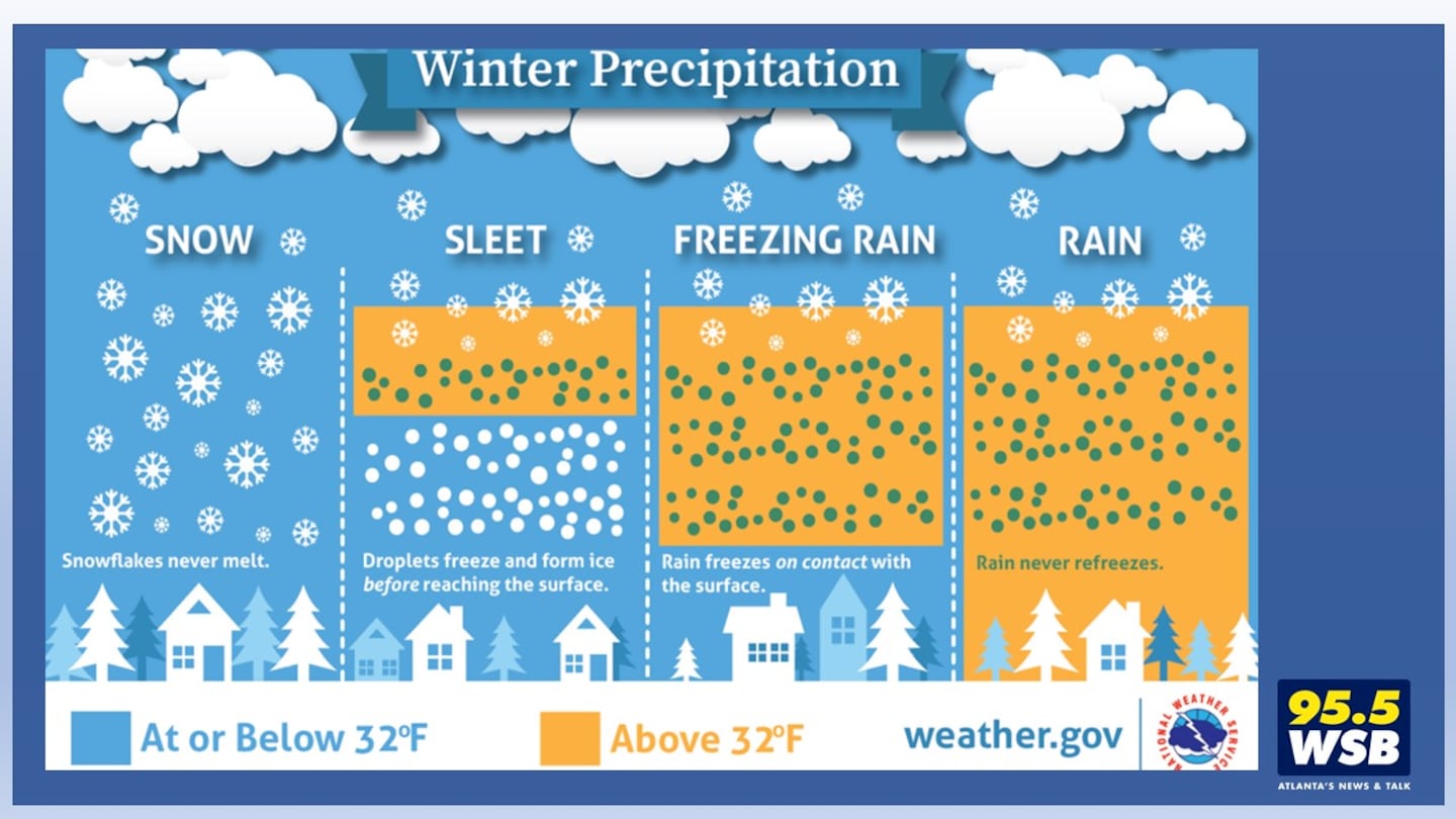
Remember: It’s not just snow! Sleet and Freezing Rain may also be at play, both of which will put a damper on snow accumulations.
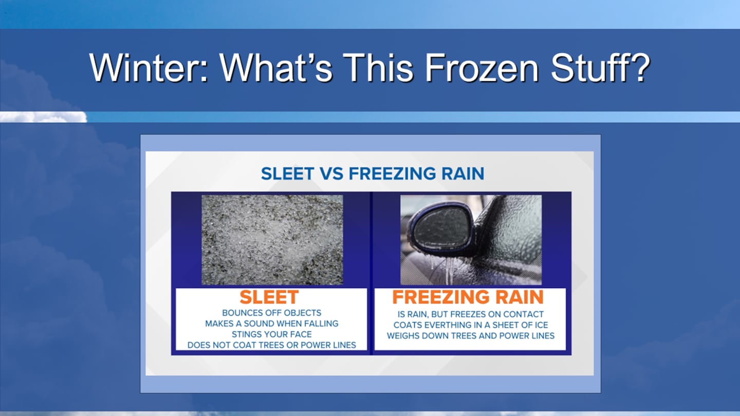
Sleet is a bummer, because it’s ice pellets that accumulate. It’s hard to have any fun with sleet!
Freezing Rain is a nightmare -- it’s liquid rain that freezes on contact with a frozen surface, like your car or the ground. You don’t know that it’s freezing until it does, and then suddenly I-85 looks like a skating rink.
SO YOU’RE SAYING THERE’S A CHANCE...
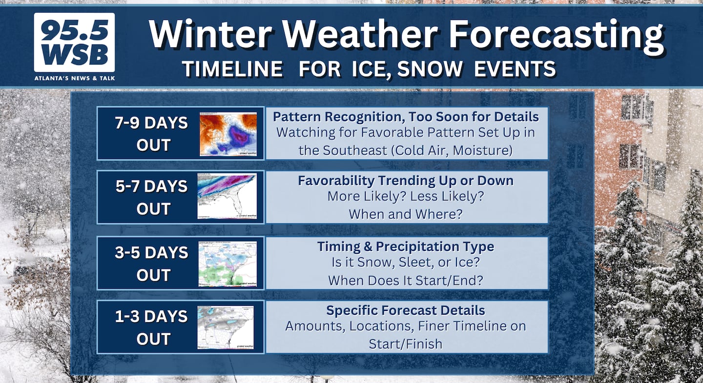
Yes, it’s a chance, but it’s not a “slam dunk” yet. There’s still too much time between now and Friday/Saturday to accurately know who, what, when, where, and how much of anything will fall.
I will say this -- both the Euro Model and the GFS have trended slightly higher for the potential for accumulating snow through the end of the week.
The key word here is “slightly”. It went from 0% last week to 10% yesterday (Saturday) to 20-60% today (Sunday).
So with this trending favorably, I need to keep an eye on this system through the end of this week.
Euro Model Ensemble Blend:
The ECMWF Ensemble Blend shows the potential for 1″ or greater snowfall trending upwards for Metro Atlanta... Though it is still 45-60%. There is a 40% chance that no snow falls at all.
GFS Model Ensemble Blend:
The GFS Ensemble Blend shows the potential for 1″ or greater snowfall trending upwards for Metro Atlanta... Though it is still 20-40%. There is a 60-80% chance that no snow falls at all.
AS OF SUNDAY MORNING, WHAT DO I KNOW FOR NEXT WEEK:
I know that the timing of arrival and ending, as well as *what kind of frozen stuff* is still too far in the future to determine. I also know that geographically, the “when will it hit my house?” will adjust as we see where the center of low goes.
If the Low goes north -- it’s a miserably cold rain.
If the Low goes south -- some of you will be making snow cream.
DO YOU HAVE PLANS FOR FRIDAY AND SATURDAY?
Don’t cancel them just yet, but keep an eye on the forecast Monday through Wednesday -- make your adjustments based on the information I and my fellow meteorology colleagues have by Wednesday morning. You should be able to make a go/no go call by then.
Cheers!
Talk Up A Storm With Me!
Facebook: Christina Edwards WSB
Instagram: ChristinaWSBwx
Twitter: @ChristinaWSBwx
TikTok: @ChristinaEdwards955WSB
©2025 Cox Media Group
