
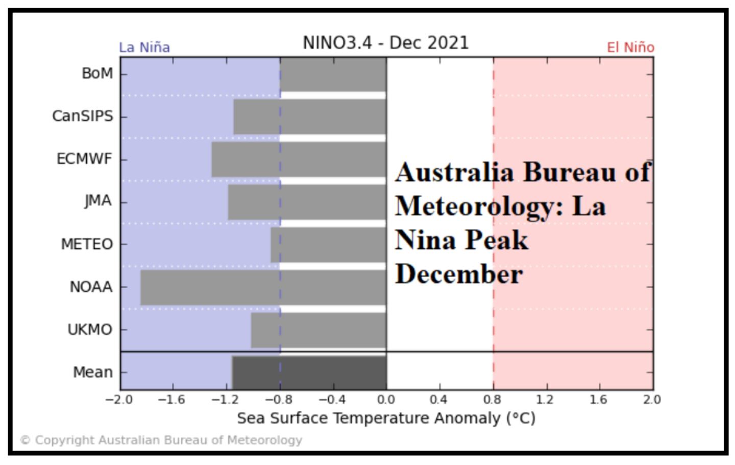
Many forecasters are calling for a very warm winter for most of the country resulting from a moderate or strong -ENSO. However, I DO NOT see the La Nina being as strong as they do.
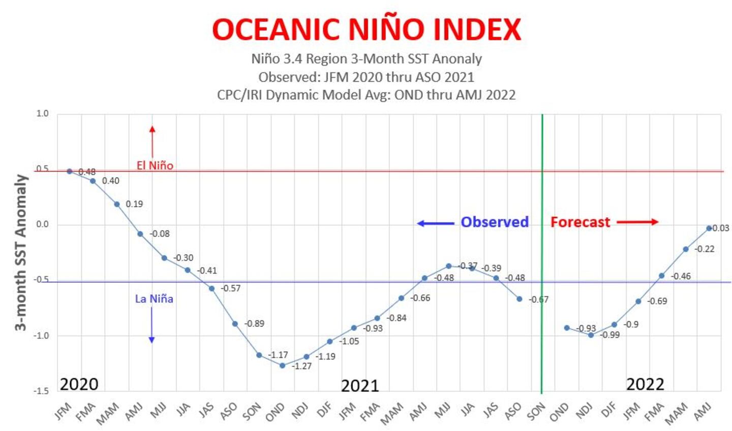
My expectation is that like last year, the Pacific Ocean will be in a state of LA NINA during the winter, probably a weak to moderate one with only modestly cooler than normal sea surface temperatures for this second year “double-dip” La Nina (-ENSO):
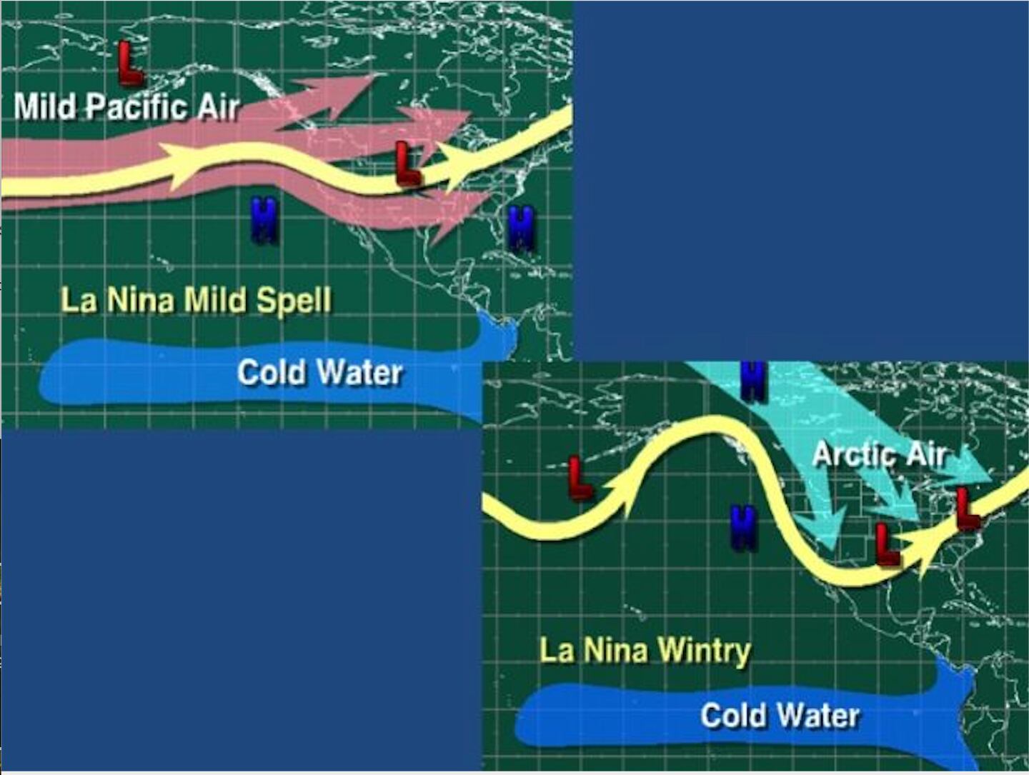
A gulf of Alaska 500mb low pressure persistence is typical of La Nina and when it is stubborn it is hard to get much cold in the East as it lends to a -PNA. We will have to watch to see if it can be replaced with ridging during the winter or at least shift enough Southwest of the Aleutian Islands to allow more of a +PNA.
For true cold air in wintertime in the U.S. much of Canada first needs to be snow covered and that Gulf low needs to go away. Otherwise it’s hard to get real cPK, cA, or cAK air masses (remember your high school geography class?) to intrude deep into the lower 48 states. If the Pacific jet stream is roaring into the U.S. you get milder ImP, mT or mP air masses, moderated by time over marine (ocean) territory.
On a national basis, this winter leans akin to last winter but with a bit more bite to it when and where it does get cold and snowy, it also looks erratic with changeable jet stream patterns over the December through March period, more so than last winter.
I don’t think the La Nina will be as strong as many other forecasters do so I will adjust my outlook accordingly.
EL NINO/LA NINA MODELS:
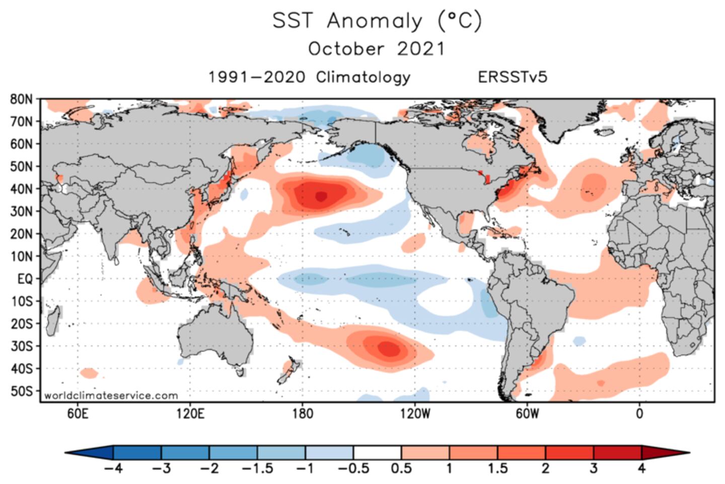
The Pacific Ocean is a huge energy source for the Atmosphere and thus the ENSO (El Nino Southern Oscillation) condition-- La Nina or El Nino-- is a major driver for weather patterns.
However, neither La Nina nor El Nino can be broad-brushed because no two are every exactly the same, but we do know what the composite looks like or what typically happens. We just have to remember mother nature does not care about what’s typical. The composite analog approach says to expect similiar weather in the future with similar conditions as in the past. But a KEY POINT is similar is not = same.
Sure a LA NINA WINTER does favor warmer than normal in the Southeast on average. But the SSW events and behavior of the (AO/NAO) are wild cards that can flip the script if the stratospheric polar vortex ends up weak during winter, but those are things that can’t be forecast with accuracy this far in advance.
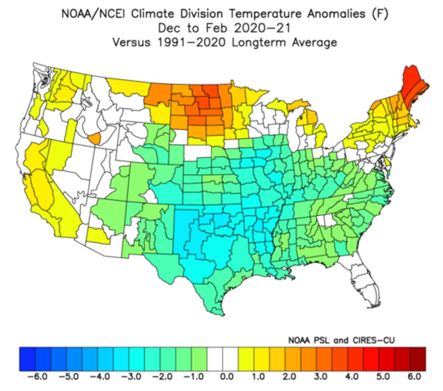
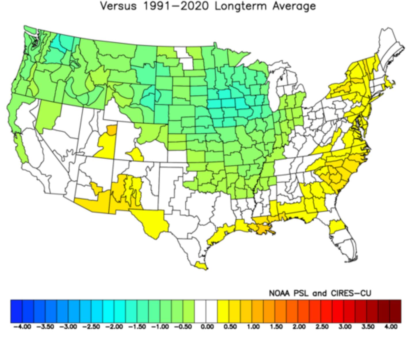
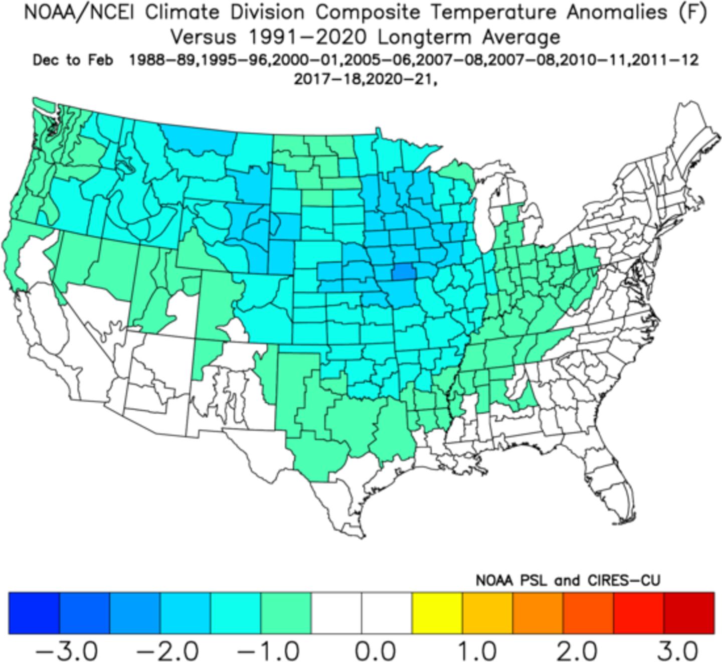
Last winter for example, was a first year La Nina but oops, the winter temperatures were opposite the composite mean of past La Nina’s in most of the country:
This is why it is important to remember that having an El Nino or a La Nina is NOT THE ONLY driver of the winter weather patterns, the totality of the global ocean-land-atmosphere-stratosphere matters and not all of those factors are predictable months in advance, we can only make a best estimate.
Long time followers/radio listeners know the details about the various inputs to long-range outlooks because I’ve explained them many times over the past decades so I won’t repeat them here to save time. But obviously since you’re looking at this on the web that means you can look up any terms used to learn as much as you want to go more in-depth. I’ve posted multiple blogs on the subject of winter over the past couple months that you can still view if you missed them.
FACTORS TYPICALLY USED TO COMPILE THE WINTER OUTLOOK:
Solar Cycle/sunspots, ENSO (LaNina/ElNino), IOD/SOI, Sea-Surface Temperature Anomalies across the Northern Hemisphere, North Pole and Eurasian Sea-Ice and snow coverage/advance in Autumn (SCE/SAI), the nature of the hurricane season, Asian-Bering North American teleconnection (ABNA), the nature of the summer and early autumn across North America, Northern Annular Mode (NAM), MJO best estimate, QBO trend and estimate, climate trends, AMO/PDO, Tropical Northern Hemisphere (TNH), research studies, statistical analysis models and dynamic forecast models, NAO/AO/EPO/WPO/PNA/MT-GLAAM estimates, PMM/AMM, SSW event-polar vortex estimate, Circumglobal teleconnections (CGT), high-latitude blocking estimates from these inputs (Greenland block), Rossby Wave jet stream storm track cycles since spring, ENSO-atmosphere evolution using ENSO region 1.2 and MEI/ONI historic comparison, Southern Hemisphere South American Summer to North America winter echo pattern, synoptic evolution of early Autumn.
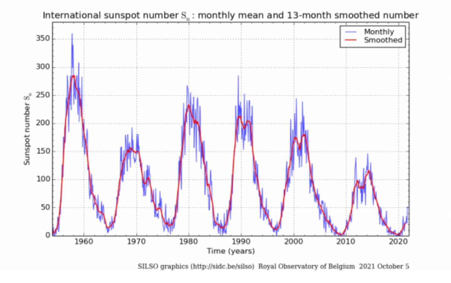
RAW SOLAR CYCLE ANALOGS FOR THIS WINTER:
WEIGHTED SOLAR CYCLE ANALOGS ENSO STRATIFIED FOR THE COMING WINTER:
CLOSEST MATCH SOLAR CYCLE WINTER ANALOGS FOR THIS WINTER:
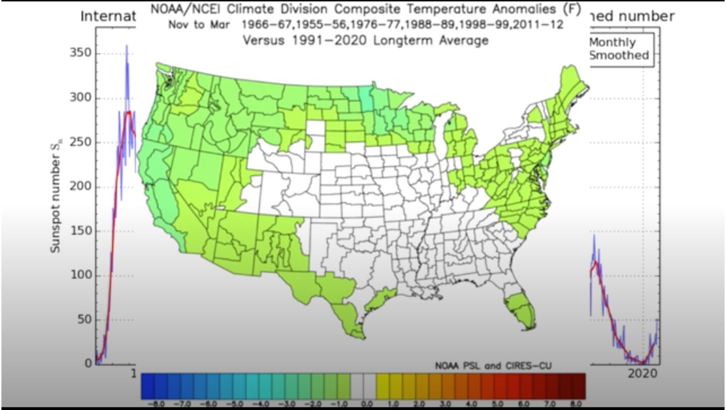
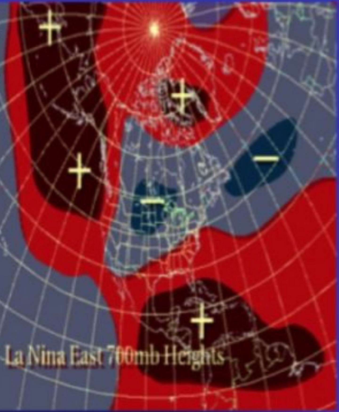
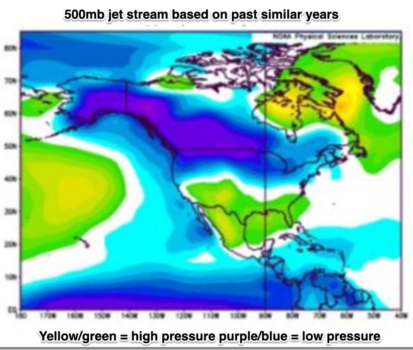
FAVORED 500MB JET STREAM PATTERN FOR WEAK CENTRAL PACIFIC LA NINA:

This winter the La Nina type looks to be a combination of Central Pacific and Eastern Pacific, this is the analog combo for this winter:
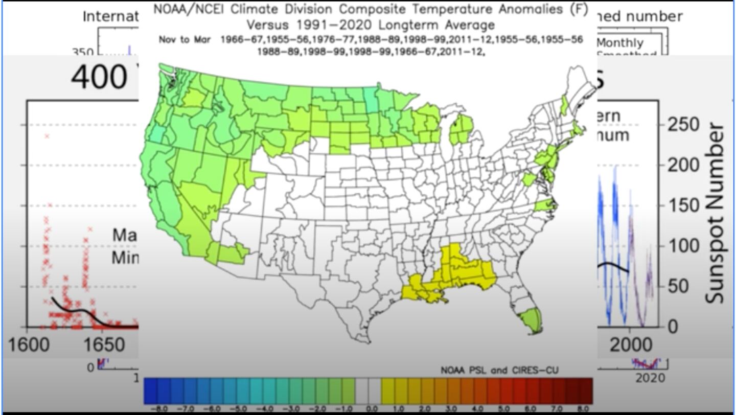
RESEARCH BY CPC SHOWS AN EAST QBO FAVORS THIS PATTERN IN A LA NINA:
It (above) shows a Southeast ridge like last winter, but weaker and centered farther SE than last year. A similar pattern shows up in their research for an East -QBO in low sunspot periods which is were we line up now.
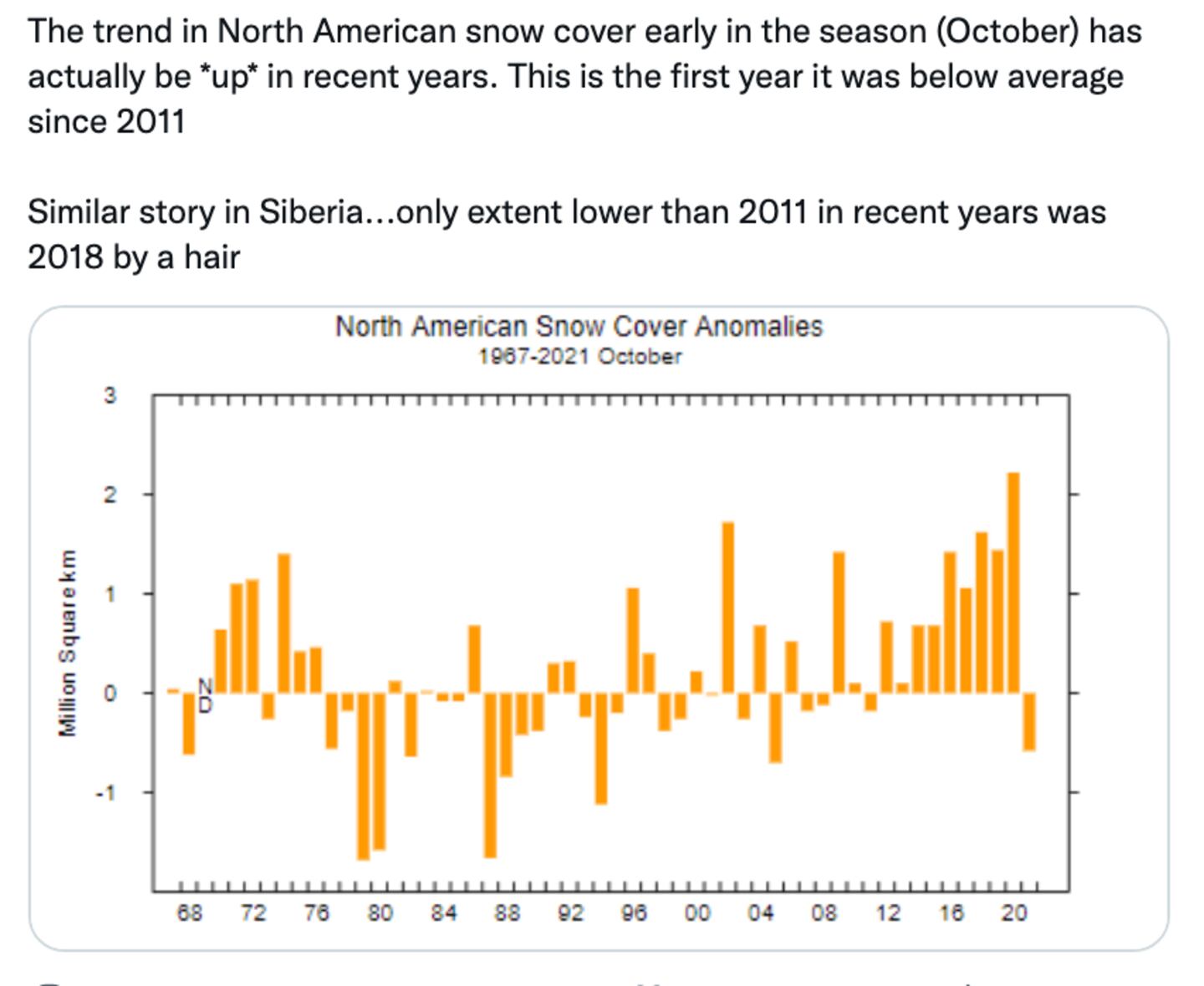
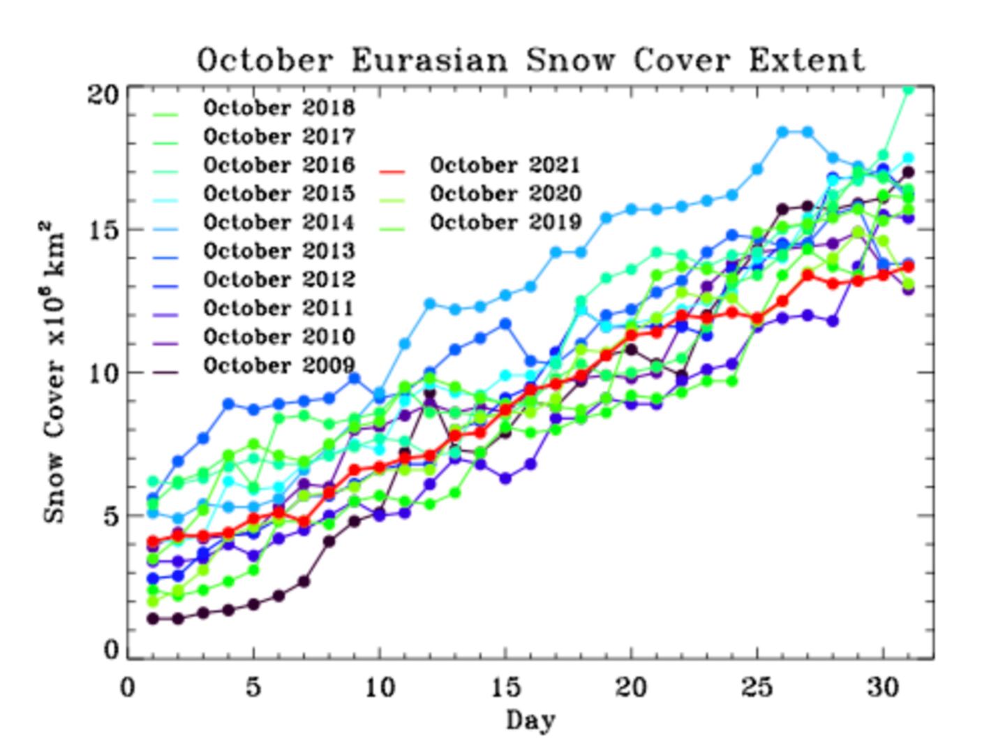
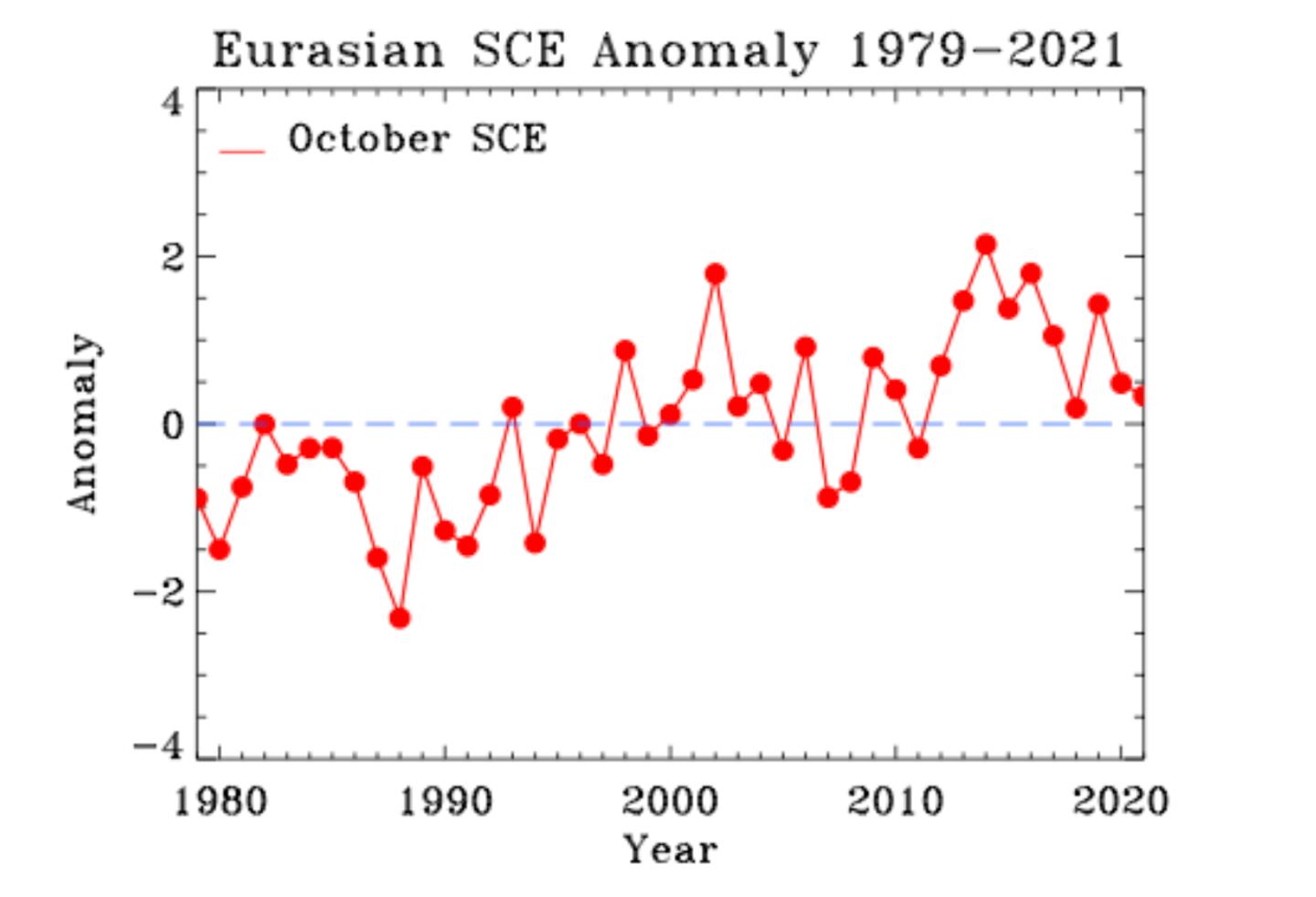
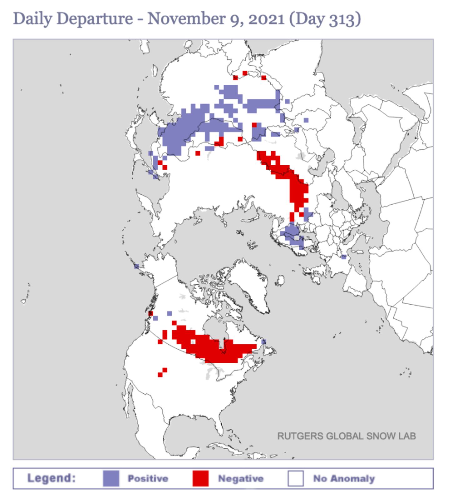
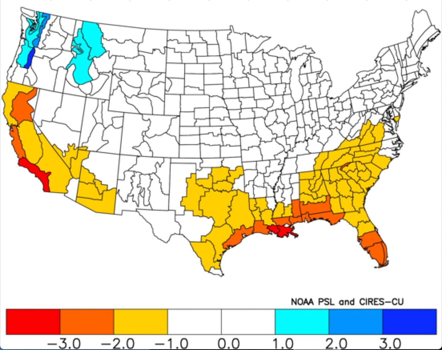
Eurasian and North American snow cover advance in October is monitored as a winter signal as well. This was the first below normal October since 2011 & lowest value since 2005, 2006 & 2012 La Niña & mild Eastern US winters. BITTER COLD is hard to get in the U.S. without substantial snow cover in Canada and other points North and West.
These indicators currently are bearish (negative) for a PV arctic intrusion this winter:
The SSW events that have already occurred are projected by both the GFS and ECMWF Ensembles to repeat in the months ahead. Stratospheric Warming Events (SSWE) can disrupt the polar vortex and provide an opportunity to allow for atypical La Nina weather.
While the odds do favor milder than average mean temperatures for winter as a whole stretched out over the entire season, but that does NOT mean there can be no harsh cold spells or that snow/ice is not possible. LA Nina’s are known for more volatility than El Nino with changeable jet streams as shown above. I expect the mean this winter as depicted below:
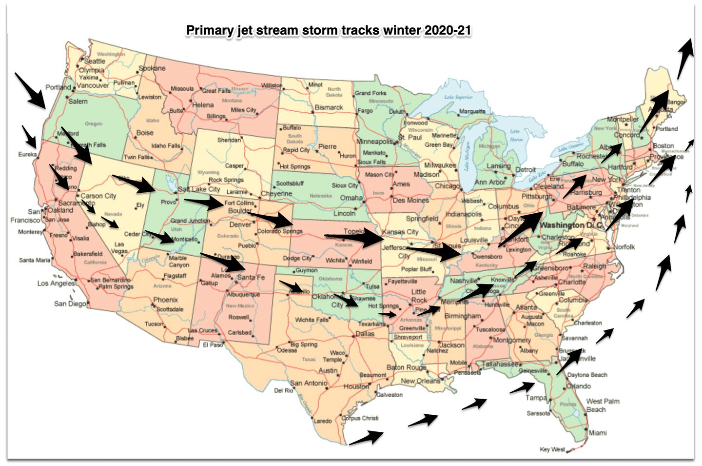
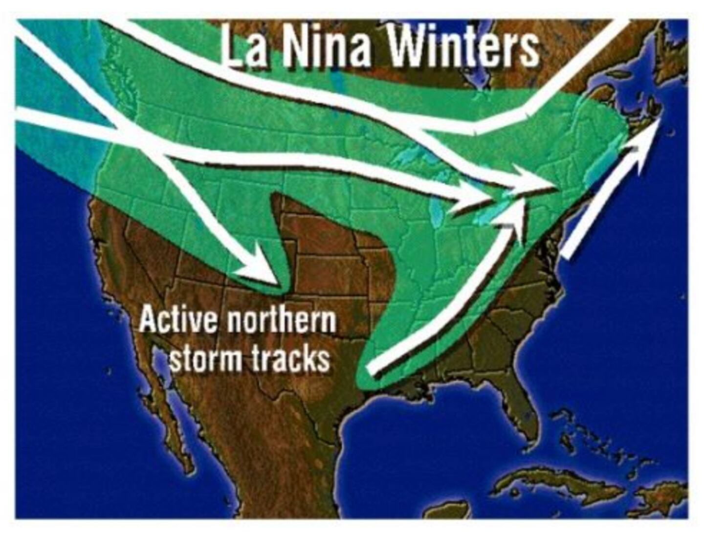
This winter favors “MILLER B” winter storm tracks and other inland northern tracks with a predominant Pacific and sub-polar jet stream. But a weaker occasional sub-tropical jet stream could provide a “MILLER A” type at least a couple times through March.
Other factors mean that La Nina’s typical climatology can be overridden for a week or more at any time during the winter and early Spring. We saw that happen last winter when a SSW/Polar Vortex disruption impacted OK/TX with extreme cold and ice/snow that came as close to us as TN/AL/NC on multiple occasions.
So an overall winter outlook can work out to be fairly accurate averaging temp and precip over the entire season, but that can’t account for breakout cold/snow patterns that may occur in the midst of an otherwise mild winter. Warm spells can certainly be expected in the Southern tier of states again this winter.
This is because there are short-term variables that can have drastic impacts but those variable cannot be reliably forecast more than a couple weeks at a time. The most important of these are the WPO/EPO, AO/NAO, QBO/MJO/IOD which relate to the strength and position of Pacific Jet stream and the strength or weakness of the Polar Vortex and Polar Jet Stream (blocking). All we can do this far in advance is to decide the probability of these being tilted in one direction or the other, which modes seem to be favored.
As I already stated it doesn’t just matter that we have a La Nina, it will in the end matter what KIND of La Nina we have for the heart of winter. In other words the evolution and ultimate strength and type of La Nina will matter, so if it deviates from pre-season expectations the forecast will be thrown off and need to be updated. This is true of the other warm and cold spots in the oceans discussed previously over the past couple months.
There are plenty of conflicting signals as to what to expect this winter as a whole on average, and even conflicts on whether the coldest part will be the front half or the back end. SIGH.
The past tells us that if the end of Autumn and start of winter are chilly then the back of winter will be mild and vice versa. That doesn’t happen every year or season but usually it does, along with the “January Thaw”. 4-9 week cycles are not uncommon before a flip, we call this the “rubber band” idea or if you prefer, the pendulum swings idea.
THE PAST CAN BE A GUIDE TO THE FUTURE. This is the “analog” forecasting approach which does not use models but instead looks at the past to find similar conditions existing now or expected to exist in the coming season. “The past is a prologue to the future”, Shakespeare noted in his play The Tempest. AKA “What’s past is prologue”.
However we must remember what the world of finance and investing warns us: “PAST PERFORMANCE IS NO GUARANTEE OF FUTURE RESULTS.
-------------------------------------------------------------------------------------------------------------------------------------------------------------------------
ANALOGS FOR THIS WINTER 2021-22:
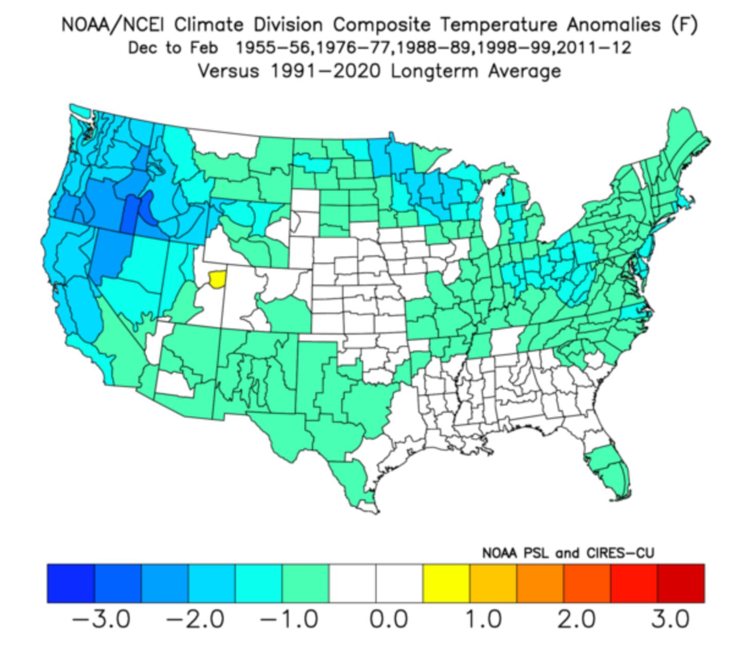
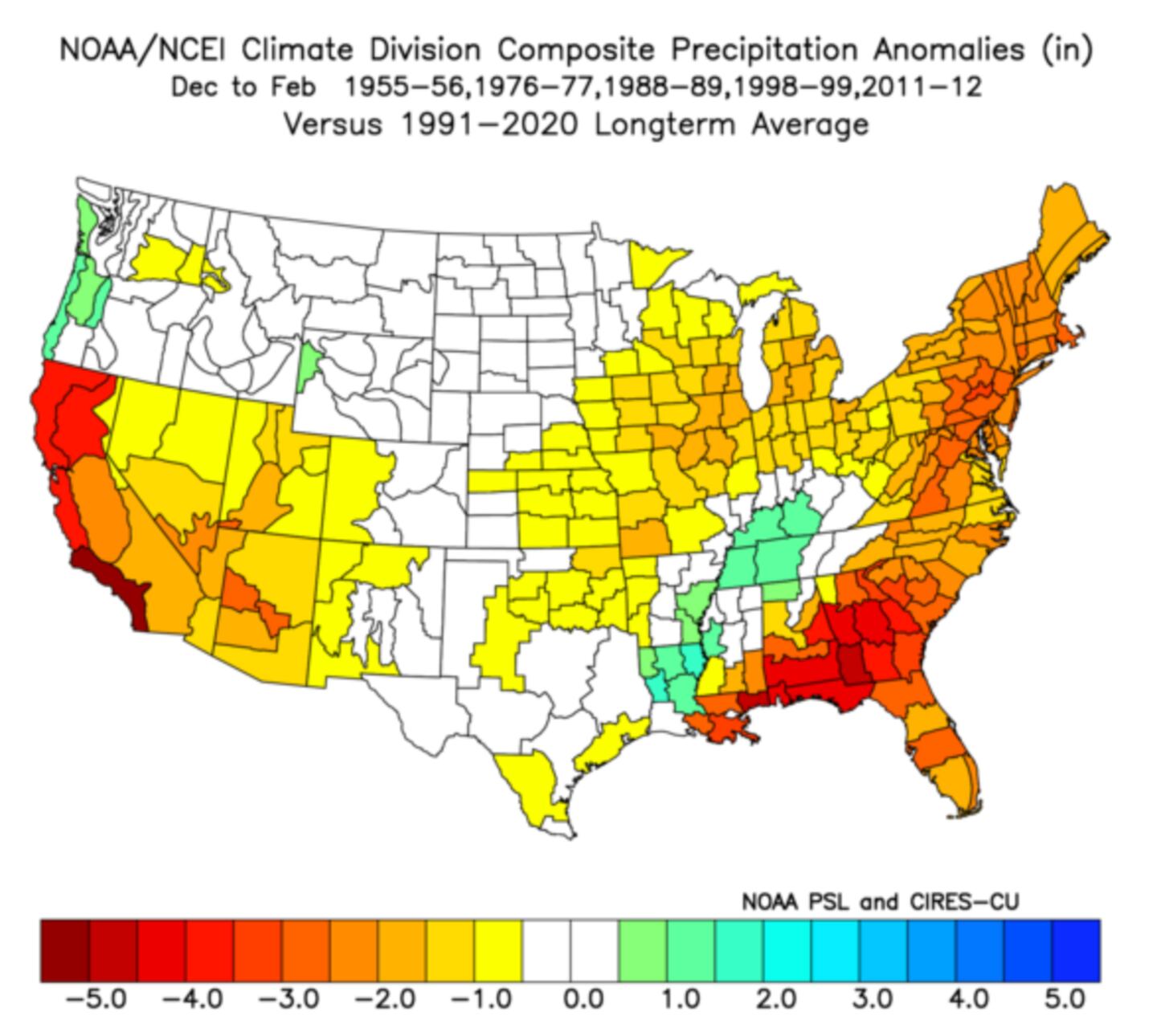
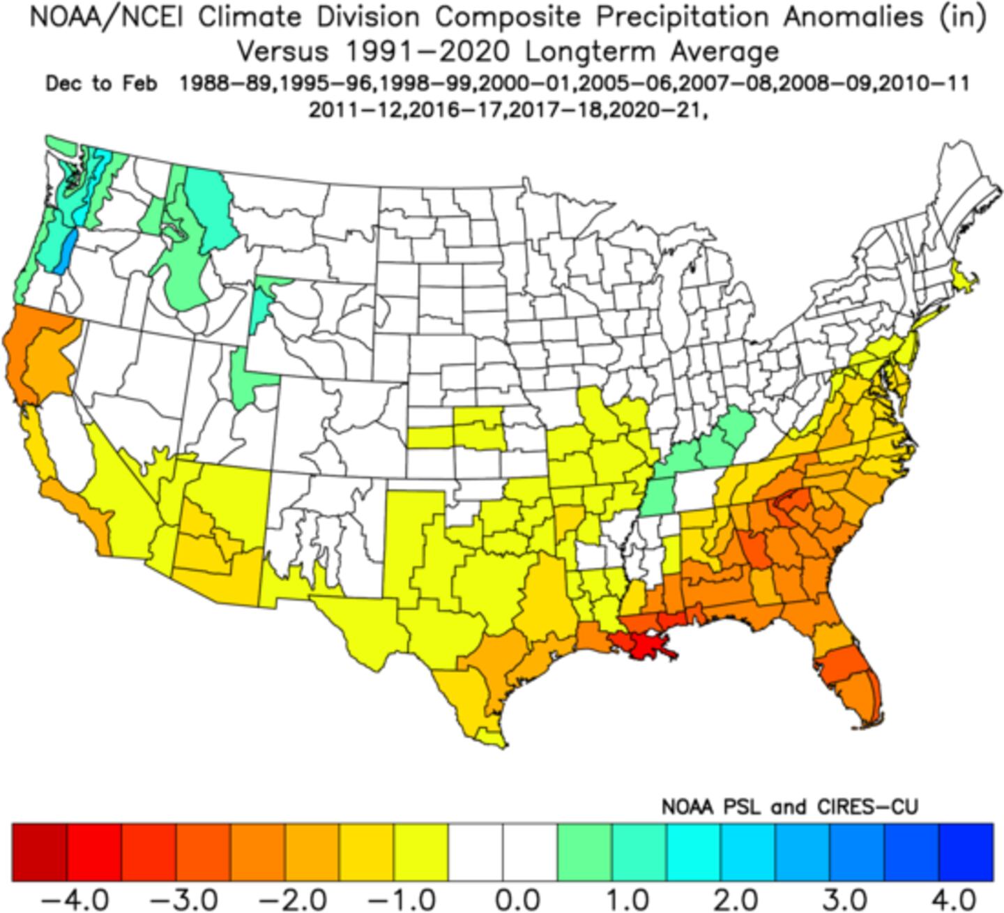
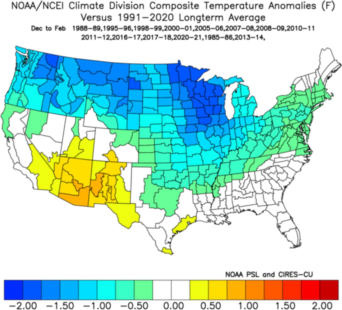
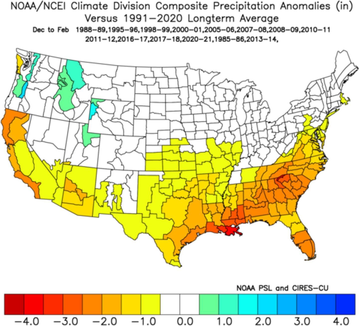
COMPOSITE OF THE ANALOG YEARS THAT SHOWED UP MOST OFTEN:
TEMPS:
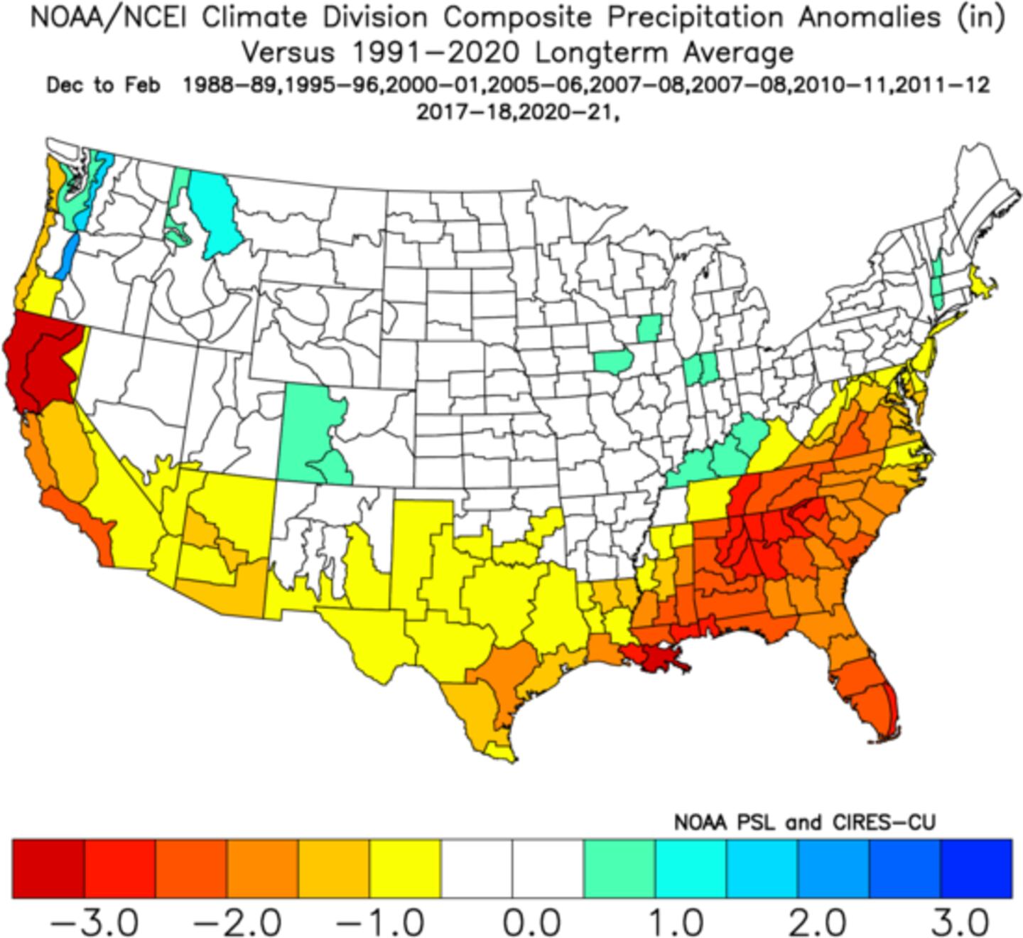
PRECIP:
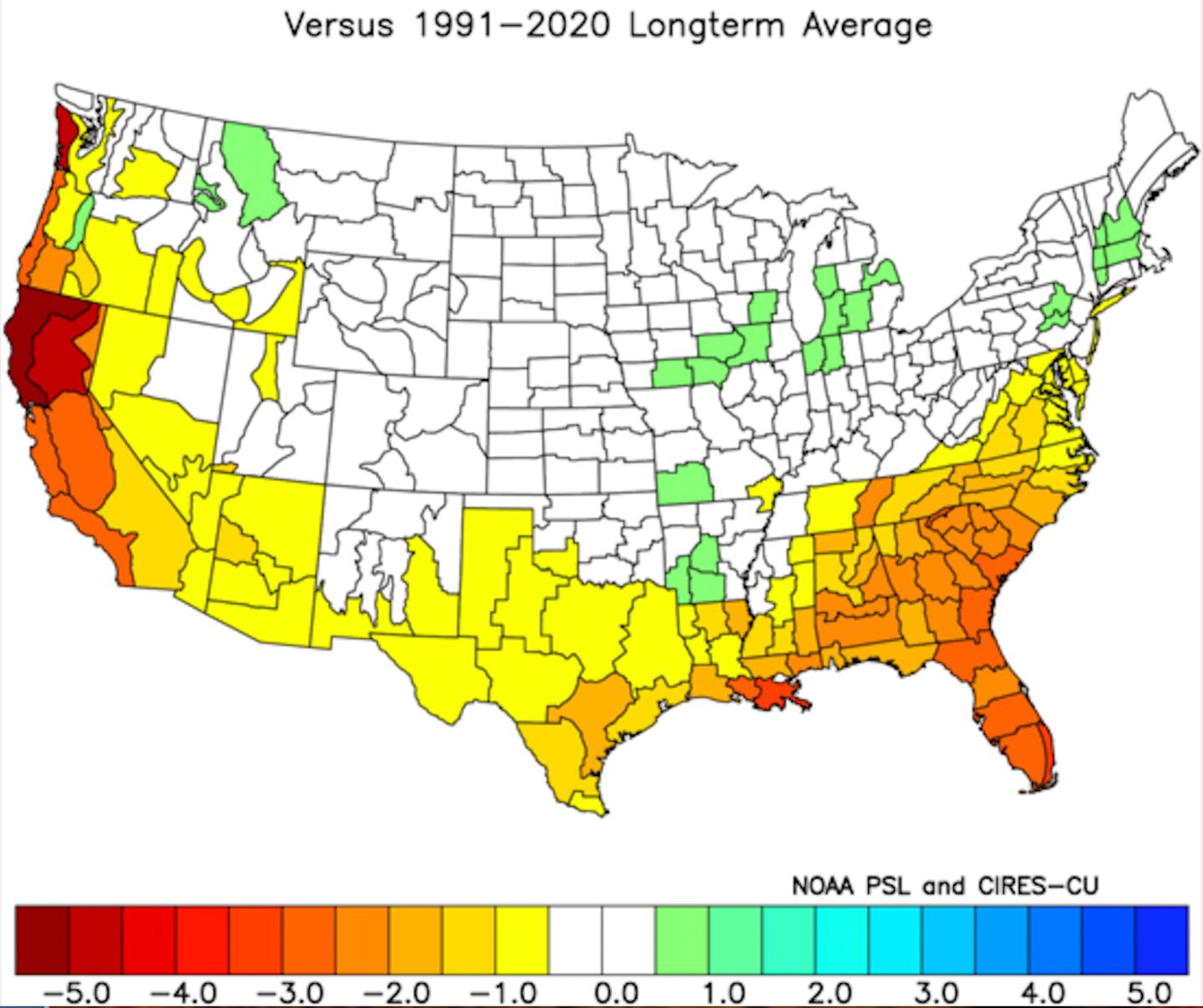
Here is the composite for all the similar analog years without subjective weighting for temperatures and precipitation this winter December-February average:
TEMPS:
PRECIPITATION:
Subjectively weighted analog results:
TEMP:
PRECIP:
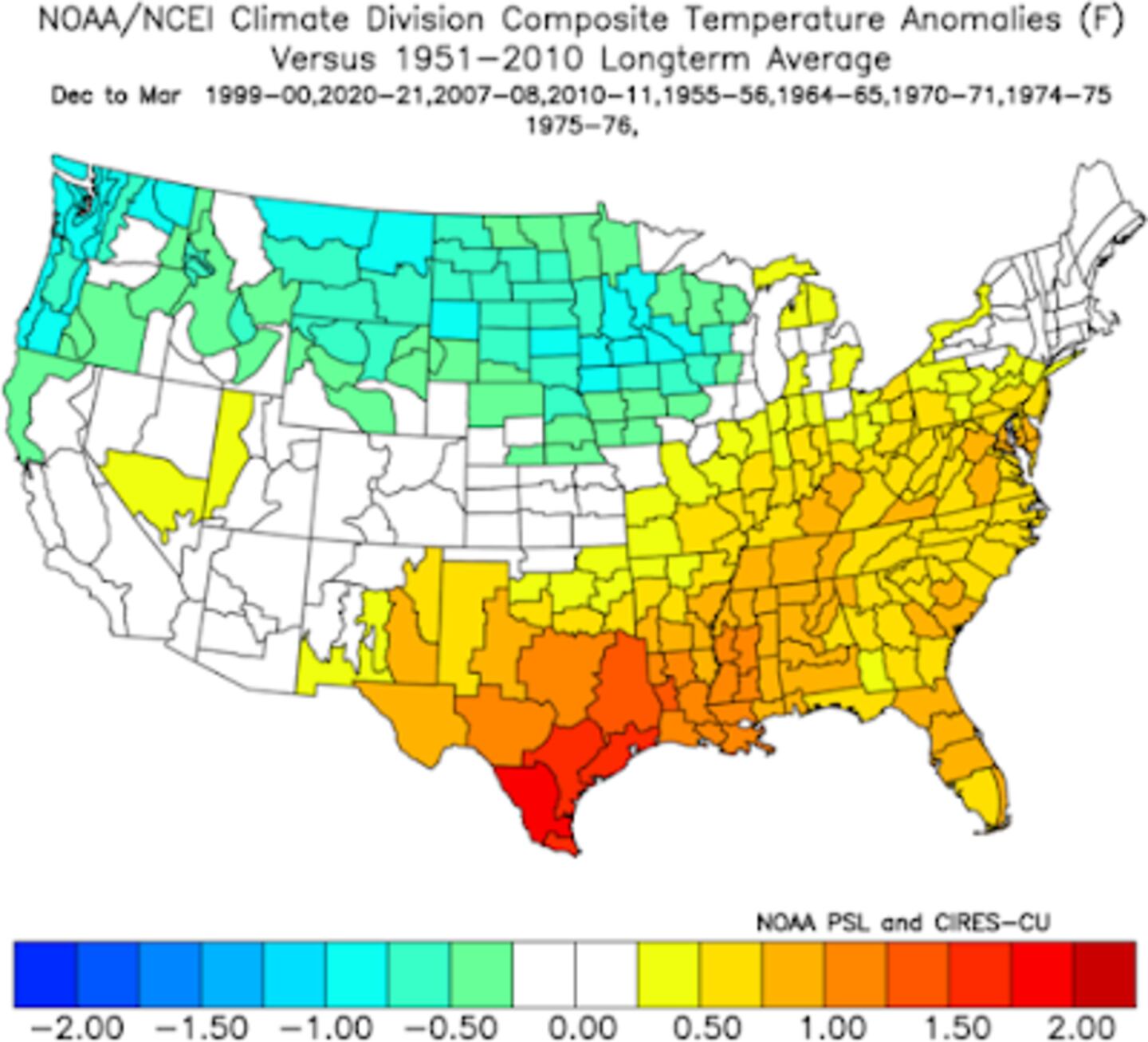
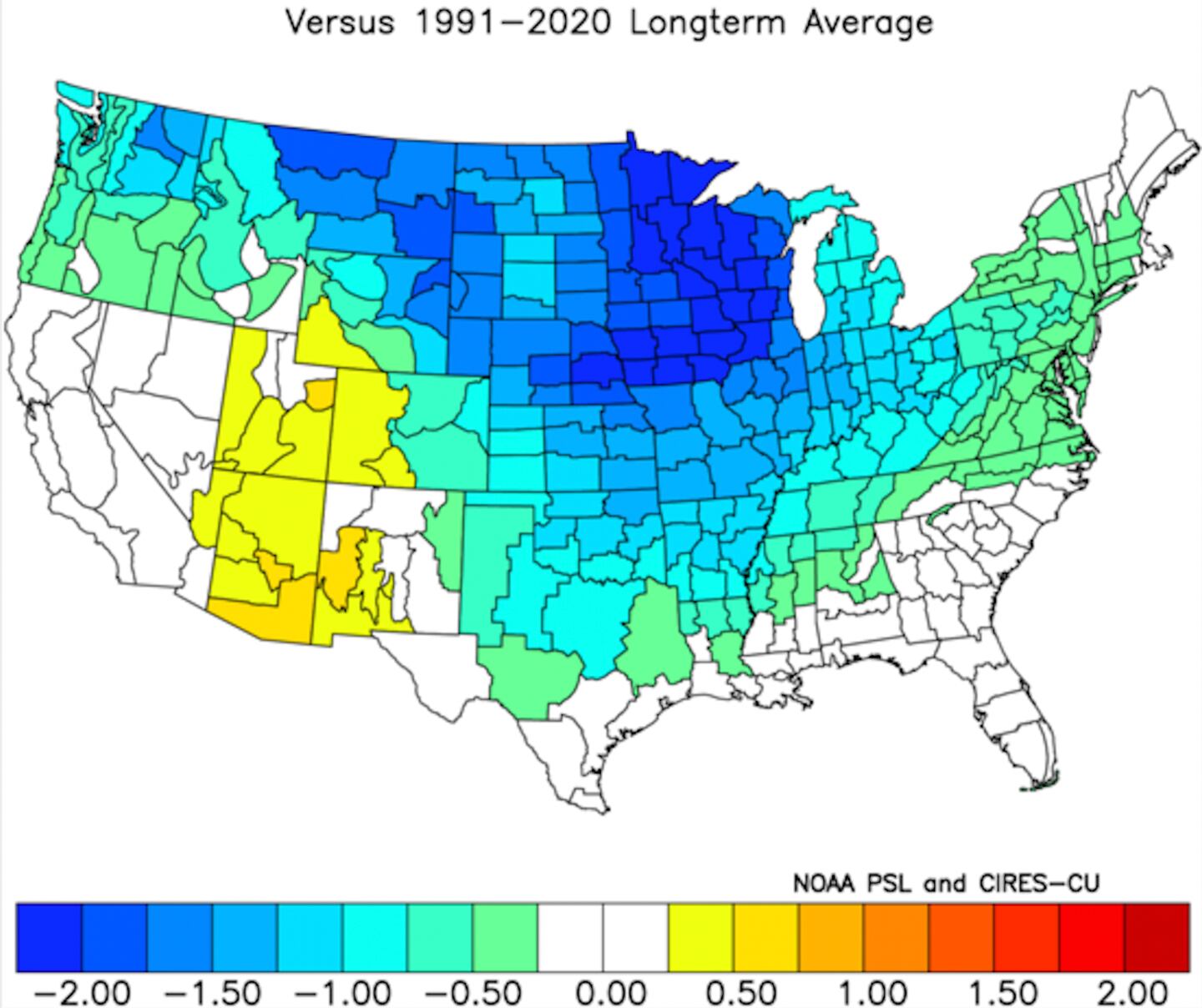
STRONGEST ANALOG WINTER 2021-22 TEMPERATURE AVERAGE DECEMBER-FEBRUARY:
STRONGEST ANALOGS WINTER 2021-22 PRECIPITATION AVERAGE DECEMBER-FEBRUARY:
STRONGEST ANALOG WEIGHTED MATCHES WINTER 2021-22 TEMPS/PRECIP:
REMEMBER, all the above analog maps show the composite mean or average of the entire 3-month winter period, this does NOT mean it will be the case at all times December-March. It represents the average of the entire winter season NOT EVERY DAY OR EVERY WEEK.
My take away from the analog approach is that a somewhat DRY winter is likely (not wet at the very least), and as far as temperatures are concerned, the LEAST likely outcome is a colder than normal winter. The signal for below-normal precipitation is stronger than the temp signal.
The La Nina template and all the models say a warm winter in most of Georgia.
But I will subjectively modify that based on the totality of the conflicting signals from all the factors studied.
I think THIS WINTER in the NORTH HALF OF GEORGIA... will be drier than normal on average with temperatures near-normal on average... NOT significantly warmer or colder than usual on the whole 3-month period. I think odds for snow/ice look normal or average/typical for this winter. I would not be surprised if we are in a drought by the start of Spring 2022.
Again that does not mean every day every week or every month but this is the expected mean for the December through February period. About the same November-March.
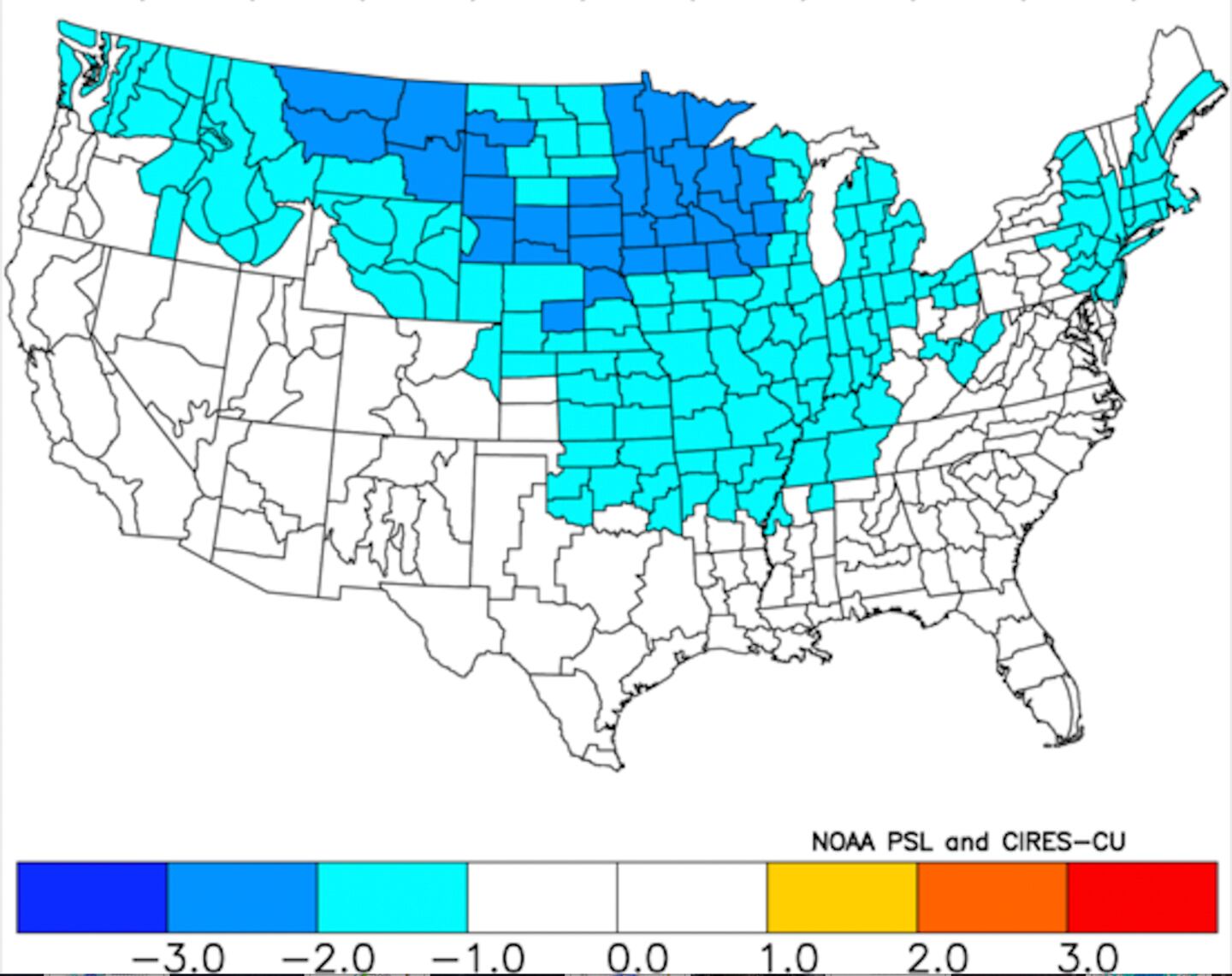
MOST LIKELY AREAS OF BELOW-NORMAL WINTER TEMP ACCORDING TO ANALOG METHOD:
MOST LIKELY AREAS OF ABOVE-NORMAL AND BELOW-NORMAL WINTER PRECIP ACCORDING TO ANALOG METHOD:
WILD CARD UNICORN BLACK SWAN:
You may have read about “black swan events”. Also known as a unicorn or rare wild card result. Here is one concerning this winter... in terms of the ocean temperatures we are currently looking at a pattern that is unprecedented:
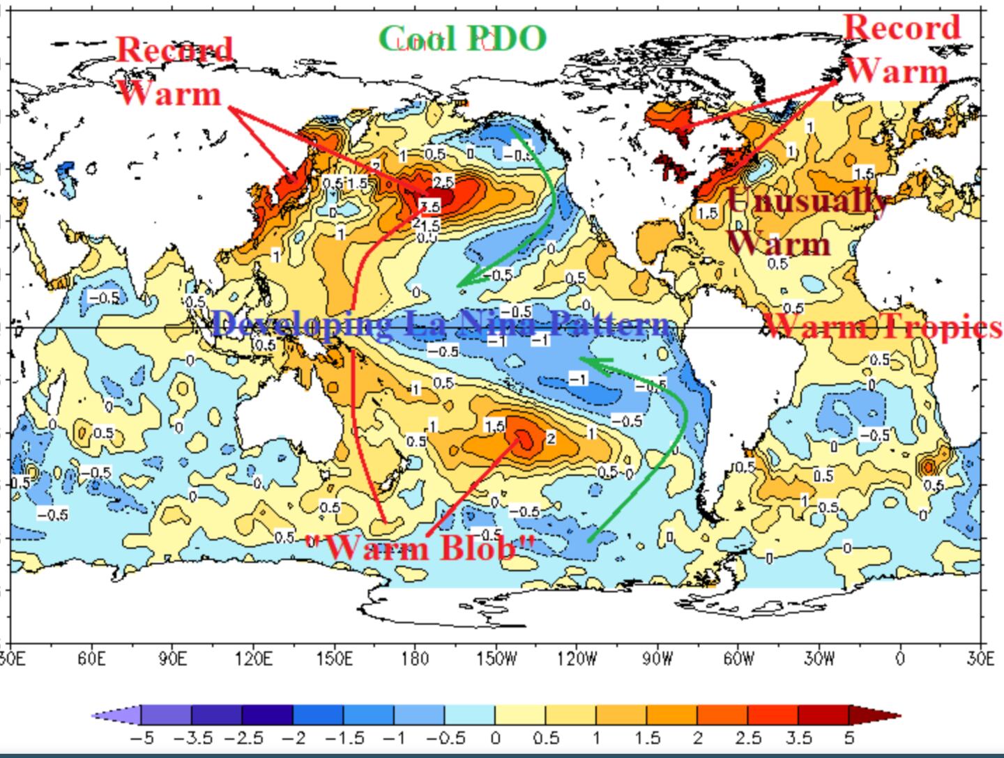
Hmmmmm:
So perhaps mother nature will show us something new for a weak to moderate second La Nina winter season. God only knows and only time will tell.
IF new data in November shows any major changes I will do an update early in December.
For more connect with me on Twitter @MellishMeterWSB.
©2021 Cox Media Group


 Sign Up


